The Driver Speaks!

This was our first big trip with Lisa’s car (a Mazda CX5), rather than my old Honda Fit.  Bottom line, having a relatively big car is a tradeoff (duh…).  Lisa was much more comfortable as a passenger, and we were both much more comfortable driving on South Dakota’s Interstates, with their 80mph speed limit!  On the other hand, the difference in gas mileage was uncomfortable—especially in the Northwest and California!  We ended up paying a wide range of gas prices—from $5.40 to $2.51 a gallon (but dodged the $6.00 per gallon prices in Lake Tahoe.)

We ended up driving right at 9800 Miles, with this as our route:

(Note the long, circuitous route from “E” to “F” in far north Washington; road closures due to forest fires turned the planned short driving day with a decent hike into a long driving day.  Luckily, that was the worst impact that we experienced with fires on this trip.)

Our first stops were to visit our families in Missouri—and to participate in a new sport:

(Apologies to Lisa for the chain-link fence shadows!)

One generally doesn’t worry too much about the differences between Canada and the USA when traveling.  But even outside of Quebec, there are reminders (other than flags and gasoline being priced per liter!) that you are in a different country.  For example, in the US, Costco doesn’t accept Mastercard at its stores or gas stations, and co-issues a Visa card for members.  In Canada, however, Costco doesn’t accept Visa at its stores and gas stations—and co-issues a Mastercard for its members!  Luckily, there was an ATM just past the checkout lines, probably for that reason.

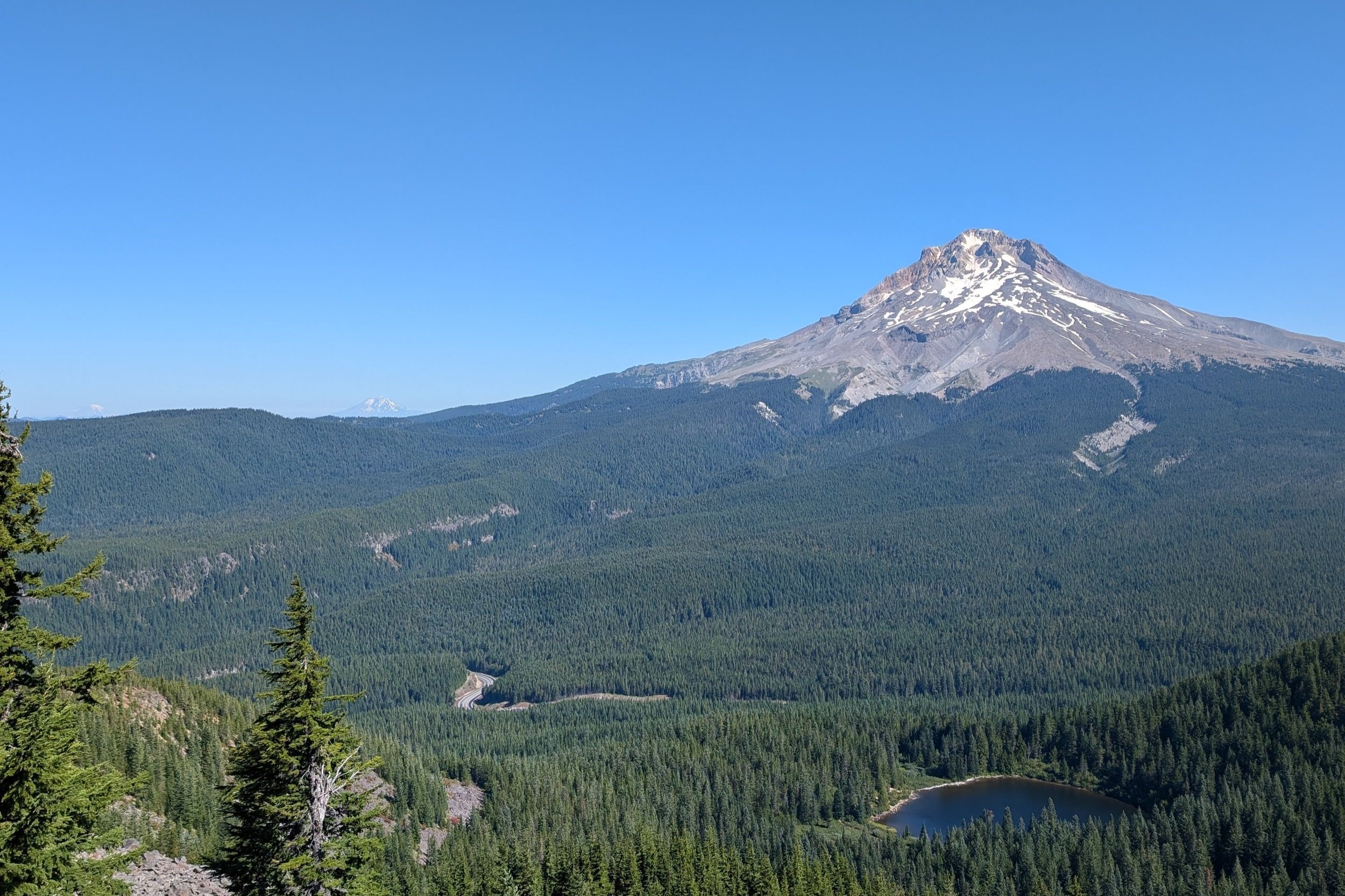
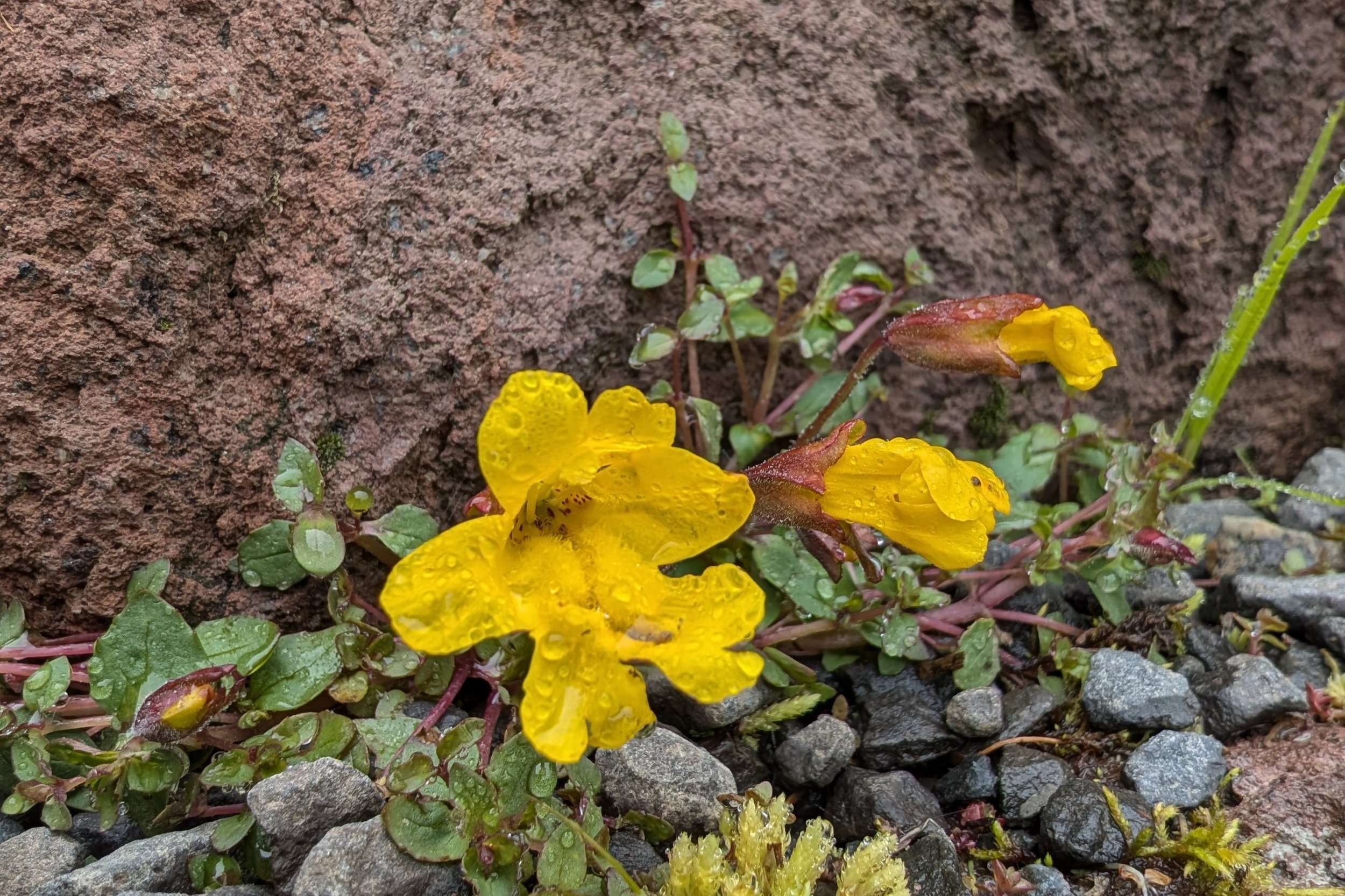
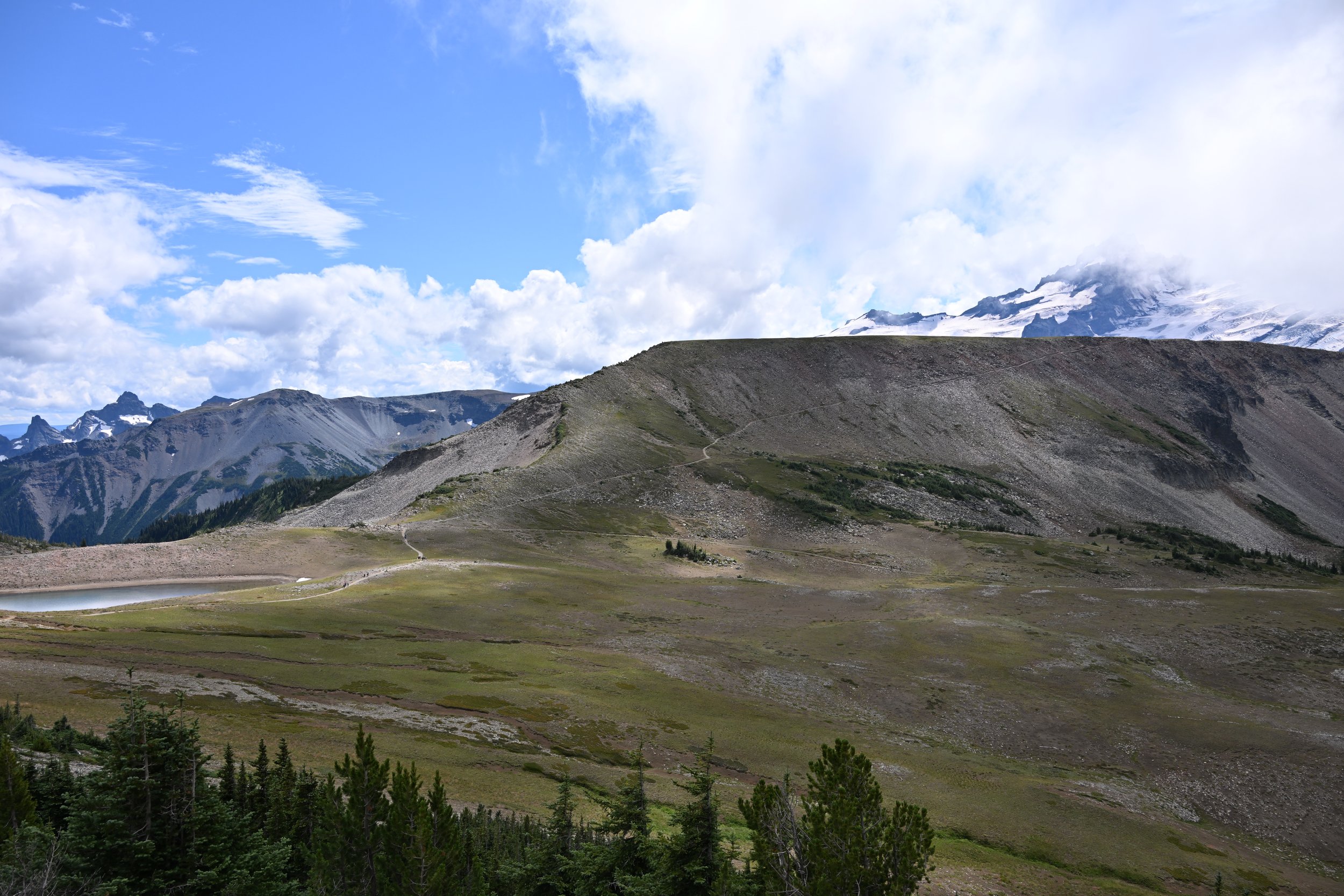
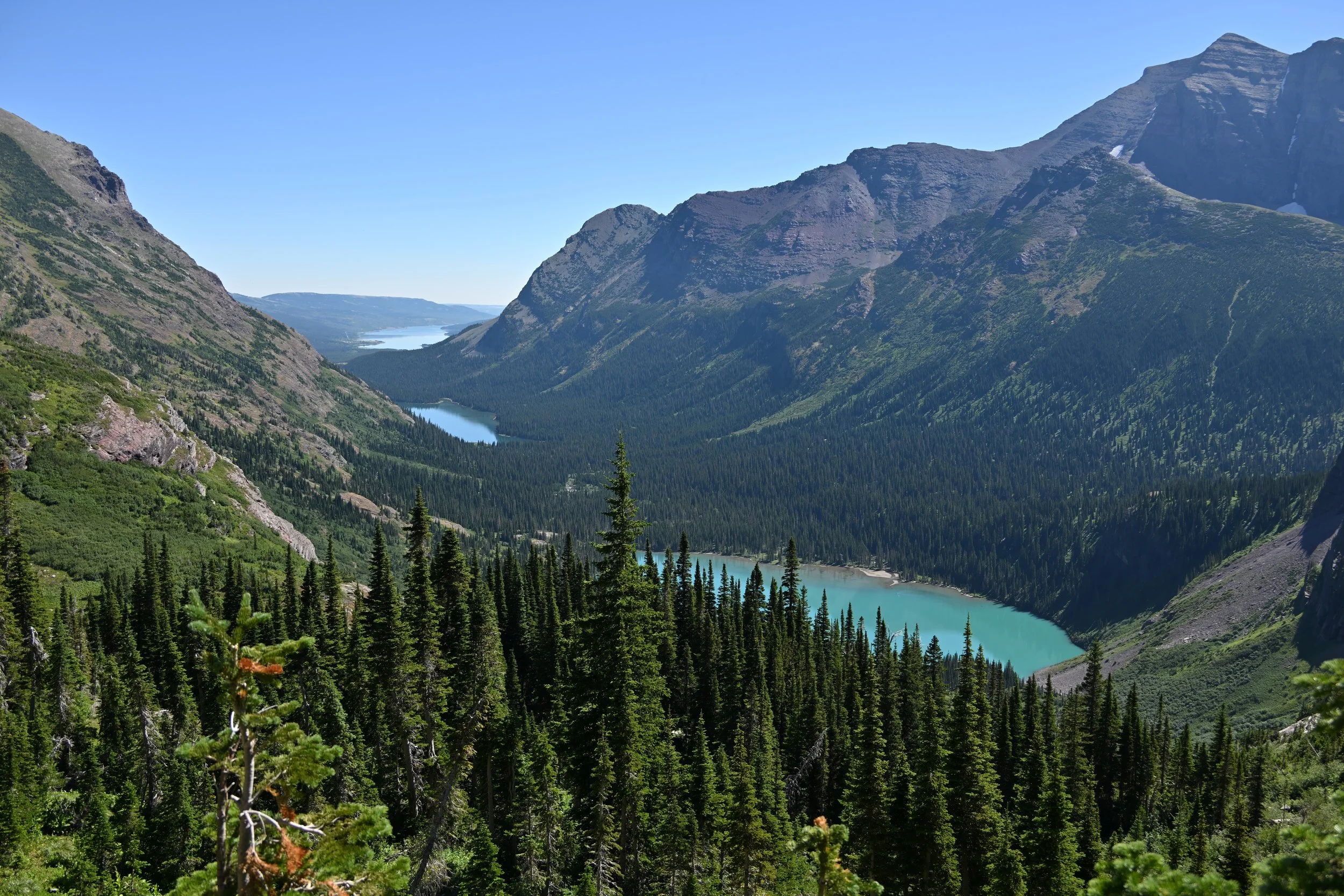
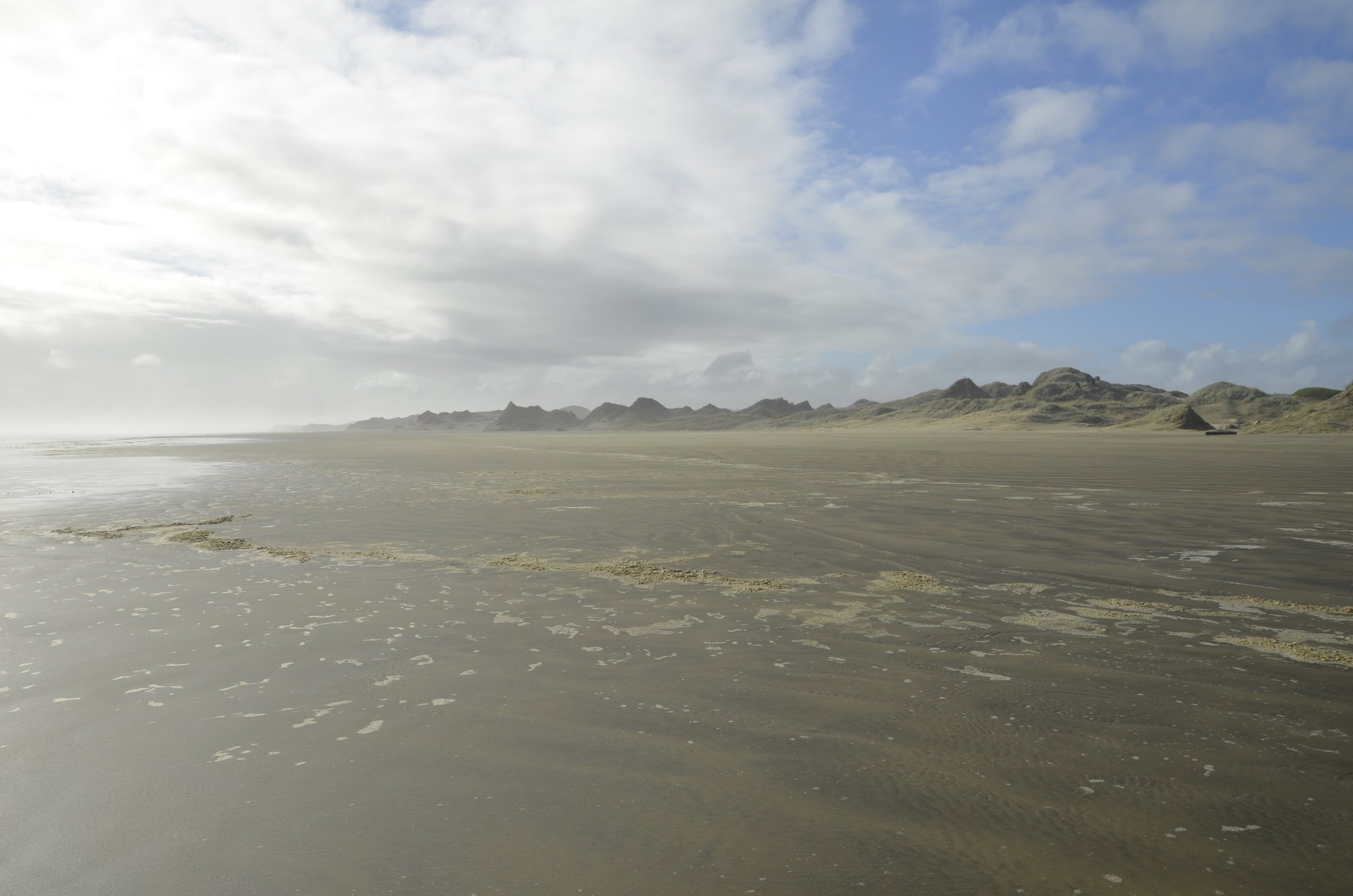
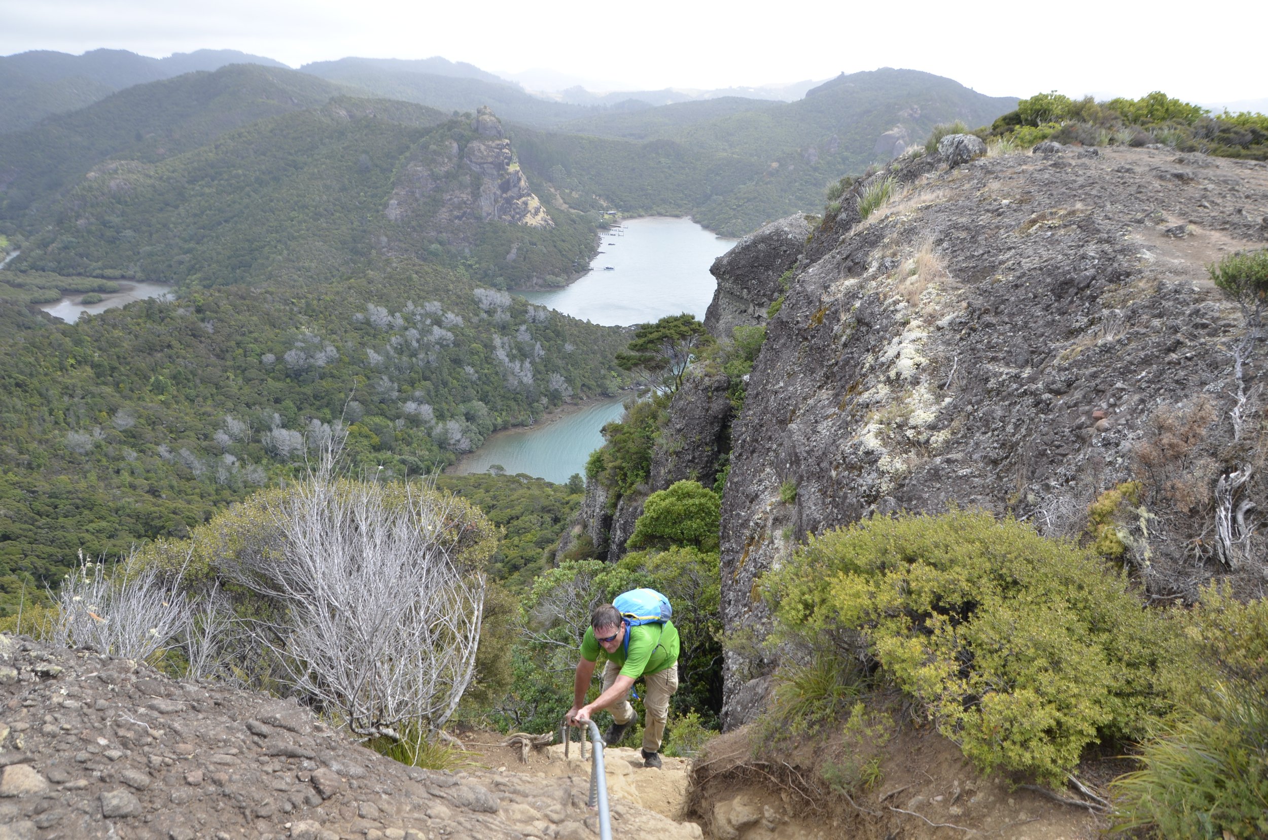
Lisa mentioned how much we enjoyed exploring Mt. Ranier National Park, but neglected to note that it has 28 “major glaciers,” even more than Glacier National Park.  Thus, it was no surprise that hiking at altitude sometimes involved snow—even in mid-August:

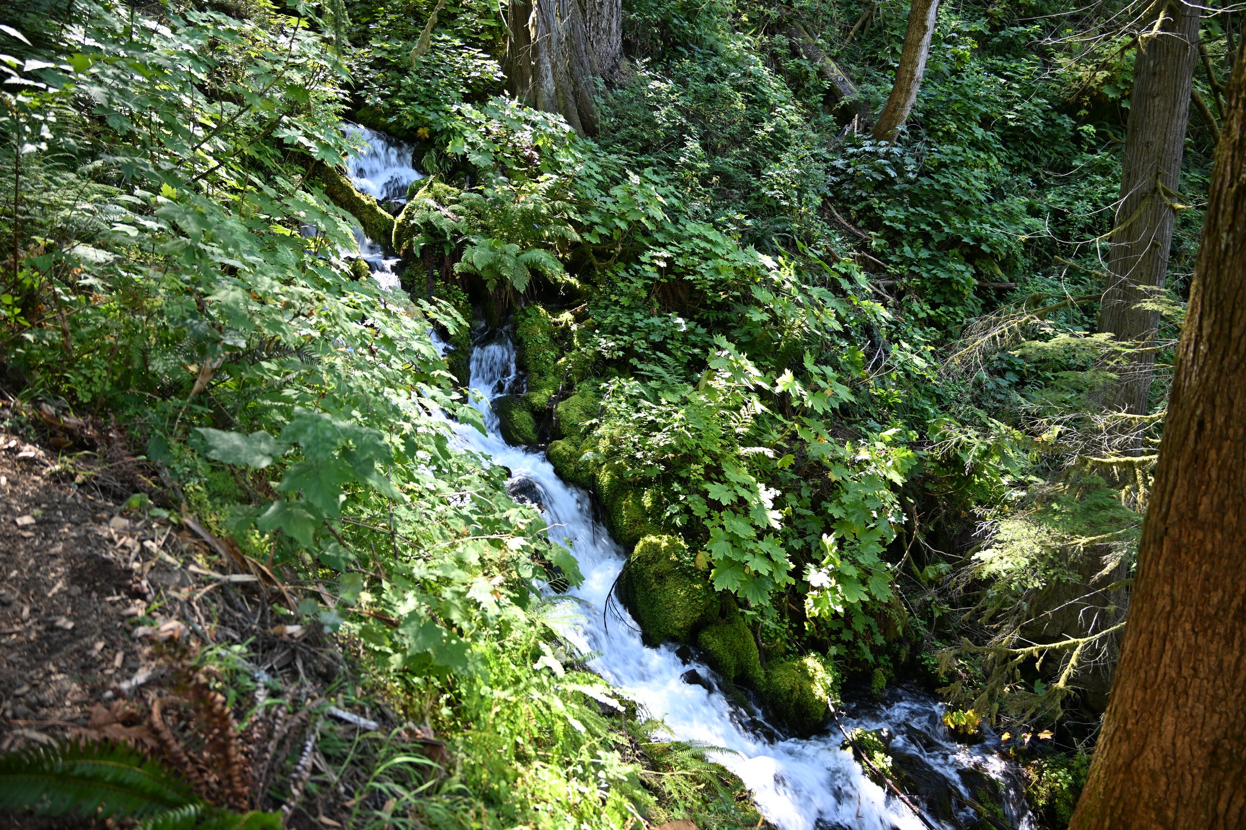
The glacial melt streams were seemingly everywhere.  Fortunately, the park service provides many rudimentary (but sturdy) bridges,

which were more than sufficient for the intrepid photographer:

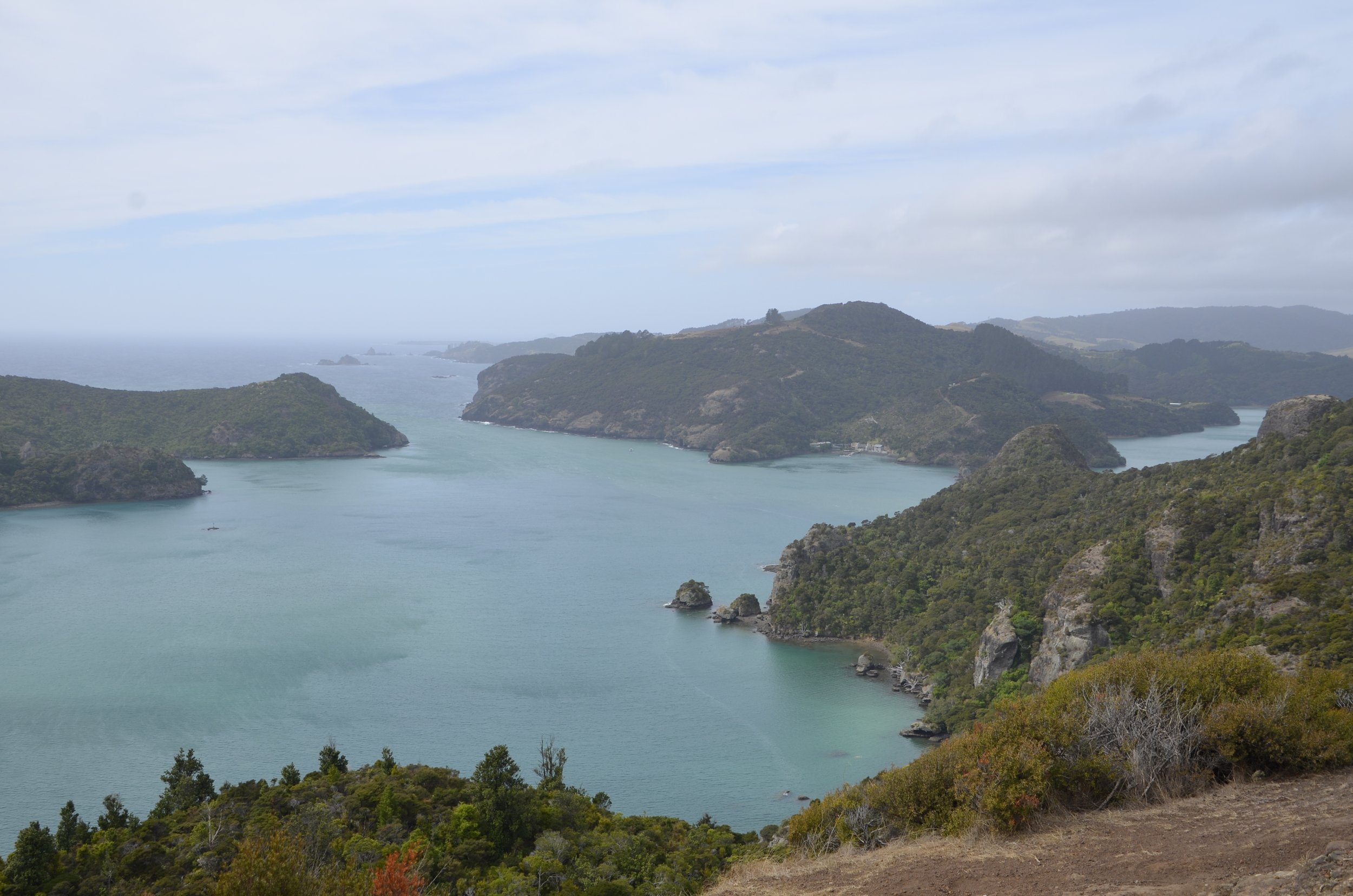
After Olympic National Park, we revisited Astoria, Oregon, which was the first American permanent settlement west of the Rockies.  It was established in 1811 as, no surprise, a fur trading outpost by John Jacob Astor’s American Fur Company. (It is also where the Lewis & Clark expedition over-wintered in 1805-06, hoping in vain to hitch a ride back home with a random ocean-going ship.)  Unfortunately, we ended up strapped for time, so we still haven’t visited the Lewis & Clark site!

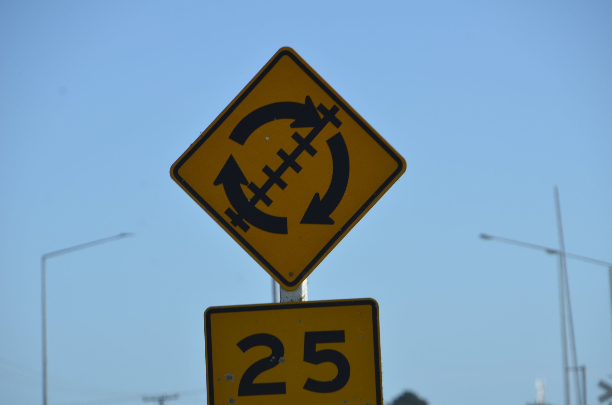
We also made a quick drive through Longview, Washington, on our way from Astoria to Multnomah Falls and Hood River, Oregon.  This is the town in which Lisa’s parents met; but, unsurprisingly, we had no luck in finding noteworthy buildings that would have been around in that time frame! We did, however, easily remember where we were at by virtue of Washington’s unique state highway signs:

Driving through the Columbia River Valley between Washington and Oregon, we were frequently reminded of the history of the area, both with signs memorializing Lewis & Clark, and others taking us back to our sons’ one-time favorite PC game

It was nice to see the Dalles before we died of dysentery, and we were thankful that travel is far easier today than for those embarking on the Oregon Trail in the mid-nineteenth century:

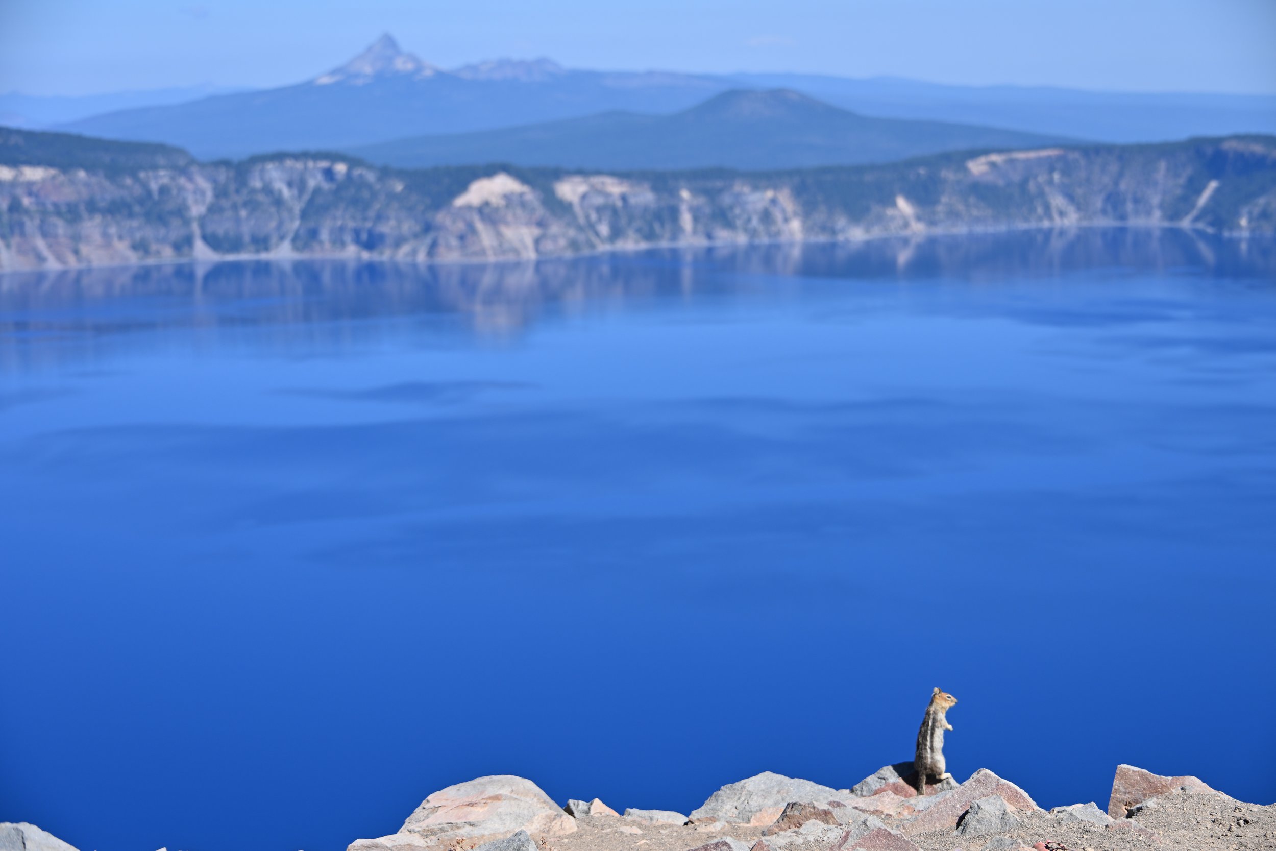
Our only other major destination in Oregon was Crater Lake, which Lisa has covered in detail, albeit without this picture:

Yikes! That makes my nose look HUGE, but it is the best shot for her!

It was also in Crater Lake N.P. that we met a couple who live very near us, in our county seat of Lebanon—who were also on a big driving trip.  Once again, it is amazing how small the world can seem when serendipity strikes!

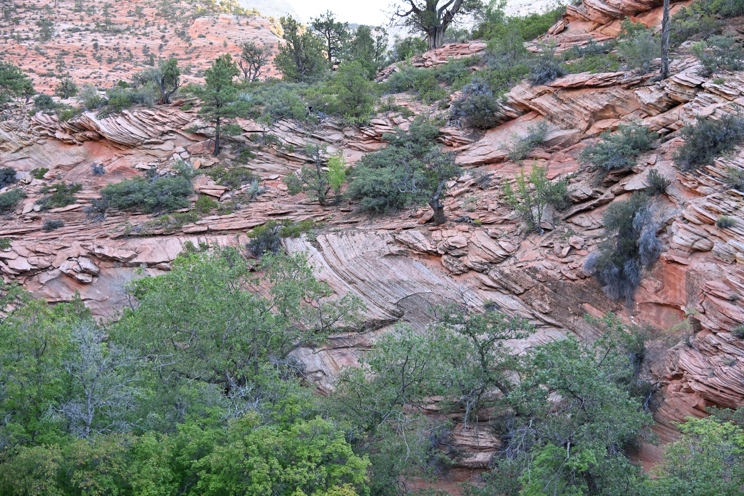
As Lisa noted, we decided to take a southern route home from Lake Tahoe so as to try our luck with the daily lottery for the “Wave” and revisit Bryce Canyon National Park.  After enjoying the day of following my spouse through the pinnacles and canyons of Bryce

and unfortunately confirming why we don’t buy lottery tickets, we faced the long drive home from Kanab, Utah--once we had the oil changed for the second time on the trip. 

Overall, an excellent trip.  We were pleasantly surprised by some of the parks, and none of them disappointed. We truly have some amazing destinations in the United States and we look forward to exploring many more in the future.

A revisit to Bryce Canyon NP

But before we check in with Bryce, I wanted to share some scenes from the road through Nevada. There were many long (15 mile!) stretches of very straight road…

… free ranging cattle…

… and even Joshua Trees -

Our route into Utah had us slice through the NW corner of AZ. As we were driving, we were searching for where the road went…

… into the Virgin River Gorge -

It was amazing…

… what each curve in the road…

… revealed -

The next morning we just “had” to drive through Zion NP…

… and it was such a hardship (eyeroll) -

The way the terrain changed…

… over a short span…

… was quite beautiful -

This is a photo (Credit: @bilder.strom) of The Wave in the Coyote Buttes North, in northern AZ -

Only 64 people per day are allowed in to hike, and I really wanted to see this in person. Alas, we didn’t win the daily lottery to do so. We had to be in the local vicinity so that our phones’ location was picked up on GPS, before being accepted into the lottery. This was why we ended up driving into Zion and Bryce Canyon national parks again on this trip.

In the past, I had proclaimed Bryce as my favorite national park, and I fell in love all over again.

I just loved the gradations of color from orange, pink and white contrasted with the piercing blue sky. The picture above was taken from the “Queen’s Garden” trail. We had hiked this on our previous visits to the park, but I never get tired of it!

As the afternoon progressed during our hike, the clouds kept piling up, and the darkness provided an interesting contrast to the sandstone hoodoos -

Luckily, we just heard a lot of thunder rumbles, but only had scattered sprinkles, so our hiking didn’t have to be cut short. We combined the 3 mile Queen’s Garden Loop with the 3+ mile Peek-a-boo Loop to see new areas (to us) below the rim -

That ombre shading near the Wall of Windows was so beautiful.

And this huge bowl’s symmetry was just stunning -

(enlarge it for some neat details of the layers)

Even though the light wasn’t optimal, this last picture included all the elements I just adore in this park - huge scope, color gradations, hoodoos, and evergreens offering perfect contrast -

So this ends our massive road trip. Steve plans on sending a driving summary post. Our next big trip will be halfway ‘round the world next spring. Stay tuned!

Lassen Volcanic National Park

This was the last National Park we planned on visiting on this far-flung road trip, and we weren’t really sure what to expect. Our first stop was at Chaos Jumbles, …

… which is a large rock avalanche from the Chaos Crags you can see in the background. This occurred 350 yrs ago, and it was interesting to see that only scattered trees had been able to grow in the area since.

We then passed by one of my favorite areas in the park - Lassen Peak with King’s Creek running through a meadow:

I really liked the swathes of blue and violet on Lassen’s shoulder -

Another favorite area was Lake Helen…

… which, when the wind was calm, gave a nice reflection of Lassen -

We of course had to hike to Bumpass Hell…

… which is the active geothermal area of the park. There were bubbling mud pots…

… beautiful collections of minerals around a steam vent…

… and multicolored acid pools -

This area was much smaller than similar ones that we’d seen in Yellowstone and Iceland, but the surrounding vegetation made a nice contrast -

The infamous Dixie Fire in 2021 burned an enormous amount of land, including about 2/3 of Lassen, but the denuded hillsides here revealed a colorful palette -

Another hike we did followed King’s Creek…

… through a burned area starting to rejuvenate -

The culmination of the hike was King’s Creek Falls (40 ft drop)…

… but hiking back up the series of falls that contributed to it…

… especially with the bank-side flowers…

… made the climb well worth it -

Not a very spectacular bird, but definitely new to me - a White-headed Woodpecker:

Our next destination was Lake Tahoe for some R&R. A beautiful blue lake ringed by mountains and pines…

… with exquisitely clear water…

… and home to a stunning Steller’s Jay, who bids you good-bye for now -

Crater Lake National Park

We arrived in the late afternoon, and this was our first peek into the crater…

… as we were greeted by this cheeky fellow -

Golden-mantled Ground Squirrel (that’s a pine nut he’s eating, not a handout from a person)

The clouds you saw in the first picture cleared quickly, so we headed to Watchman Overlook for sunset. Apparently this spot is overrun by people in the summer, but since we were there on the evening of Labor Day, the parking lot wasn’t even full. The “golden hour” light was pretty nice across the lake…

… but this was even better -

We actually stayed until “astronomical twilight” so I might capture the Milky Way over the lake. It was really cold and windy, and we were the only ones there. The Milky Way stretched from one horizon to the other over the lake, but alas, I couldn’t get my new camera to take a picture, so it’ll just have to be a neat memory for us.

An interesting side note - do you see the pole extending way beyond the car in the picture above? I think they get a LOT of snow up here! (our car’s roof is at a height of over 5 ft)

The next morning we drove the Rim Road, stopping at all the overlooks and pullouts. Above, you can see the little island that has been dubbed “The Phantom Ship”.

The reflections in the still morning water were just stunning…

… but this reflection on a reflection was mind-blowing -

As I’ve written in the past, I do NOT enhance my pictures whatsoever. The water was really that blue. It is the deepest lake in the US at 1,949 ft. No rivers flow into or out of it, and any evaporation loss is replaced by rain and snowmelt.

Crater Lake was formed 7,700 yrs ago when the Mount Mazama volcano collapsed in on itself. There are several cinder cones on the floor of the caldera, but only Wizard Island rises above the lake level.

We hiked the Garfield Peak trail, and can highly recommend this for almost anyone. The total ascent is 1,074 ft, but it is actually fairly gradual, and the total hike is only 3.4 miles out and back. The views were spectacular…

… to be able to see the entire lake -

The whole time we were hiking, and at every overlook spot, I couldn’t stop saying,” Wow, it’s so blue!”

We had a buddy up at the top -

(there were tons of Golden-mantled ground squirrels all around)

And for those of you who’ve always wondered what ~1,000 ft of elevation difference looks like -

If you enlarge the picture above, you’ll see Crater Lake Lodge at the left edge of the lake, and it sits at about 7,000 ft elevation, while we were at ~8,000 ft. on top of Garfield Peak. The bang for the buck (energy expenditure) on this hike is fantastic!

Seeing the “crater” of Wizard Island was pretty interesting -

Enough blue! Time for a sunset ending -

Traveling in Oregon

After leaving Olympic NP, we traveled south to Oregon, so we could follow the Columbia River back eastward. On a previous road trip, we had briefly visited Multnomah Falls and then returned to Portland. On this trip, we undertook a hike that combined several falls with expansive views of the Columbia.

Multnomah Falls (above) is the tallest waterfall in Oregon, with the upper falls dropping 542 feet, then sloping 9 feet before falling another 69 feet in the lower falls. From that footbridge, the upper falls are pretty impressive -

We carried on past the waterfall to hike a trail between this waterfall and Wahkeena Falls, just up the road along I-84.

We had nice expansive views up the Columbia…

… as well as a number of waterfalls along the trail -

(the person at the bottom R of the falls gives a little perspective)

That was Wiesendanger Falls, and here’s the top of another, unnamed falls -

We hiked on, for a total of 5.5 miles with 1,600 ft of elevation gain -

The middle third of the hike was pretty boring, but then we came upon Fairy Falls -

The greenery alongside of it was so lush, and the waterfall just kept stepping down the entire hillside…

… and then another unnamed waterfall jumped out at us as we rounded a corner -

As we continued down the trail on a switchback, we were treated to Fairy Falls again!

By the time we neared the end, Wahkeena Falls was a little anticlimactic -

We stayed in Hood River and thoroughly enjoyed that “little” town. I suggest you check it out the next time you’re rambling along the Columbia River.

We wanted to hike near Mt. Hood…

… so I chose the Tom, Dick and Harry trail. This hikes up the mountain of the same name and gives great views of Mt. Hood. The first part passes by Mirror Lake, but I didn’t get any good reflection shots, so you’ll have to settle for this one, as we walked on boards through a marshy section, surrounded by wildflowers -

By climbing to the top of ”Tom”, we had some of the best views of surrounding peaks, that we have ever had. As you look at the next picture, see if you can see all the peaks. Mt. Hood is the closest at 7 miles away; Mt. Adams is the next one to the left of Hood, and is 64 miles away, while Mt. Rainier can be seen on the far left of the picture, and it’s 108 miles away! We also saw Mount St. Helens, but it wasn’t very clear, and wouldn’t fit into the line-up picture below.

After we got to this peak, everybody else who was up there, turned around and went back down the same way they came up. I had read about doing the hike as a loop, so we proceeded forward to the “peaks” of Dick and Harry.

(see the bright blue jacket on the guy on the ridge in the center of the picture? That’s the trail along the ridgeline.)

The trail kept disappearing on us as we continued to scramble along the ridge…

… but we are so glad we persevered. The next picture shows where we came from…

… and this was our reward -

Huckleberries!

Once we came down off the rocks, the hillside was covered in huckleberry bushes -

As we walked along, we’d stop every few feet, picking and eating berries until our fingers and lips were stained. Huckleberries taste somewhat like blueberries, but better. They are considered a real treat in the NW because they can’t be cultivated, only grow at high elevations, and have a short season (mid-August to mid-Setember).

After we left Hood River, we followed the Columbia for awhile, loving all the changes in topography of the far bank.

I really liked how this next picture turned out, from the locomotive along the deep blue river, up the smooth foothills to the ridge topped with wind turbines -

We were headed for Walla Walla, WA for wine tasting. This is a region in SE WA that has developed a well deserved reputation for its Syrahs.

There is a small region just across the border in NE OR called “The Rocks” that had quite the unique ‘terroir’ -

I’ll finish with a close-up of Mount Hood -

Olympic National Park, part 2

The weather cleared nicely as we settled into Forks, WA, so I convinced Steve to visit Rialto Beach for sunset. This beach, along with a number of others in the area, are part of the Olympic Wilderness Coast region of the national park. Rialto Beach is known for its giant drift logs…

… black stone beach …

… and pounding surf.

I really enjoyed watching the sunset and the squadrons of pelicans making their last forays over the water in search of a bedtime snack. They were out in full force the next day when we revisited the beach…

… to check out the Hole in the Wall at low tide. First we checked out the sea stacks…

(did you notice the Hole in the Wall?)

… that on further inspection were quite different than when viewed from afar -

The life in the tidepools was colorful and interesting…

… especially to me to see that anemones can survive out of the water during low tide

I got the requisite picture of Hole in the Wall…

… but without any posing Instagrammers.

The next morning was cloudy and spitting light rain, so when better to visit Hoh Rainforest (another section of the national park)? There were amazing amounts of draping mosses…

… myriad types of ferns…

… and several waterways -

There were nurse trees that allowed a row of giants to get a great start…

(can you see where the trunks and roots straddle the nurse tree?)

… and places where nurse trees had disappeared -

I was mesmerized by all the furry trees -

(This picture may look a bit distorted because I used a wide angle to try and get in all the trees in this pretty dell.)

The afternoon skies were clear as we visited a few beaches, all part of the Olympic Wilderness Coast. First up was Ruby Beach…

… so named for the sea glass and agates found there, as well as the minerals in the sand that supposedly give it a reddish cast. We found neither treasures nor red sand (it just looked gray to us).

We moved further south to Kalaloch Beach where there is a Sitka Spruce that has been dubbed The Tree of Life for its gravity defying root system just barely holding on.

So that’s it, for all the different regions of Olympic NP. Which was your favorite part?

Olympic National Park

This park has 3 very distinct areas - mountains and glacier, temperate rainforest and Pacific coast. We visited all three, but I can’t give you a favorite, as we didn’t have ideal weather to show any of them off.

We first came into the park in the SE quadrant and explored the Staircase area. There is no remaining staircase, but when the area was first explored in 1890, a cedar staircase was built to get over a bluff in the area. This is old growth, Douglas Fir predominant forest.

I'm not normally a tree-hugger, but as I was beside this giant, I wanted to give a sense of its girth.

And because it’s located in the moist Pacific Northwest, there are loads of mosses and ferns -

There are also huge Red Cedar trees…

… and we got to see the remains of one labelled “Big Cedar,” which had a 14 ft diameter!

We traded this lush, moist area…

… for a stay in Port Angeles, so we could explore Hurricane Ridge. As we drove up to the top…

… we realized we would not have panoramic views, but the views we did have set quite the mood -

We got to see some wildlife…

… including this Sooty Grouse -

The male has yellow over the eye and bare skin patches on his chest for use in courting -

(you'll need to enlarge the center for better detail)

We also were treated to new flowers (really?? oh yes!) -

Harebells

Broad Scaled Owl's Clover

As we descended, we were given glimpses of the views we could have seen on a clearer day -

We were then heading counterclockwise around the Olympic Peninsula to visit the Pacific Coast. On our way, we took in a trail near the northwestern-most point in the continental US. I had read that the trail was quite muddy, but it started off very innocently…

… with some cool fungi…

… before we hit the middle mile of mud -

In the picture above, you can easily see a way around the worst of the mud, but for a good portion of that mile, we felt like “tough mudders”. Not really. We didn’t have to crawl around in it, but there was a lot of balancing (or not) on fallen branches, and general ‘mucking about’.

We made it to Shi Shi Beach!

We had this 2 mile long beach nearly to ourselves.

Above, the collection of sea stacks is called the Point of Arches. As we headed back, we tried not to dwell on the river of mud we had to traverse again.

To finish the story, we did make it back relatively unscathed and drove on to Forks, where we were spending the next two nights. That town was used for filming both “Twin Peaks” and “Twilight”. And there’s your pop culture trivia for the day ;)

Mother Nature is a beautiful artist!

Another post on Olympic NP will be coming soon.

Mt. Rainier NP Finale

On the day we moved from the east side of the park to the west side, we planned only a few stops. First was to Narada Falls…

… where a brief blast of sunshine let me capture a faint rainbow at the base of the falls -

Next up was a short hike (3 1/2 miles total, but 1200 ft of elevation gain)…

… with the first hint of fall coming (in August!) -

The creek carved some beautiful cuts through rock -

We passed an interesting formation, that reminded me of a certain “sorting hat” :)

It was a drizzly day…

… so I didn’t take many pictures along the way. Bloucher Falls…

… was just a prelude to Comet Falls…

… which drops an impressive 380 ft!

We left this hike with magnificent Ponderosa Pines towering over us -

The next day we were taking on the Skyline Loop trail, but these were the conditions as we approached the trailhead -

As we were trying to admire the wildflowers…

… a young marmot waddled by -

Since we didn’t have any big vistas…

… I focused my attention on what was up close -

Bird’s Beak Lousewort

And yes, it was pretty damp walking in a cloud.

I loved how the Lupine leaves were lined with dew -

For those of you dying to know, that’s Pink Mountain Heather on the right in the pic above.

Some interesting rock formations, along with large snow banks, would suddenly appear out of the mist -

After reaching Panorama Point and seeing nothing, we started heading down, and came out from the fog…

… to find even more wildflowers we hadn’t seen before!

Mountain Monkeyflower

Beargrass

Magenta Paintbrush

Okay, okay… so you’re not as enamored of the wide variety of subalpine flowers as I am. How ‘bout a nice stream tableau?

Tired of flowers, you say? Well, here’s a marmot family -

(be sure to enlarge)

We were astounded by the volume of their whistles echoing off the cliffs.

This Black-tailed Deer was grazing…

… just above Myrtle Falls -

This was the view I was thinking of seeing on that hike…

… but I’ll happily settle for this -

Summerland Camp & Panhandle Gap via Wonderland Trail

This was my favorite hiking trail in all of Mt. Rainier. It was 11 1/2 miles with 3,000 ft of elevation gain. The various microclimes we passed through were fascinating. We started in deep forest with tumbling streams…

… passing these interesting “closed up” flowers…

… that opened up after they were hit by sunlight (after we progressed along the trail) -

Pearly Everlasting

We saw many different types of conifers -

… often side by side. My eye was always caught by the drooping Alaskan Cedar (the tree on the left in the next picture) -

We crossed a river…

… and passed through meadows of wildflowers…

… giving us a peek at one of Rainier’s several glaciers -

That day Rainier remained hidden, but everything else on the hike more than made up for it. The huge variety of wildflowers was captivating…

Fringed Grass-of-Parnassus

Pasqueflower seedhead

Pink Monkeyflower

My favorite part of this favorite hike was in the subalpine area where a number of streams were running through…

… and then just a little further on, the landscape turned to rocks -

It was in this alpine region…

… where the flowers got really interesting -

Elephant’s Head Lousewort (definitely enlarge this one!)

Pussy Paws

At this point, we were 5 miles into the hike, and I was considering turning around…

… but with every little climb further, we’d find gorgeous pockets of life…

… or fantastic geologic formations -

So, we just kept climbing…passing a turquoise lake…

… and brilliantly colored rocks and plants -

We met a squeaking Pika…

… on our way to the ridge -

Yes, that’s the trail just in front of the snow banks.

At the Panhandle Gap (6,755 ft), we peered down over ranks of hills where the Wonderland Trail continued deeper into the park…

… and then back over our successful climb -

The colors in the rocks were almost as striking as the alpine lake -

We took our time as we descended, pausing at my “favorite spot” -

As usual, to see the video, click the link at the end of this email to open it in your browser.

I never got tired of the Mountain Bog Gentian…

… or wandering through wildflower meadows -

As we finished our hike, Mt. Rainier graced us with one final appearance.

Mt. Rainier National Park

Wow! Such a massive and beautiful place!

We didn’t realize how lucky we were to see Mt. Rainier during our stay on the east side of the park. I loved the cloud formation and view of a glacier -

On our way in, we visited Bench and Snow Lakes. Bench Lake didn’t provide the reflection I was hoping for…

… but Snow Lake was pretty -

We found later that this is a rare clear view of Rainier -

On our way in to our hike the next day…

… Rainier was playing peek-a-boo, but was still quite majestic -

We set off on the Mount Fremont Lookout hike, aiming to reach a fire lookout tower. We initially passed some beautiful meadows with views of glaciers and adjacent peaks…

… and advanced to seeing forested hillsides with trails and waterfalls -

We saw another marmot…

(enlarge to see details)

… one of several Yellow Pine Chipmunks…

… and a large herd of Mountain Goats (70 of them!), which were taking a siesta -

(again, enlarge to see details)

This was our last clear view…

… before we rounded a corner and were enveloped in fog for the rest of the upward climb (1,200+ ft gain on a 7 mi. hike) -

Briefly, the clouds would clear and we were given a hint of what we were missing…

… before they would close in again -

We descended back to familiar views…

… and continued descending through wildflowers and forests…

… to finish with nearly our last view of Rainier -

I definitely started falling in love with all the different wildflowers…

Mountain Bog Gentian

… and hopefully, I won’t burn you out with all the different species. :)

Fireweed

I’m going to pause here, along with this sleeping bee in a Cascade Aster, and bid you adieu until our next post…

Mount Baker

This is a 10,700+ ft active volcano in the North Cascades range that I had read was gorgeous to hike around. It’s also apparently a great ski area, for those of you so inclined.

It was less than a 2 hr drive from the west side of North Cascades NP, and the weather forecast wasn’t the greatest, so we did our big hike the day we arrived.

That’s actually Mount Shuksan peaking out of the clouds, in the picture above. We never did see Mount Baker, but we did enjoy our hike on the Chain of Lakes Loop (6 1/2 miles with 1,800+ ft of elevation gain). We started at the edge of this bowl…

… and hiked down to the lakes…

… sighting our first Marmot -

why did the marmot cross the road?

They are the size of groundhogs that we have around our house, and I’ll have much better pictures in later posts.

You know I’m always on the lookout for reflections…

… and the wildflowers made a nice accent.

We hiked around Bagley Lake…

… and up the side of the bowl I showed at the beginning, passing nooks filled with wildflowers -

We kept on climbing…

… and when we reached the pass (Herman’s Saddle), we caught our breath and looked back on where we came from -

And this is where we were headed -

This is the view we had of Iceberg Lake…

… and this was a view (from very nearly the same spot) that someone posted on AllTrails 2 days ago -

Amazing what clouds can hide!

It was nice that the clouds broke up some for the second half of the hike…

… letting us enjoy the blues of the many lakes we passed -

It was pretty neat to see wildflowers around Iceberg Lake -

We enjoyed the vistas and valleys (even without Mount Baker) -

We finished our hike, and then visited Picture Lake…

… where Mount Shuksan made a partial appearance -

Since the weather was predicted to turn to rain the next day, we decided to visit a local park, and were treated to an entirely different ecosystem -

There were some massive trees..

… and some furry ones -

There was even a pretty little waterfall -

We really got into the varied plant life in this area, and it was similar to Glacier NP. This is a close up of what is commonly called “glacier corn”..

That’s all from here. Stay tuned for Mt. Rainier.

North Cascades National Park

After leaving our tour group on the west side of Glacier NP in Montana, we headed back into Canada to sample wines around the town of Kelowna, British Columbia.

The body of water in the picture above is Lake Okanagan, which is 84 miles long, up to 3 miles wide and is over 750 ft deep at its deepest point!

As we drove south into Washington state…

… the vineyards continued, but the surrounding land became much more arid -

The morning we set off for a hike to Blue Lake, we were greeted by a sentinel along the road -

As we drove closer to the park, evergeens started making an appearance…

… and the land rose appreciably -

That is Liberty Bell Mountain…

… and it formed the backdrop for our hike -

So, on to the hike. We ascended through lush forest…

… and a wildflower filled meadow…

… catching glimpses of more of the Cascade Range across a valley…

… before reaching Blue Lake -

As we passed around to the other side of the lake, we could see the back side of Liberty Mountain -

For those who are keeping track, this was a fairly short hike for us at 5.2 miles roundtrip with 1,000 ft of elevation gain.

Our original plan to explore North Cascades NP was to drive through it on US 20, a distance of about 85 miles. Forest fires closed a section of it, so we did the hike to Blue Lake (on the east side of the park) and then the next day had to drive 5 1/2 hours in a detour around and south of the park to reach the west side. This turned out to be a very scenic drive…

… along the Columbia River…

… and then back up into the west side of the park…

… along gorgeous glacial rivers -

At Diablo Lake…

… we encountered some really stiff winds. The tree on the right side of the next picture was being blown as I took the picture -

In a cove of the lake, we were able to see a small bit of the wildfires impacting our trip -

So long, from North Cascades!

Waterton Lakes National Park, Canada

After walking around picking up my jaw around Many Glacier Hotel…

… we headed out for an epic bike ride from Chief Mountain in Montana…

… to cross the Canadian border on bikes…

(obviously not the border, but that IS Steve with his bike)

… and coast past majestic mountains…

… to roll onto the plains of the Waterton Lakes region -

As we cruised along this lakeside bike trail…

… a black bear, barely off the side of the road, ambled into the brush, but it was so close and so quick that I couldn’t get a picture, so you’ll just have to believe me!

We got to stay at the Prince of Wales hotel…

… which is perched on a bluff overlooking Waterton Lake -

Apparently, the picture above is exceedingly rare, as there is always wind in Waterton. It was a beautifully calm morning as Steve and I set out for a solo hike starting across the lake, while the rest of our tour group rode bikes, kayaked or had high tea. :)

We had bought tickets the day before in “downtown” Waterton for the ferry that would take us the 15 minutes across the lake to the trailhead for Crypt Lake. It was to be an 11 mile roundtrip hike with 2600+ ft of elevation gain. We had to complete it in 6 1/2 hours to get the return ferry back to Waterton. The picture above is Waterton Lake as we climbed up and out of the surrounding forest.

We passed waterfalls and craggy ridges…

… and looked back on the valley we had climbed up through -

As we hiked ever higher, I was certain that the massive waterfall was coming from our goal -

Do you see the tiny people in the next picture, on the rock face? They are walking along the trail (really not all that narrow), passing through a natural tunnel, and walking up an angled rock face with the help of chains bolted into the rock -

This was a really unique trail for us…

(the dark rectangle in the rock face is the tunnel)

… and we enjoyed the variety of challenges…

… with the tunnel being quite new to us (and very low at times) -

I had walked along ledges with chains on Angel’s Landing hike in Zion, but this was new for Steve. It didn’t really faze either one of us -

We crested the lip, and there was Crypt Lake!

We sat and had a nice lunch, admiring the reflections…

… before walking around the lake some, for a different perspective -

On our way back down, the waterfall was in better light -

We returned to the lake edge as the dark clouds were gathering…

… and with 30 minutes to spare before the ferry arrived. Whew!

For my closing picture, I’ll share the last waterfall we visited on our final afternoon of our tour - Running Eagle Falls:

(it may not look like much at first, but I loved the curving, upthrust rock, the smooth water, and even a hint of reflection in the stream)

Biking, driving and hiking in Glacier National Park

We joined some friends for a “multi-activity” adventure through Glacier park, and its sister park in Canada -Waterton Lakes. Before we joined them, we did the two hikes I’ve already shared, but then also drove along the Going-to-the-Sun Road, twice! We stayed on the east side of the park, and after hiking to Scenic Point in Two Medicine, drove west on the Going-to-the-Sun Road in the afternoon. I was able to get some neat shots with great lighting, which were definitely not replicated the next morning.

That’s the view as you head towards Logan’s Pass, as was this -

As you can see, we had gorgeous weather. This next shot is looking west down the valley from Logan’s Pass (the highest elevation in the park reachable by car - 6646 ft), and is probably my favorite along the entire road -

I loved all the views, and Steve actually enjoyed driving on the curving narrow road, catching glimpses of vistas when he could.

About halfway along the road through the park, we chose to turn around and head back to the east side and our lodgings for the night.

The views sure didn’t disappoint…

… and the wildflowers were out in force -

St. Mary’s Lake is 10 miles long, and near the eastern border of the park. This view is with afternoon light…

… while this was taken the next morning as we set out to meet the tour group -

This view of Wild Goose Island in St. Mary’s Lake is supposed to be “one of the most recognizable scenes in all of Glacier” -

This next picture is of Logan’s Pass in cloudy morning light (I was SO glad we had chosen to drive the Road the previous afternoon!) -

This field of wildflowers at the pass just made me happy -

As we joined the biking group, Lake McDonald seemed more brooding than welcoming…

… but we all had a good time…

… despite hiking in the rain the next day. We did get to see some nice water features…

… including this gorgeous pool beneath St. Mary’s waterfall...

… and the impressive Virginia Falls -

So that night we stayed at Many Glacier Lodge, but it was raining, so we didn’t venture out until the next morning.

Oh my!

More to come…

Glacier National Park

After Teddy Roosevelt NP, we drove 8 hours west across northern Montana to reach Glacier NP.  Even though our road atlas said we were on a “scenic route”, we only saw wheat and grass fields stretching to the horizon for the first 7 hours.  This was our first hint that we were finally getting close:

The next morning Steve grudgingly got up at oh-dark-hundred…

…so we could get into the park early enough to get a parking place near the trailhead.  We did!  I had scored a last minute reserved timed entry into the park through the Many Glacier entrance.  After visiting all the areas of the park, this was definitely my favorite, and I would highly recommend it, along with Many Glacier Hotel, if you can catch a reservation. (this last note is only after we stayed there with our organized bike tour that I’ll cover later)

That was our introduction to the 10 mile (out and back) Grinnell Glacier hike, that at the present time, I’m considering the best hike we’ve done in North America, and in my top 5 hikes of all time!

It was absolutely gorgeous all the way up…

… and kept getting better around every bend –

We even “got to” skirt a waterfall, getting a little cooling shower –

We just kept gradually climbing (the pitch really wasn’t that bad)…

… until we reached the glacier and its lake –

Steve got a nice panorama of our destination, with other hikers down at the beach for scale –

As we enjoyed our lunch while admiring the lake (and the crazy “youngsters” who plunged in for a dip), I spied this Mountain Goat family way up on the cliffs across from us.  I’m truly loving my new camera and lens!

(go ahead and enlarge the picture if you can)

As we bid our final adieus to the mesmerizing reflections…

… we continued enjoying very expansive views all the way down (I’m trying really hard not to keep using “jaw-dropping” as a descriptor, but it was truly apt here).

The jets of glacial water emptying into the lake were pretty interesting looking –

(enlarge the right edge of the lake to see them better)

So that was our introduction to Glacier National Park.  Awesome!

Since we had one more day before joining our friends on the tour, we started the next day with a hike (of course) but it was “only” 8 miles and was in a much drier and less popular area – Two Medicine.

It was here that we had close encounters with the local citizens –

Columbian Ground Squirrel (I thought these were marmots because they had such loud alarm calls)

Golden-mantled Ground Squirrel

Bighorn Sheep

Those two finally decided to walk around us…

… after we had stopped and were wondering whether and how to yield the trail to them without upsetting them.

Our view of Two Medicine Lake from near the top made the hard climb worth it -

For the next video be sure to click the link at the end of this email to open and view a panorama from Scenic Point (I enjoyed all the butterflies dancing) –

I’ll continue with lots more in the next post –

Teddy Roosevelt National Park

Well, we’re off again, and first it’s to the wilds of North Dakota.  In our travels through our enormous country, we’ve usually aimed for national parks as a goal, and then explore the states they’re contained in.  This was our first trip to North Dakota, and most likely our only.  There’s a whole lot of empty with big pickup trucks, lots of dirt and huge machinery for the oil and gas industry.  It reminded us of west Texas.  The eastern half of ND has huge fields of corn and wheat, as well as grass bundled into round bales.

Along US 94 (that runs straight east-west through the middle of the state), the land suddenly drops away and you’re treated to the Painted Canyon in the SE corner of Teddy Roosevelt NP –

We arrived in the late afternoon, so took the time to amble along a short trail…

… and drop down a bit to see the layers and colors up close –

I just loved the variety of colors and the very specific layers, all being modified by vertical erosion –

The national park is divided into 2 main areas, a South and North unit separated by about 80 miles.  There is also a third unit comprising the Elkhorn Ranch that Teddy Roosevelt operated in the late 1880’s, but it takes a lot of driving on uneven dirt roads to reach abandoned buildings.  We passed on that opportunity.

We first explored the South Unit by driving along the Scenic Drive and stopping at pullouts to admire the local denizens…

… Black-tailed Prairie Dogs that lived in several spacious “towns” along the drive.  I tried taking pictures of the town, but taken as a whole, they were boring, other than the closeups of the inhabitants –

This next shot has a nice tableau of the prairie dog town in the foreground and the bison and badlands further back –

We rounded a corner near the Peaceful Valley Ranch (no longer a working ranch)…

…and I got all the Bison close-ups I had just been wishing for.

I liked his pantaloons!

We saw several big boys taking dust baths…

… and marveled at the size differential –

Steve captured a good video of the vocalizations, noting that they stick out their tongue when “talking”. As usual, click the link at the bottom of this email to open it in a browser so you can view the video (be sure and have volume up to hear the big guy) -

Crossing the next prairie dog town were a fine pair of Pronghorn Antelopes –

We were really glad we had gotten an early start on our drive, as the air was cool, and the animals were roaming about, like this Mule Deer –

Our next stop was Wind Canyon…

… with nice views of the Little Missouri River –

Did you notice all the bison tracks in the mud?

We moved on to the Boicourt Overlook, with a nice big picture of the park –

This was the only area in both units of the park that you can see coal seams –

My eye and camera kept being captured by neat geologic and erosive features along the road –

It took us an hour to drive up to the North Unit, and we were really glad we decided to check it out, because it was beautiful in a different way (there was more vegetation) –

Cannonball concretions…

… are formed when mineral-rich water seeps through porous sediment layers and deposits the minerals. These act like glue, binding the sediments together, but scientists still don’t know why various shapes are formed.

Near the end of the scenic drive through this unit, was another nice view of the Little Missouri River…

… with “Bentonitic Clay” capping the outcropping in the center.  From an interpretive board in the park – “this blue-grey clay flows when wet”.

I’ll let this last picture sum up the park for me –

Diving Fiji - take 2

On our way back from New Zealand, we stopped off in Fiji to collect our dive gear and go diving again for another week. This time we stayed at a new-to-us resort on a small island off the island of Kadavu (SE of the main island, Viti Levu).

Amazingly, we were the only guests!

They had been busy just before we came, and were going to be full the week after we left, but we happened to arrive in a magic window. It was really rough. ;)

The first day we went diving, I was happy with my pictures…

Giant Clam

… despite having my only remaining strobe decide to not work.

a Hawk Anthia (a new species for us)

This is an endemic Fiji Anemonefish:

Well, that was to be the last diving for me.

I developed skin bends again about an hour after our third dive. I had done everything right regarding depth and time limits, but my body is extremely sensitive to nitrogen absorption, especially if I use air, rather than Nitrox, which is an enhanced oxygen mixture (not available on that island). So…Steve continued diving while I snorkeled. I recovered just fine (after breathing oxygen for an hour).

I still got some pretty neat pics - like this Lemonpeel Angelfish, that I could never capture while breathing noisily with scuba -

At first it was very frustrating for me to be above everything, when all I wanted to do was be down in all the coral and poking around, seeing eye to eye with the fishes.

I floated right over this brain coral…

… and got to see plenty of colorful fish and corals -

And when we found this Zebra Shark (another first for us!)…

… I handed my camera down to the guide with Steve (in the picture above with his GoPro on an extension stick), and he got this shot as it swam right by him -

In between dives, we’d stop at an uninhabited island for about an hour to allow the divers to blow off some nitrogen -

Our favorite sites were on a submerged volcano that collapsed on itself thousands of years ago…

hard and soft coral, as well as schooling anthias

… that I can’t begin to show its massiveness (is that a word?), but I can share some more fish -

yes, that’s Scar! (for those of you who saw “Finding Nemo”)

I did a happy dance/swim when I saw this family of Dory’s -

can you count all the Palette Surgeonfish (Dory)?

I’ve never seen that many EVER in a group like that. They’re usually solitary -

On our last day we were treated to a traditional Pacific Island fish barbecue using palm branches for tongs…

… and serving platters -

During the week we had also gotten to enjoy lovo, which is Fijian “underground” cooking with hot rocks. First they heat the beach rocks in a fire of palm wood…

… lay a grill of fresh palm wood…

… layer the various meats (fish, chicken, pork, lamb) and vegetables (taro, sweet potatoes and yucca), and start to cover with banana leaves…

… as well as coconut palm leaves…

… then cover with wet burlap and a tarp…

… and cook for about an hour and a half, while we enjoyed a Kava ceremony -

Kava is a drink that we have had multiple times on our visits to Fiji, bur have never liked much. It tastes like muddy water with sticks thrown in. Kadavu Island kava is actually amazing. It was clean tasting, and gave your tongue and lips a pleasant tingling sensation. It’s a major social scene in Fiji, and to be a courteous guest, you must partake in drinking a few bowls (3-4 oz each) or you risk being rude.

The dinner was delicious, and I enjoyed the full moon…

… as well as the sunrise the next morning -

When we left, we were dropped off by the boat on the beach and walked over to the airport…

… and enjoyed our last views of the island from the plane -

(this was taken on the main island in Fiji)

Talk about a fringing reef -

Oh! I almost forgot our favorite moments of the trip. On several occasions we snorkeled with Mantas at a cleaning station, and Steve got a great video on our last day.

(as usual, click on the link at the end of the post, “Read in browser” to see this video)

From Steve (sneaking in for a last minute edit):  My Travel Agent/Lisa did a great job on this trip.  After talking to others along the way who were disappointed at being unable to make last minute bookings or RV/car rentals, the advance planning was critical.  Reservations at 22 AirBnBs in NZ, 2 dive resorts and a hotel in Fiji, 1 youth hostel, and a wilderness lodge made things seamless.  She also made many dinner reservations at popular restaurants.  As a result, the trip was very easy, (But, rest assured, most New Zealand wineries can be done on a walkup basis!)

Bye for now!

Driving Miss Lisa [around New Zealand]

In the 53 days that we had our Toyota Corolla, we drove 8700 kilometers (~5400 miles).  We left Auckland airport, went south, looped the South Island in a rough figure 8, then came back and did the same in the North:

(To see a full sized, interactive version of the map, just click on the full screen symbol in its top right corner.)

The roads are, as expected, pretty good.  Just don’t be silly and expect multiple lane freeways outside of the very biggest cities. The major 2-lane highways have fairly frequent passing lanes, and you are alerted adequately to one-lane bridges, including which direction has the right of way. Generally, signage is exceptional, particularly on the major motorways in the heart of Auckland.  

The signs, however, can be different than those we are used to: 

This one is pretty easy!

Although we didn’t see any Kiwis in the wild, we apparently were in many of their territories:

I was initially perplexed at how many schools had the same name:

…Until we figured out that New Zealand has two official spoken languages, and since 2022, new school warning signs need to be in both te reo Maori and English!

One really neat sign that we saw in a few places is used to warn of an upcoming communal meeting house of the Maori community, where pedestrians of all ages might be present:

Granny and child.

New Zealand has 5,300,000 people, and 103,483 square miles.  Or, the population of South Carolina in an area the size of Colorado.  Those numbers are  actually misleading though, because a whopping 30% of the people live in Auckland alone–and the urban population amounts to 87%. (Compared to 80% in USA)  So, there are a lot of wide-open places, with Northland reminding me of Appalachia and Michigan’s Upper Peninsula, and the western side of the South Island being very reminiscent of the American West. This is true even with respect to the type of commercial traffic that is on the roads:

Pretty common in both Northland and the west of the South Island.

These logging trucks were a common occurrence on the roads.  As Lisa noted earlier there are presently about 5 sheep for every person in NZ, but that is a historic low.  In the 1980’s, it actually achieved  22 sheep for every human!  But, the declining price of sheep’s wool, and the increasing value of farmed trees, have caused a continued decline. 

 Particularly outside of the major cities, stop signs and traffic lights are rare; like many countries, New Zealand instead embraces roundabouts.  As normal, those already in the roundabout have the right of way—but there is always some exception to the rule!

Yeah, the train pretty much always wins!

Finally, like in the USA, some signs just made us want to say “Duh.”

“Two Nations Divided by a Common Language”

That joking observation is generally applied to describe the US and England, but it applies equally well to the US and New Zealand.

Looking for a cooler to keep your food and drinks chilled on drives between lodgings? You’ll need to ask for a “Chilly Bin.”

Looking for a tasting room at the winery? The proper term is “Cellar Door.”

And this sign is not related to batteries at all (although it does make a feline non-lover wonder):

A boarding kennel for cats—and this particular one is highly reviewed on Google!

“Grouper” is pronounced “Gropa.”

No is “nawr.”

When you greet oncoming hikers on a trail, the proper terminology is “Hi Ya".”

A “boot sale” at the county farmers’ market has nothing to do with footwear—but there sure are a lot of cars with things for sale in their trunks.

Despite asking and being given examples, we are still at a complete loss as to how to differentiate between a Kiwi and an Aussie based on their speech—although both nationalities claim that it is obvious!

Tidbits for American Travelers:

“Nashville style” frozen chicken strips (huh?!?) in the frozen section of the grocer.

Petrol: usually around  2.80 NZ per liter ($6.28 USD per gallon).  Most expensive was 3.25NZ ($7.30).

Portapotties are everywhere–even in midst of long mountain hikes, where they sometimes appear to be serviced via helicopter. Consistently clean and well stocked with toiled paper. And, when you are driving, small towns will have well marked public toilets (often in the local library).

24/7 fuel stations usually require a chip and PIN credit card–very few of them have been updated to allow pay by phone.

If you are interested in nice meals, we found the NZ cuisine magazine website to be a handy place for evaluations of restaurants around the country–especially its “hatted restaurant” listing: https://www.cuisine.co.nz/cgfg2023-hatted-restaurants/.  (And, if you are really interested, we’ve kept a list of the best restaurants and wineries that we encountered.)

If you are like me, your only real exposure to “hedgerows” comes from Led Zeppelin and Harry Potter. New Zealand, however, takes its hedgerows seriously.

These are basically full-sized trees!

Pasture line, or Berlin Wall??

We definitely recommend the Auckland Zoo, where we spent most of our last day in country. As we prepared to fly off to Fiji, this fellow bade us goodbye:

(To see the video, you’ll need to click the “Read in browser” link below this!)

Northland

This is a region on the North Island that encompasses most of the northern end, north of Auckland. The Bay of Islands that I described in my last post is also included in this designation; but in our mind “Northland” is the sparsely populated area north of that, stretching from coast to coast.

Our main goal was to reach Cape Reinga, which is quite near the northernmost point of the country. It made for a very long day of travel, taking 3+ hours just to get there -

That view above is actually before you reach Cape Reinga Lighthouse…

(did you spot the lighthouse?)

… and this was taken from the lighthouse -

The waters of the southern Pacific Ocean clash forcefully with those traveling east from the Tasman Sea -

In Maori, Cape Reinga/Te Rerenga Wairua means “the leaping off place of the spirits” -

The solitary tree you see clinging to the bare rock is a sacred pohutukawa, and is regarded as the gateway to the underworld -

And that is the northernmost point of NZ. Steve’s panorama may give you a sense of the grandeur of the place -

On the west coast, just south of the Cape are Giant Sand Dunes…

… that we opted not to visit, due to numerous other stops on our long itinerary for the day, and the fact that we have visited enormous sand dunes in Colorado and Peru. I just mention them, in case you like to do sandboarding and would want to visit them on your own trip.

Driving away from the Cape, I was struck by the uniqueness of the red volcanic soil. Everywhere else in the country, soil is either black or brown.

Further down the east coast is Rarawa Beach…

… a huge expanse of blindingly white fine sand…

(did you see the tiny car for scale?)

… that nicely showcased these Pied Stilts -

Continuing our drive back south, we just had to stop in at 90 Mile Beach on the west coast -

Yes, you could drive on it for the entire length, but we didn’t have 4WD nor the time to devote to that.

It’s actually only 55 miles long, but the early Europeans traversing it on horseback took three days to do so, and they knew that they usually covered 30 miles in a day, hence the name. They didn’t account for the slower pace of the horses in the sand.

It was definitely impressive, and quite empty.

We finally reached our lodgings in Opononi on the west coast after a 10 hour day of driving and exploring (probably our longest of the trip). The next morning we got to see the awesome view from our deck -

We had a nice short day planned. Along the way I got this shot from Pakia Hill overlook, highlighting various shades of blue and green -

We were aiming for the Waipoua Forest, which is the home of Tane Mahuta (Lord of the Forest), the largest kauri tree in New Zealand -

We tried to give a sense of the awesome scale with this video (open this email in your browser by clicking the link at the end) -

The girth (circumference) of the tree is 45 ft, and it is estimated to be 2,000 yrs old. Kauris are second only to Giant Sequoias in the US as the largest trees in the world.

Their bark has very beautiful patterns…

… and the number of different ferns and mosses they harbor was quite interesting -

We enjoyed wandering the forest paths, admiring plants and fungi…

… both small and large -

That picture was Steve’s composition. He’s developing quite the eye!

We finished this part of our trip by visiting the Kauri Museum in Matakohe, and highly recommend it.

that was a phone booth sized sitting area within a 35,000 year-old kauri stump recovered from a swamp

We dropped off our car in Auckland (Steve will give you a post with all the numbers and some trivia), and spent 2 nights in the city. We visited the zoo, just so we could finally see kiwis. There were a couple of times during our travels that we could have driven an hour each way at night, to walk in a dark forest, hoping to see them. We passed on those, and opted for the easy way out with the Kiwi House at the zoo. The lights are very low during the day so you can watch these nocturnal feeders going about their business. The next video is dark, and you may have to watch it a couple of times to better make out the kiwis - they are the dark lumps about the size of chickens, moving around.

Here are some taxidermy specimens so you can get an idea of what they really look like -

All right. So this is the last post from New Zealand. What an awesome trip! I just couldn’t decide which picture I wanted to end with, so lucky you, you get a series of my favorite places.

Dawn in Mt. Cook Village

Milford Sound

my favorite reflection

So long for now!

Paihia/Bay of Islands

Well, you may be happy to hear that you’ll soon see the very last waterfall we visited on this trip. Unfortunately it was a cloudy day, so we didn’t get a chance to see its namesake rainbows…

… but Rainbow Falls did put on a pretty good show -

There was some nice greenery, as well as basalt columns (yay!) -

Our next stop was in Kerikeri, where New Zealand’s oldest stone building still stands (from 1836), and it has been a continuously operating store since then -

Nearby is the oldest surviving building in New Zealand, the Kemp House (1822) -

These were built as part of the Kerikeri Mission Station, established by the Church Missionary Society from England. Interestingly, the local Maoris accepted the missionaries peacefully (as a means to obtain guns) and protected them from other warring tribes, while the missionaries accepted the protection and recognized that they were to be cooperative members in this new land, and not conquerors.

We settled in Paihia for a few days to enjoy the Bay of Islands…

… where we opted to hike rather than take a cruise -

First we hiked through “bush” as they call it here..

… crossing a few streams by balancing on rocks…

… before ambling along a bay -

The path started getting interesting then…

… and sometimes you don’t want this interesting -

It was essentially straight up, as in rock-climbing, but with a guide rail to help when the natural rock didn’t provide big enough hand or foot holds for novice (old) climbers. We were definitely happy to make it to the top -

The views…

… were worth it!

And you can see why it’s called the Bay of Islands.

As we left the area, we visited the Puketi Forest…

… where there are some massive specimens…

… of the beautiful kauri trees.

I plan to talk about them in some detail in the next post, so I’ll leave you here, saying goodbye from Paihia -