Various Utah Parks and Monuments
We have been to so many different places in such a short time, but of course I took LOTS of pictures. I’ll share a smattering with you, in this post.
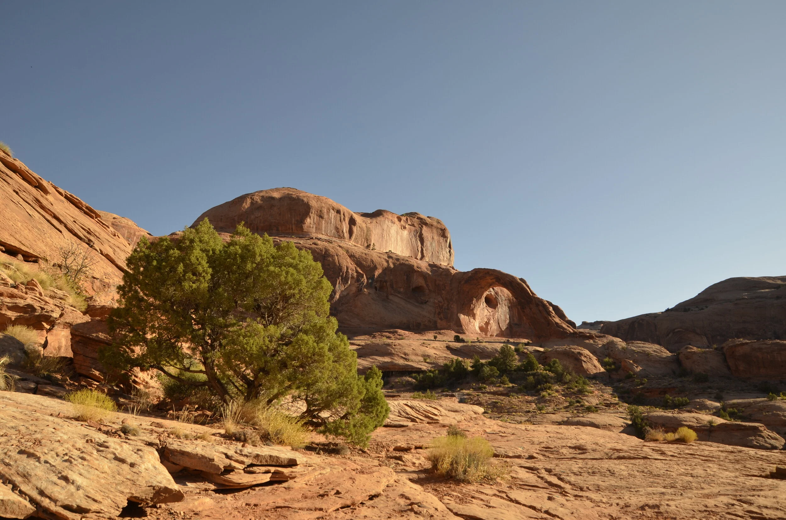
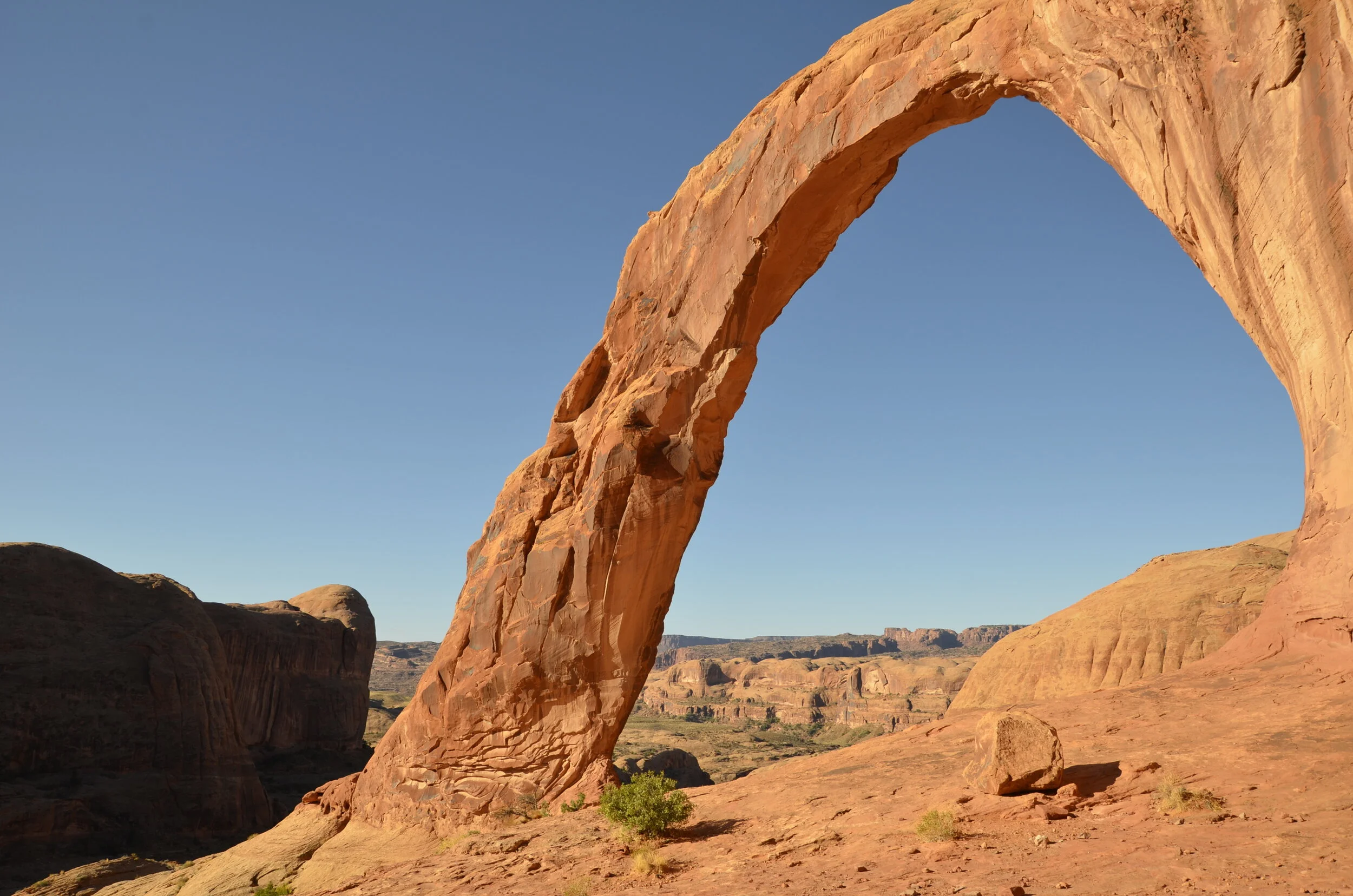
While still in Moab, we went on one of our favorite hikes - for the destination. Unfortunately, it was the site of Steve’s ankle sprain. Corona and Bowtie Arches aren’t even in a park or monument, but are easily reached outside of town. Our first glimpse of Corona Arch was an optical illusion, hiding the arch in the background rock.
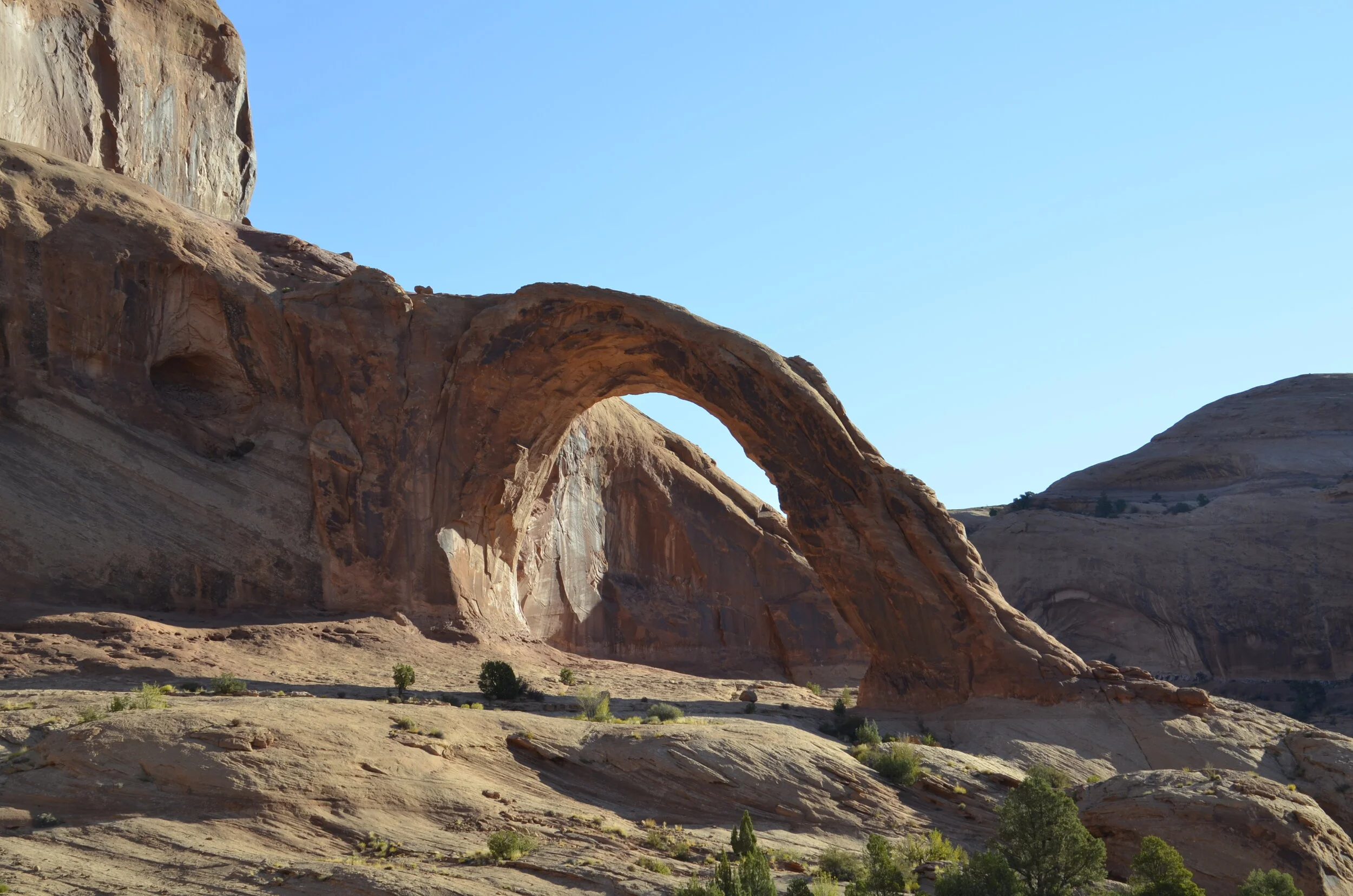
As we walked closer, you could see the arch clearly…
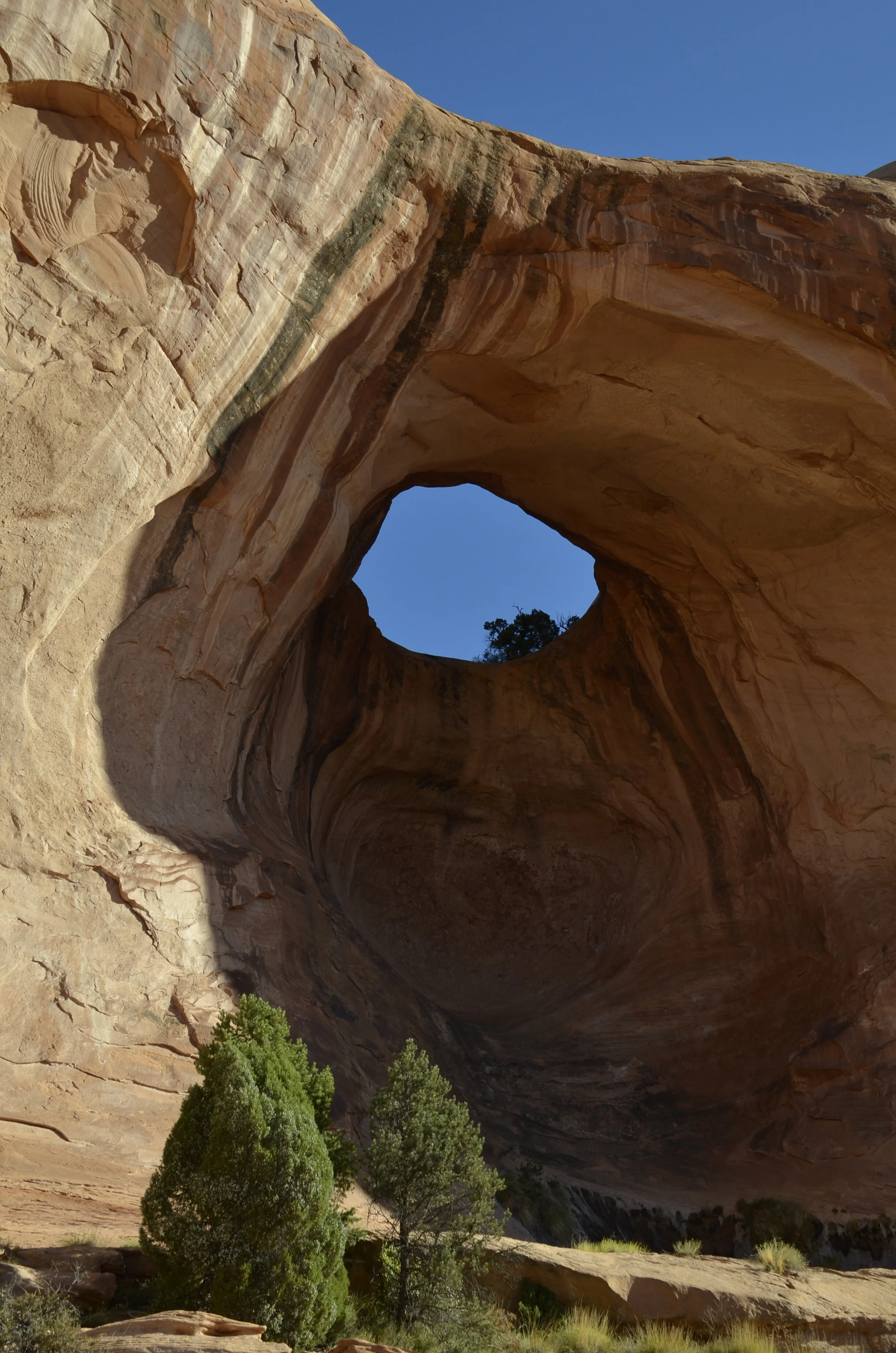
…as well as rounding the corner, and finding Bowtie Arch (a pothole type).
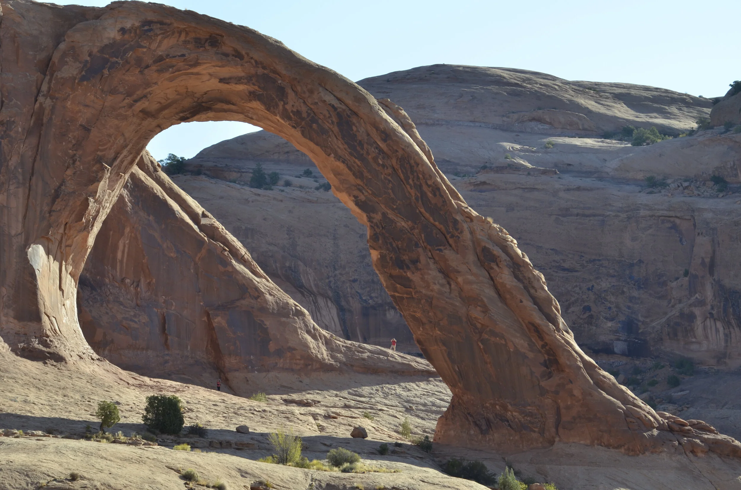
This was a massive arch (as you can see by the tiny person in the picture below), but because it wasn’t in the national park, we only had to share it with a few other hikers.
Steve took this video to show the isolation and beauty of the surrounding area, including the “secret grotto” that was around behind the arch:
A last shot, before we move on -
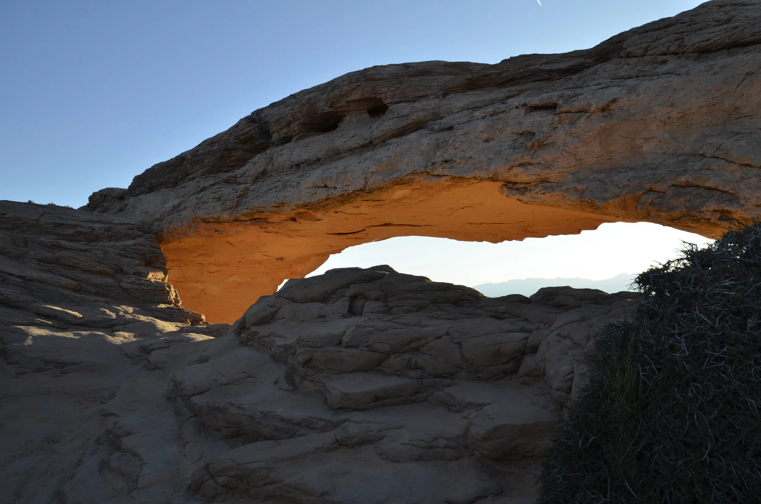
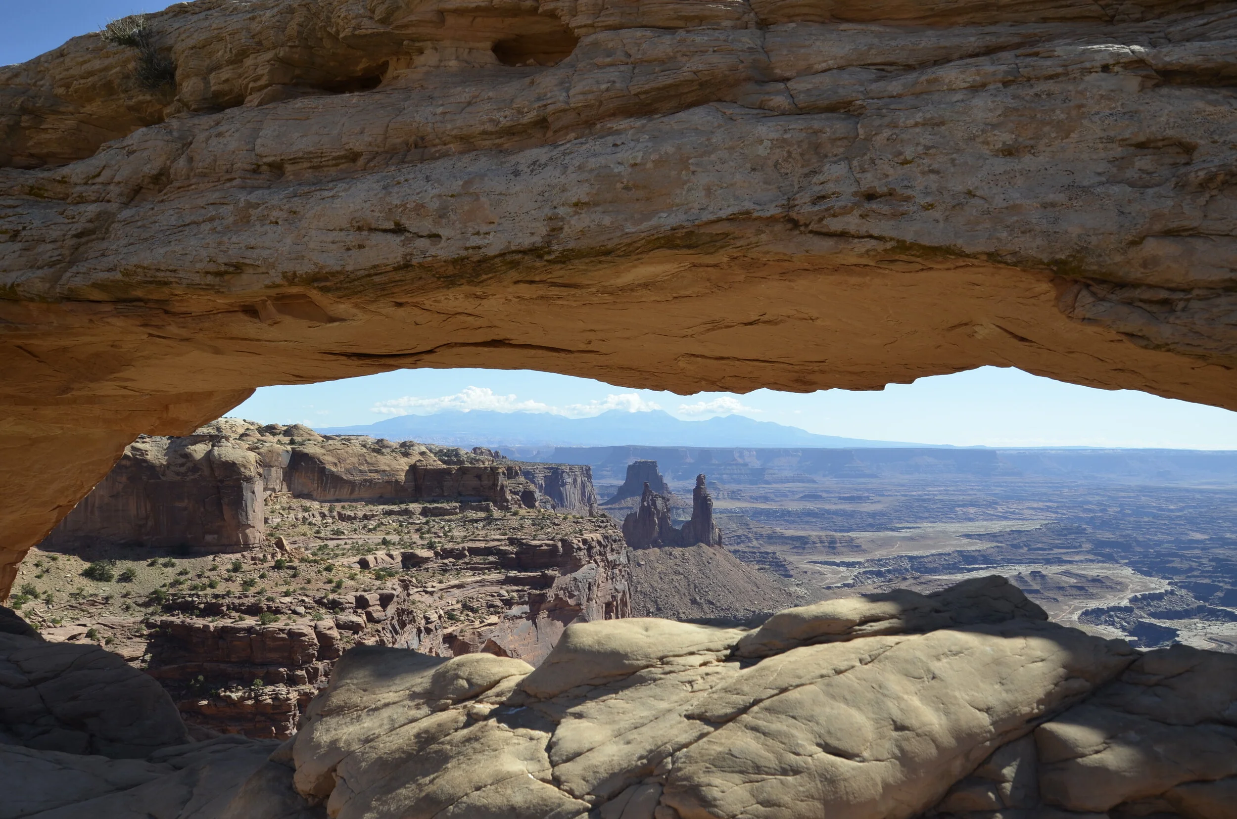
Canyonlands is an enormous national park, with several different sections, spaced many miles apart. We went to Islands in the Sky part while we were in Moab, and caught early morning light on Mesa Arch there.
We went on to hike along the rim…
…and got great shots down into the valley.
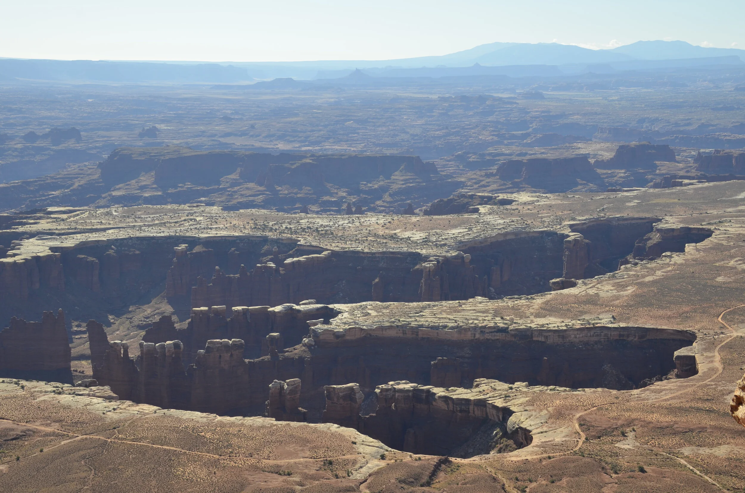
We could finally see the Colorado River that helped carve this area.

We then headed back to Mesa Arch to see what it was like in mid-day lighting.
Driving down the road to Dead Horse Point State Park, we found the Colorado again -
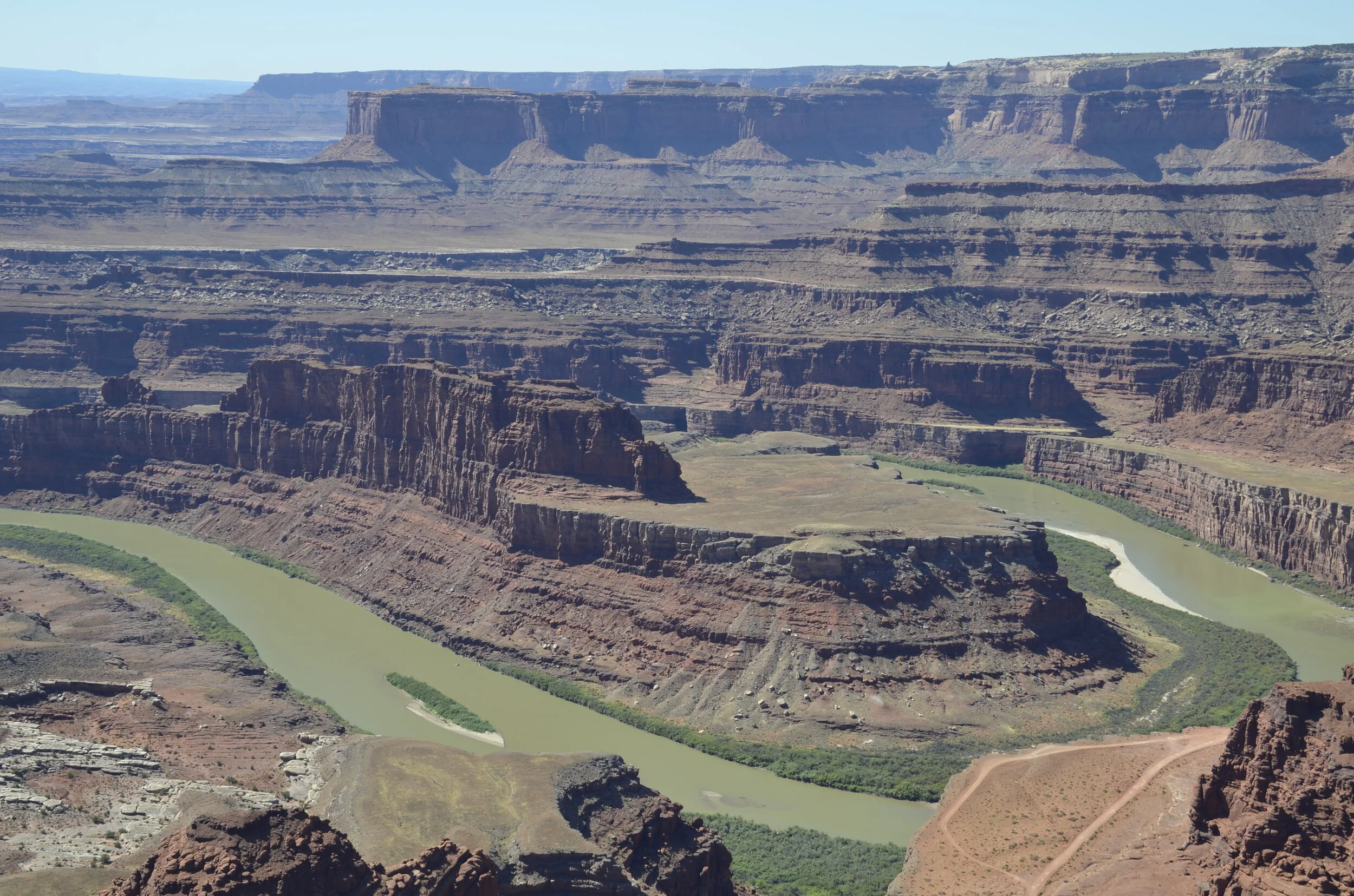
This was supposed to rival Horseshoe Bend at the Grand Canyon, that Instagrammers have mobbed, but we weren’t that impressed. I’ve got another place that I think you’ll like better (as we did).
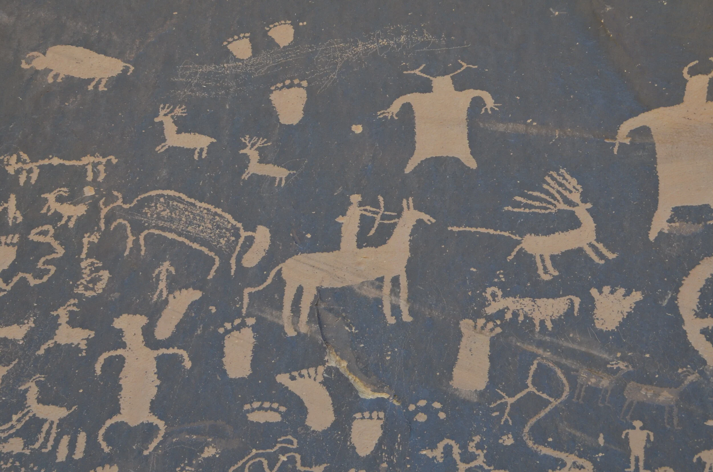
Now, driving further down the road, we stopped by Newspaper Rock, which is a state historical site. Apparently the oldest petroglyphs are around 2,000 years old. They are carved into the dark “desert varnish” (manganese-iron deposits that form on exposed sandstone) exposing the lighter rock underneath.
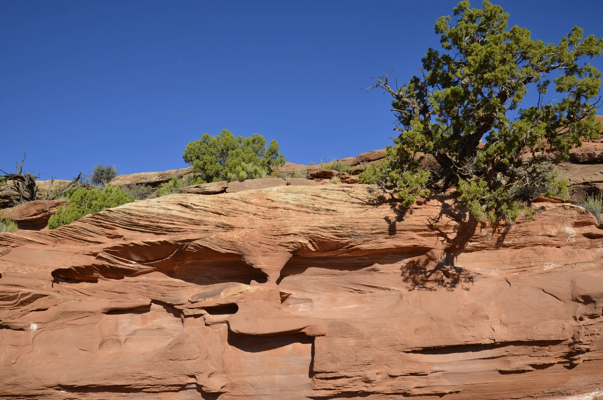
Moving on yet again, we were treated to some awesome vistas -
…before coming to Goosenecks State Park. This is the San Juan River in extreme SE Utah.
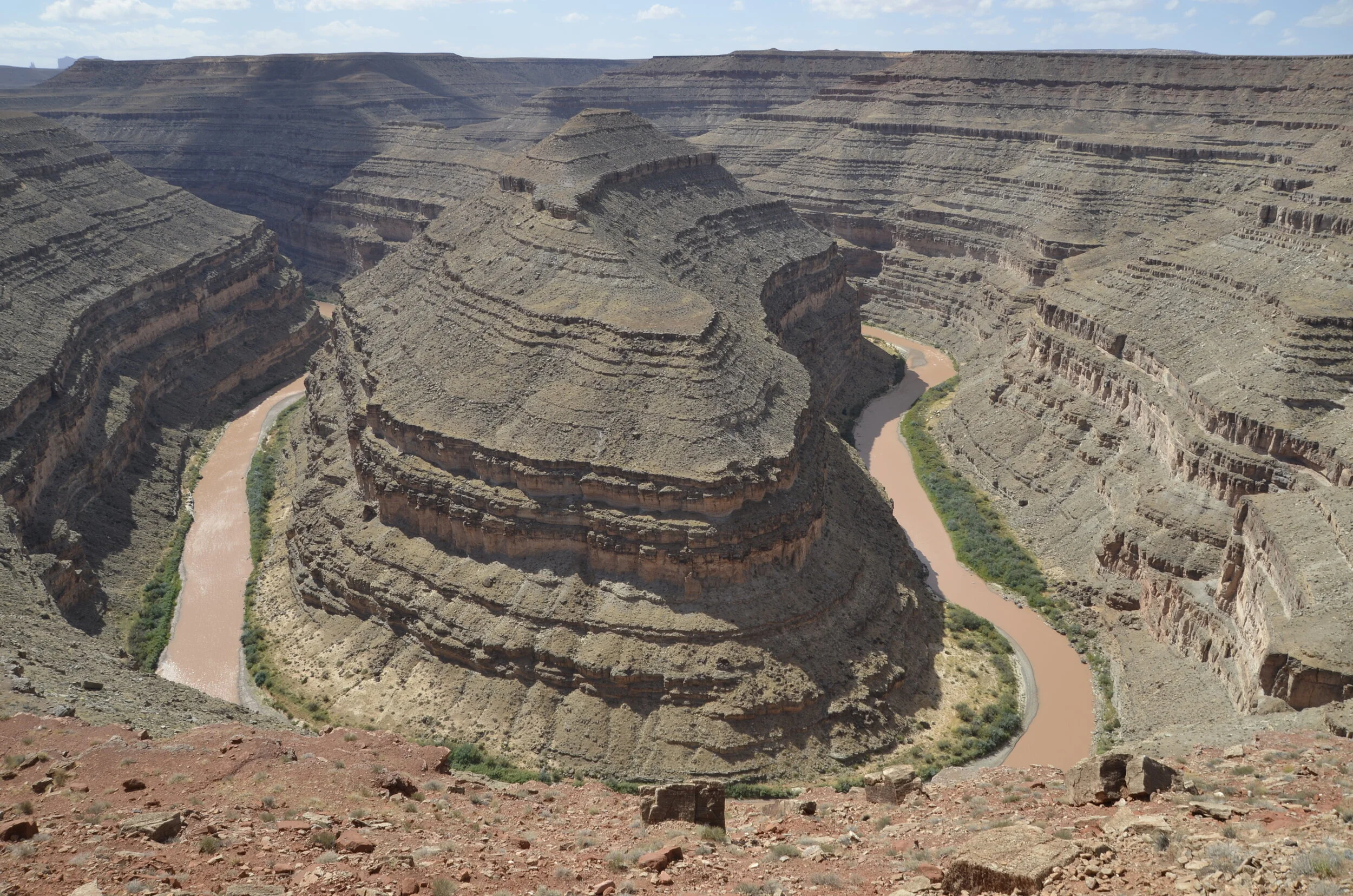
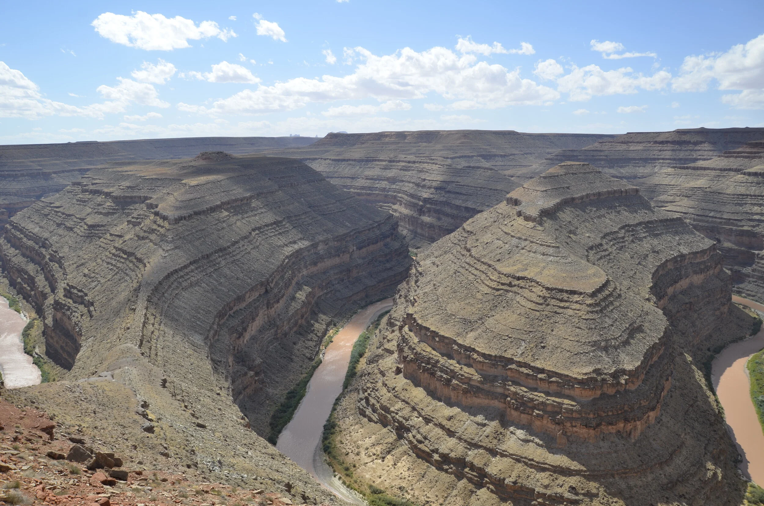
It was horrendously windy that day, as you’ll hear in Steve’s video:
Now, don’t you agree that that’s better than the ol’ single Horseshoe Bend?
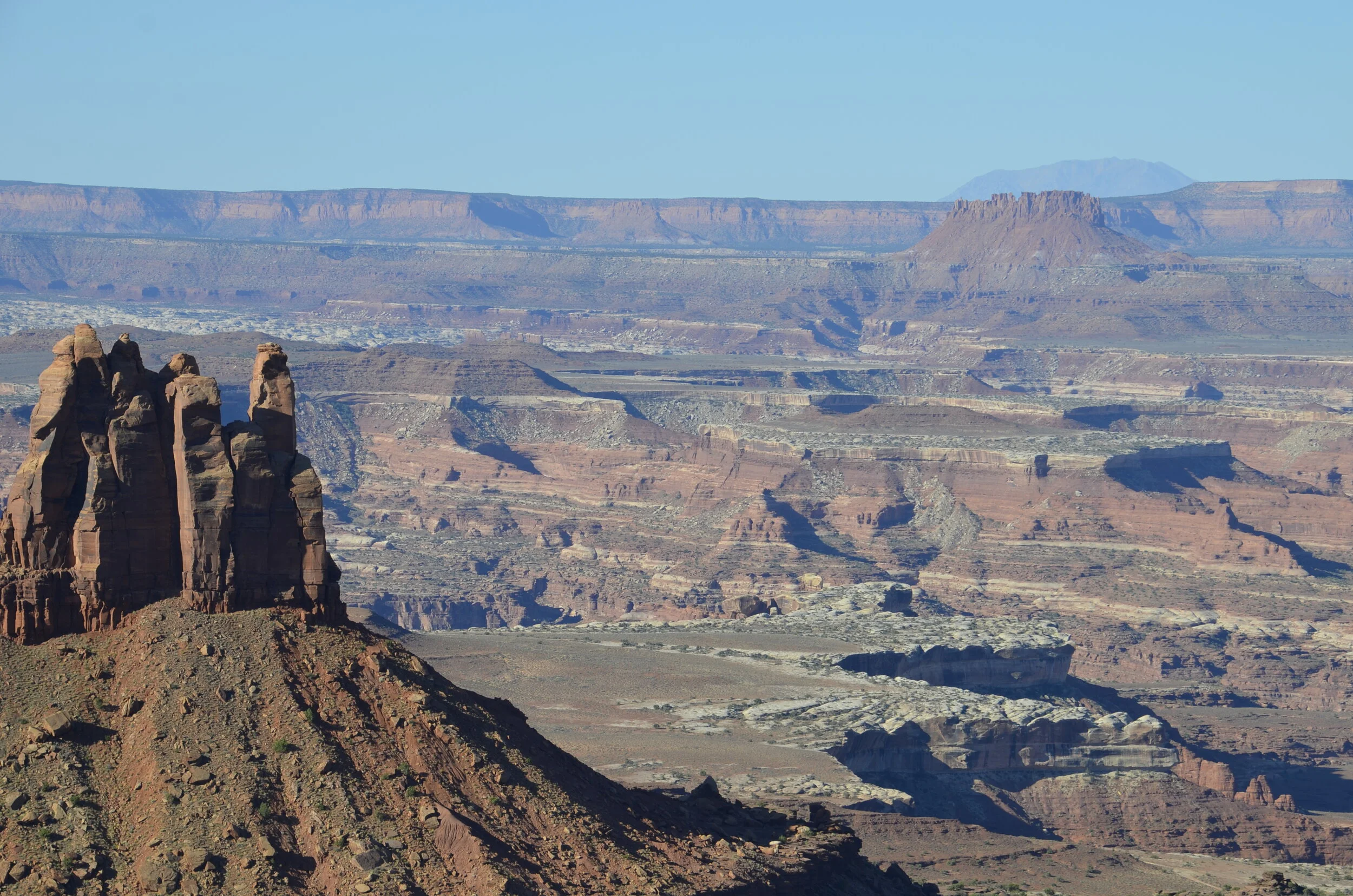
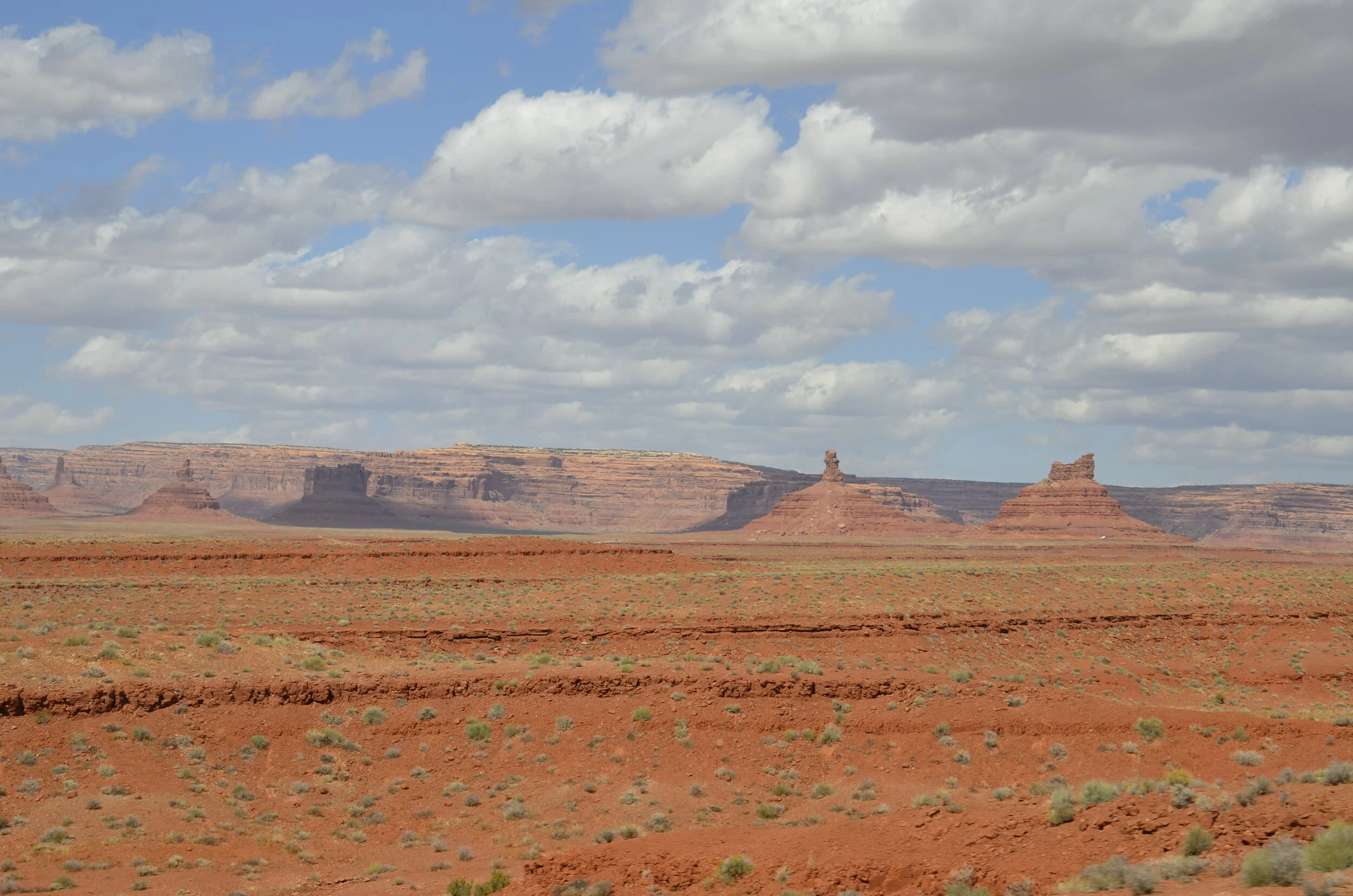
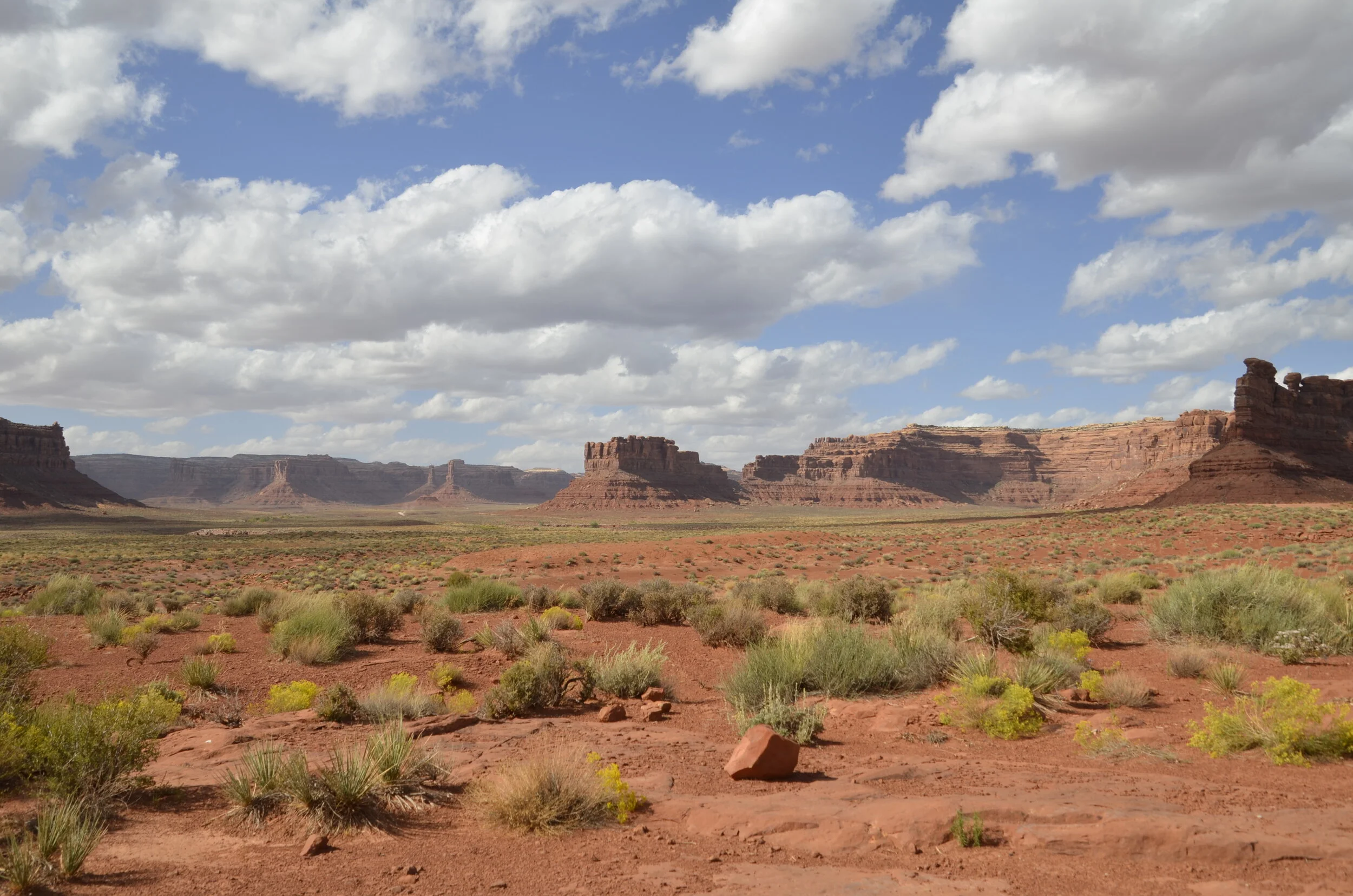
We’re still not done with this day! We moved on to Valley of the Gods, (which is apparently a condensed version of Monument Valley in northern AZ, that we’re skipping on this 5500+ mile tour).
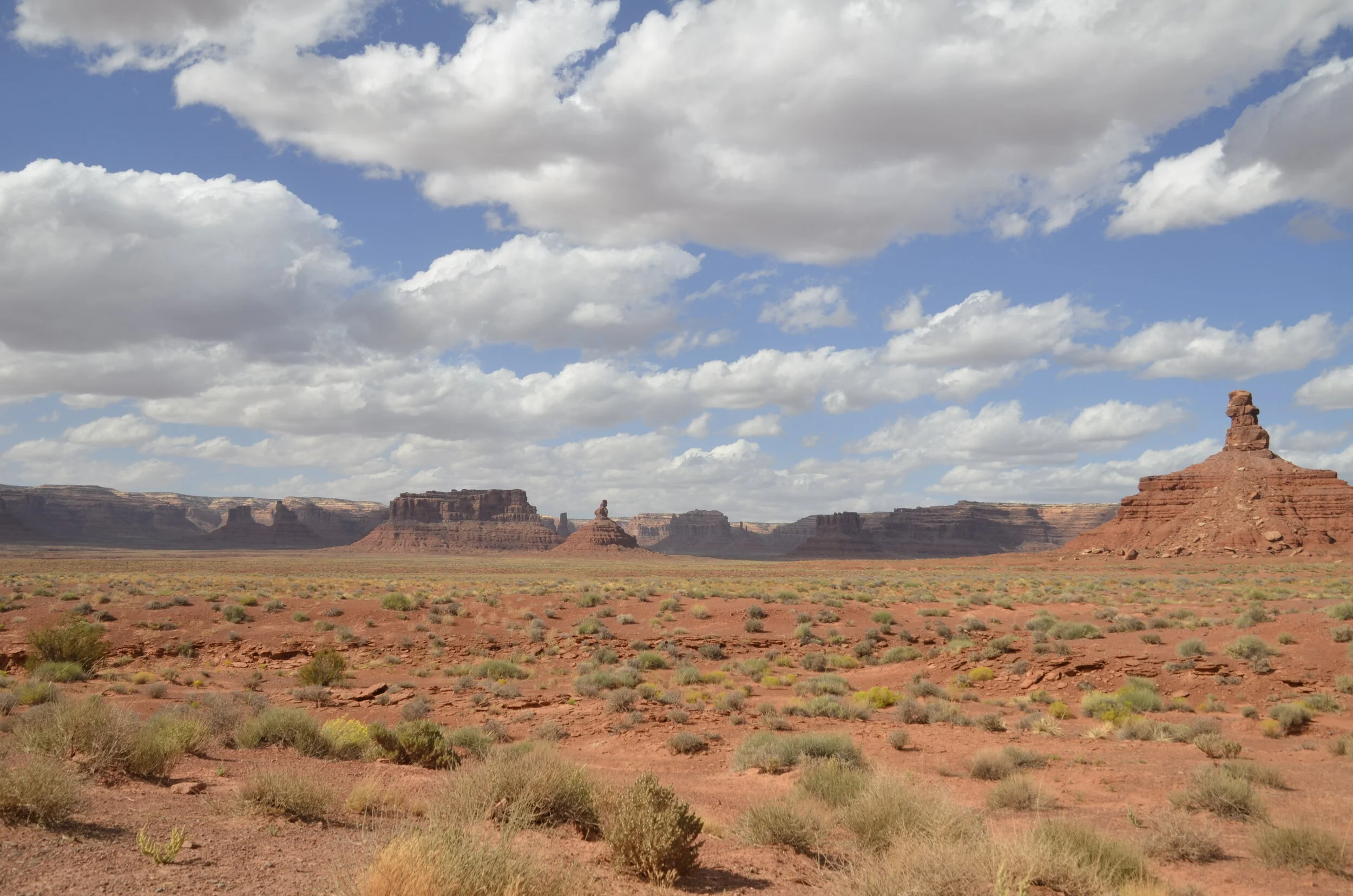
Cars included for scale:
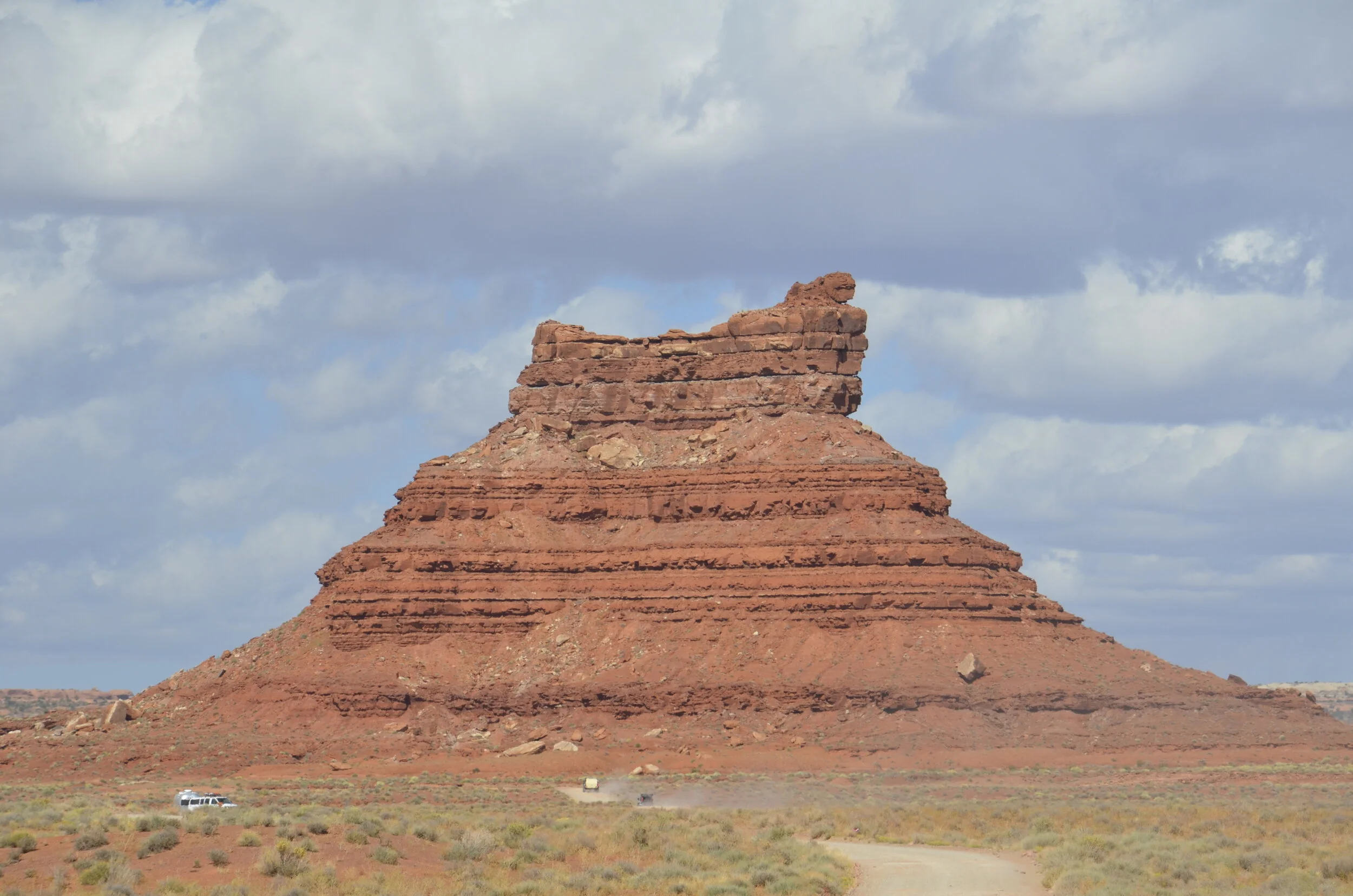
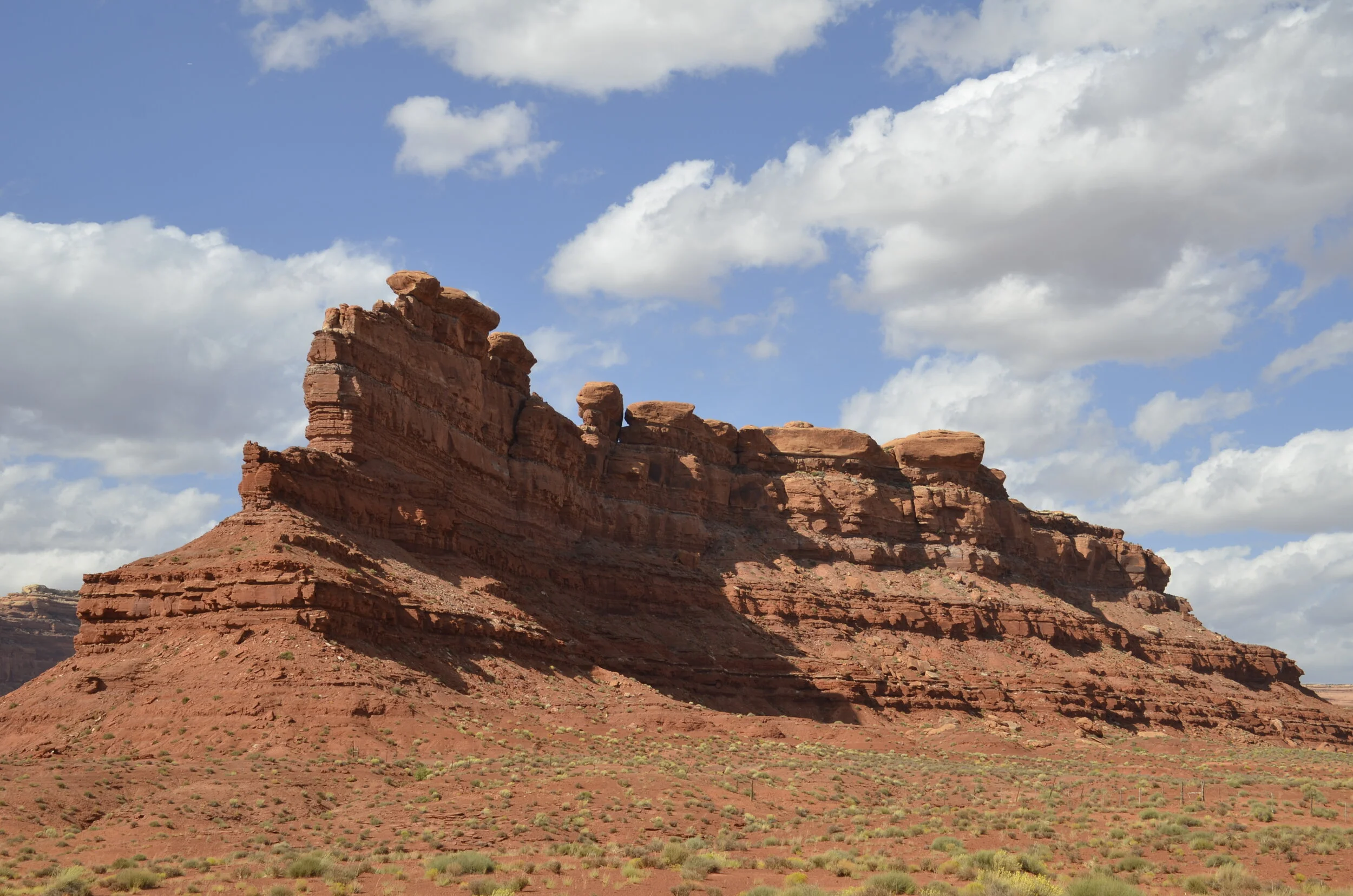
I just couldn’t get enough of the contrasting colors and “big sky” feel.
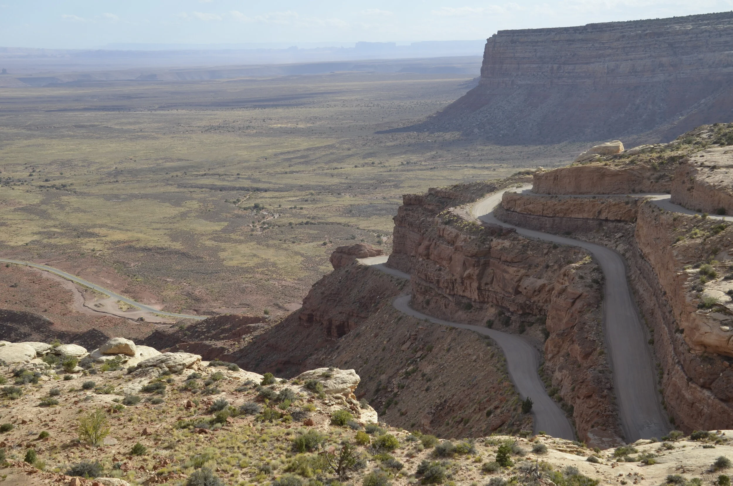
We drove up and out on the Moki Dugway, which is a 3 mile dirt and gravel road with 10% grade on average throughout.
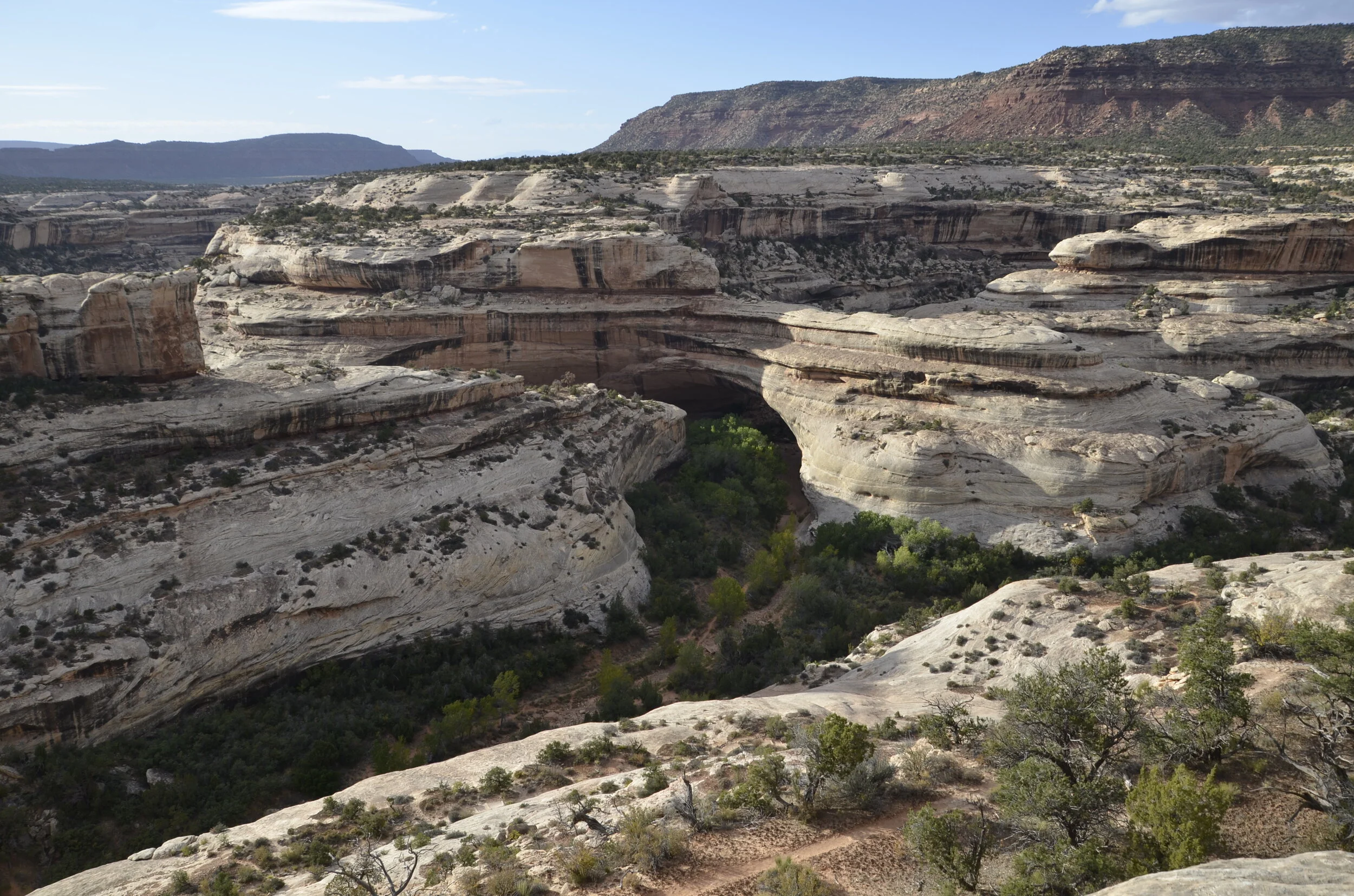
As the light was fading, we flew through Natural Bridges National Monument to check out the three bridges there and snap a few pictures.

Sipapu Bridge
Kachina Bridge is the shadowed area in the center of the picture.
Bridges (in contrast to arches), as you may have already surmised, are carved by water.

Owachomo Bridge
Whew! Enough for one day and a single blog!