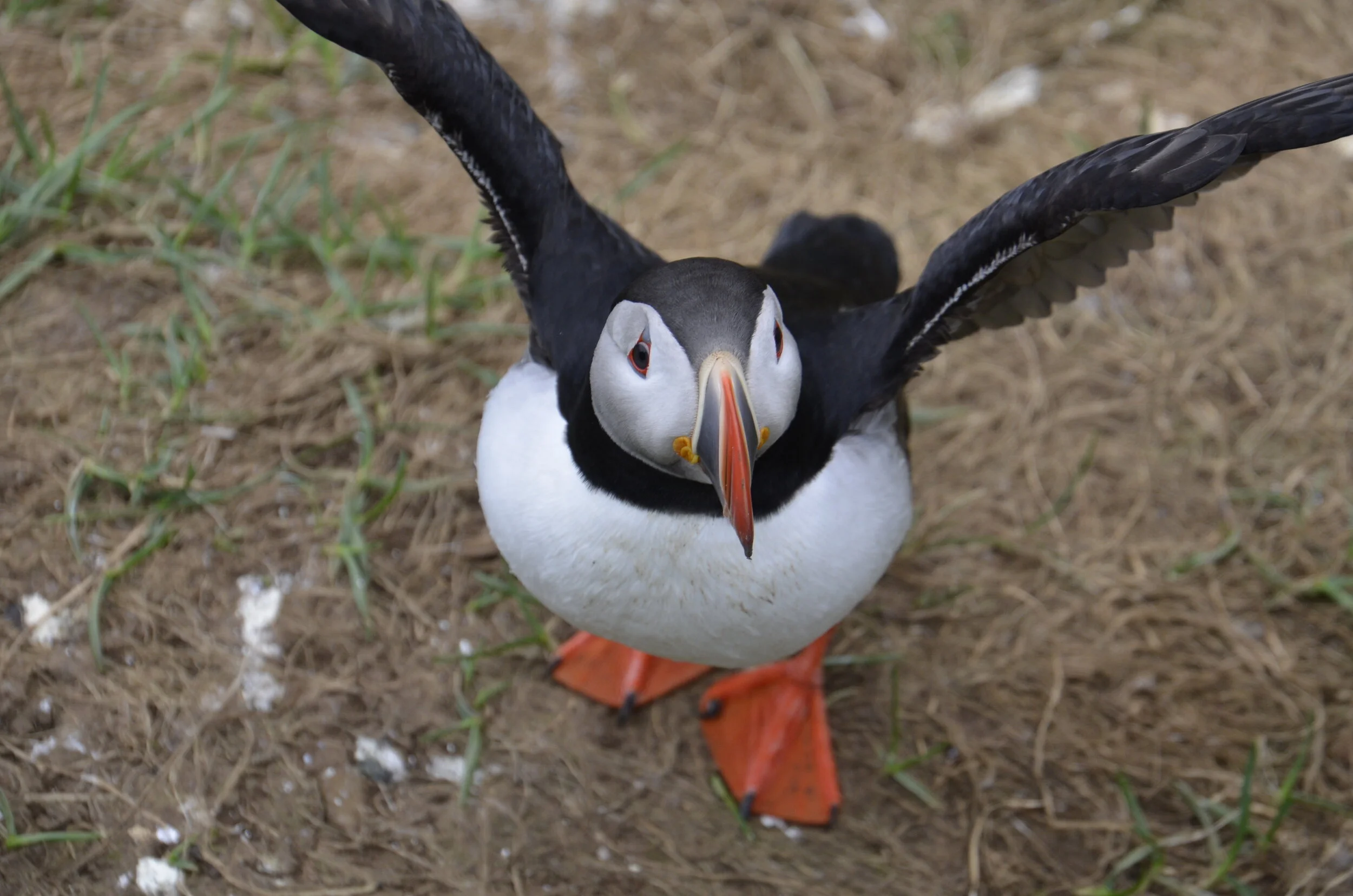
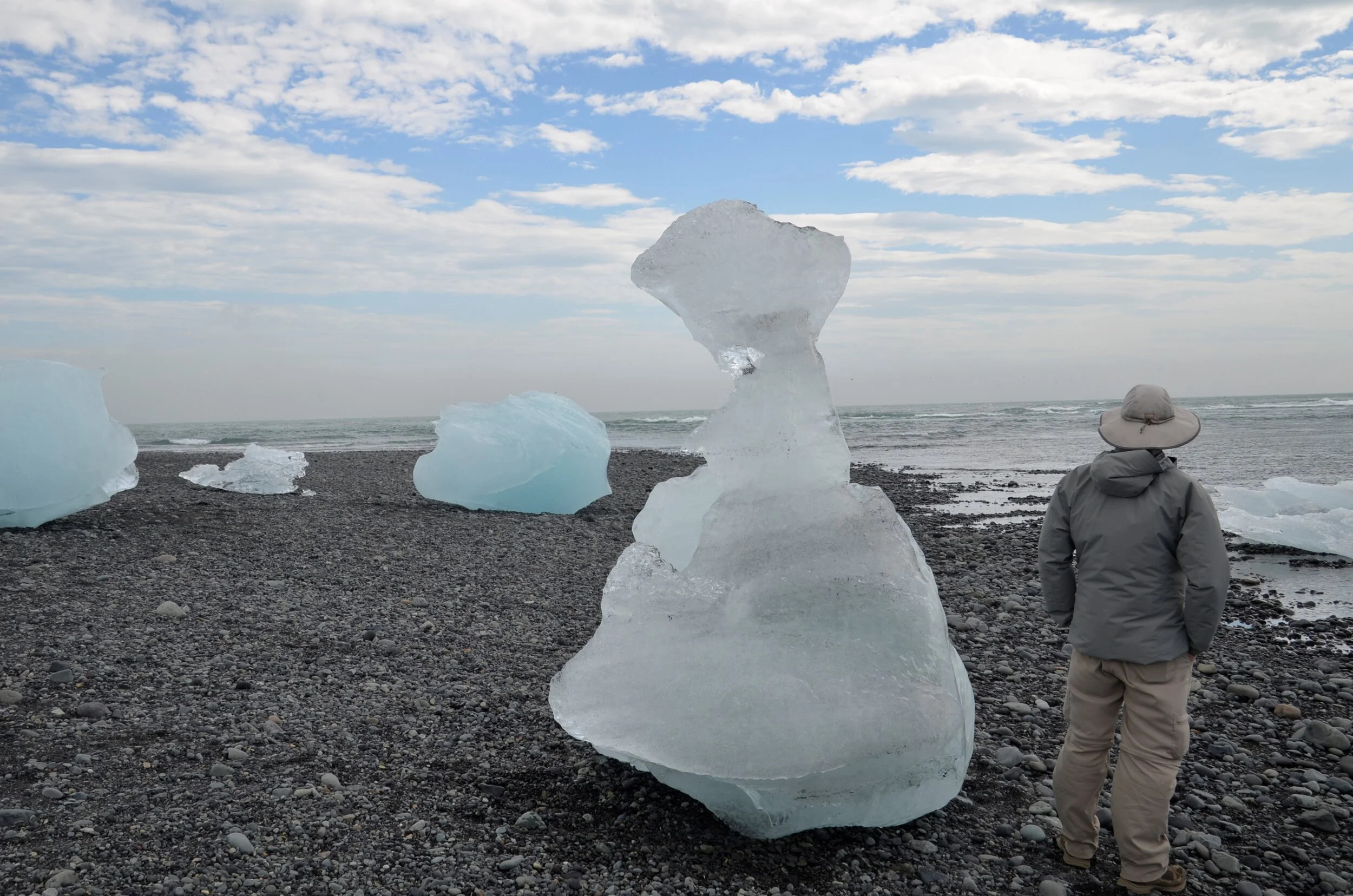
Iceland Conclusion

One last waterfall before heading to Reykjavik - Glymur - took almost 2 hours of hiking (pretty steep and also exposed trail near cliff edges) to reach. I didn’t take many pictures on the way up since I was concentrating on the hiking.

_DSC1817.JPG

If you enlarge the picture above, you can see our first challenge across the river:

_DSC1818.JPG

Steve took a video of me crossing: (remember, open this post in your browser to see the video)

After an hour of hiking, we got our first look at our goal -

_DSC1831.JPG

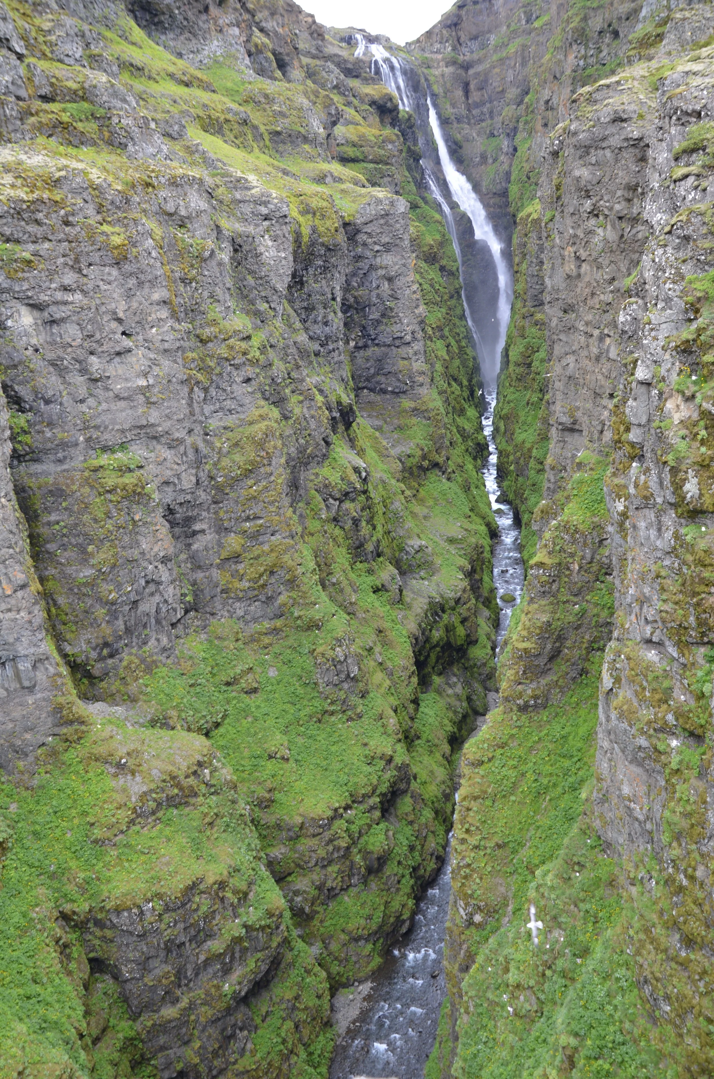
… and that was where we were (where the people are standing on the edge) when we took that first picture of Glymur -

_DSC1855.JPG

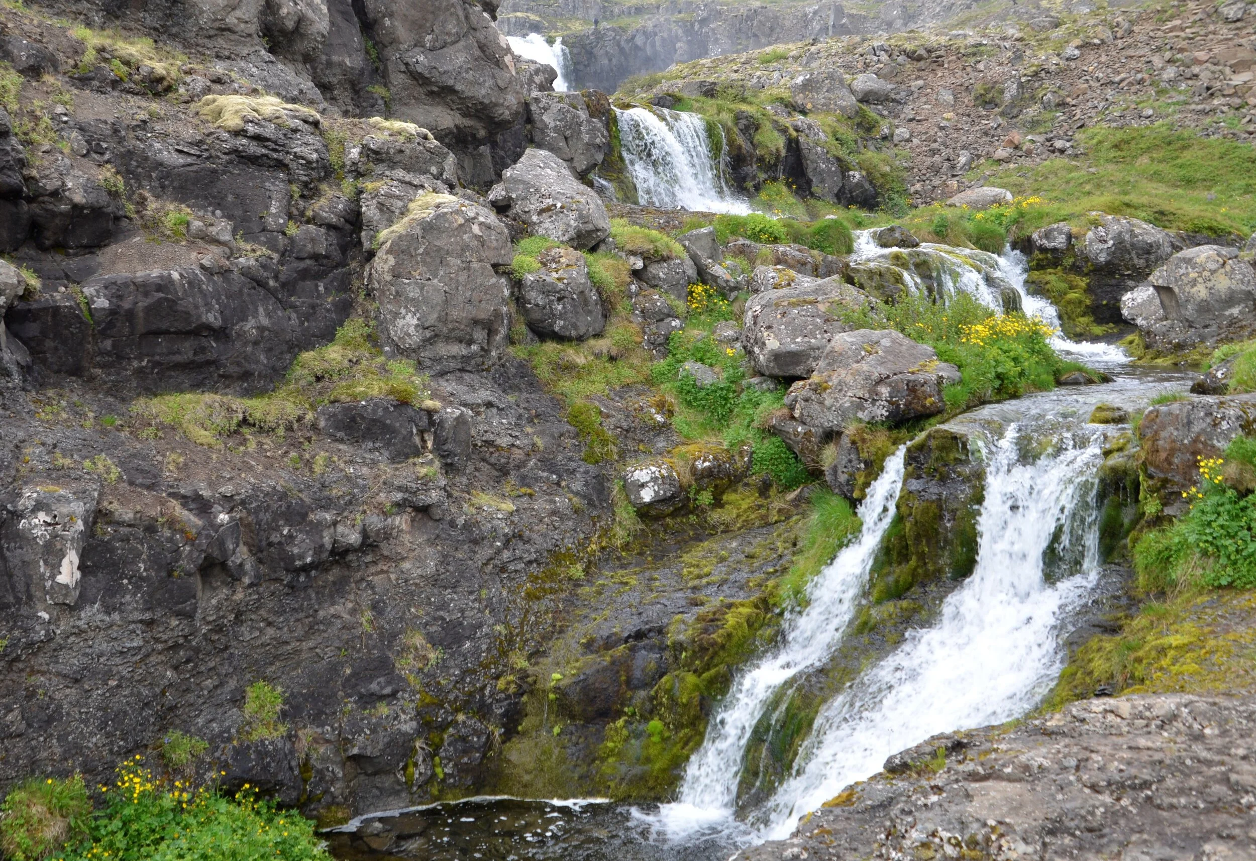
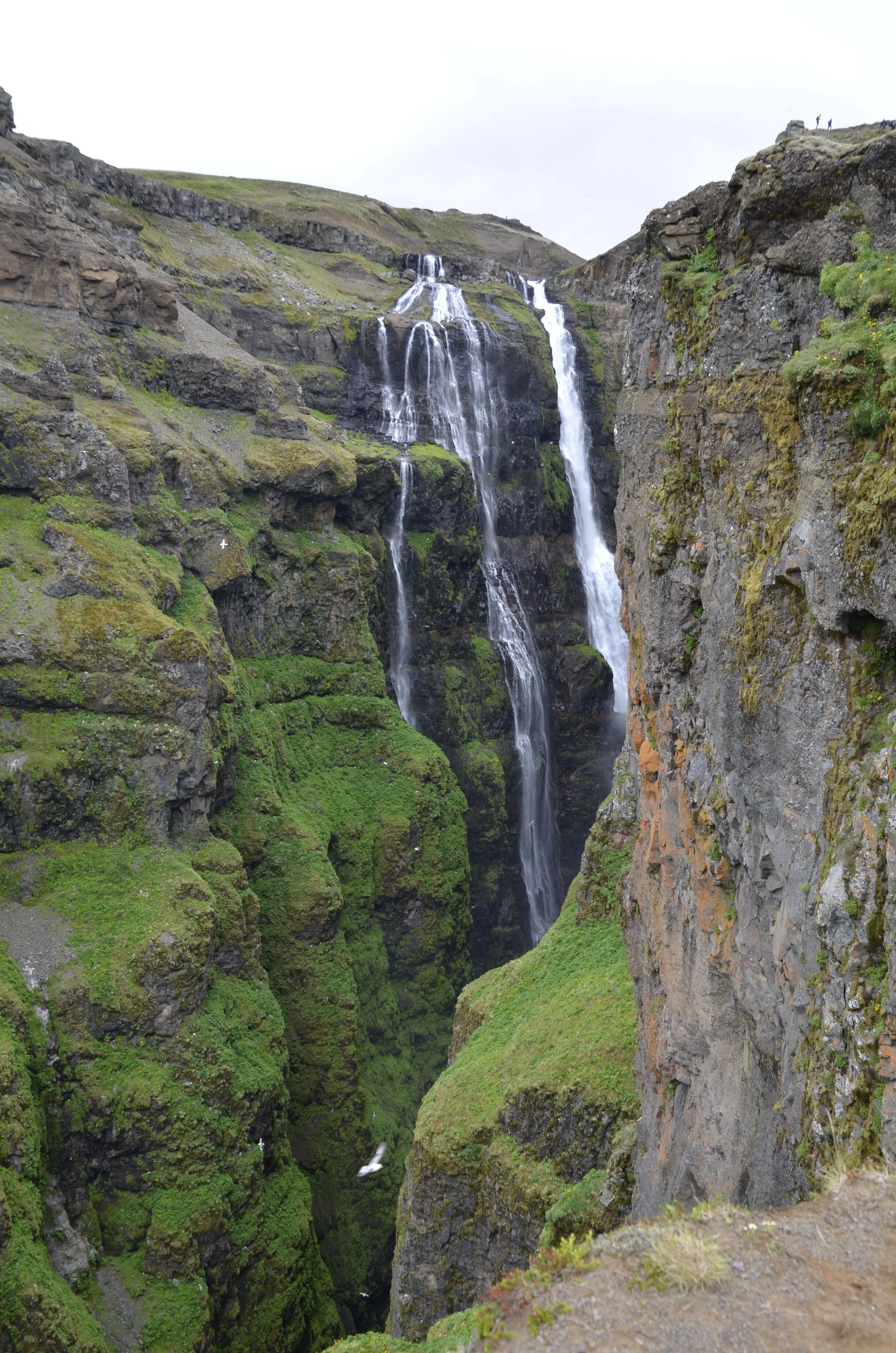
It just got better and better, the closer and higher we got -

_DSC1854.JPG

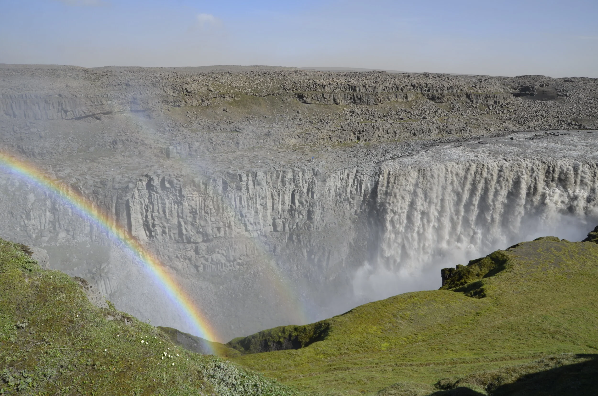
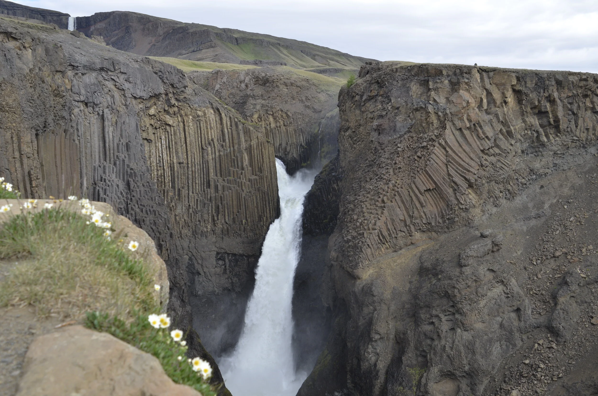
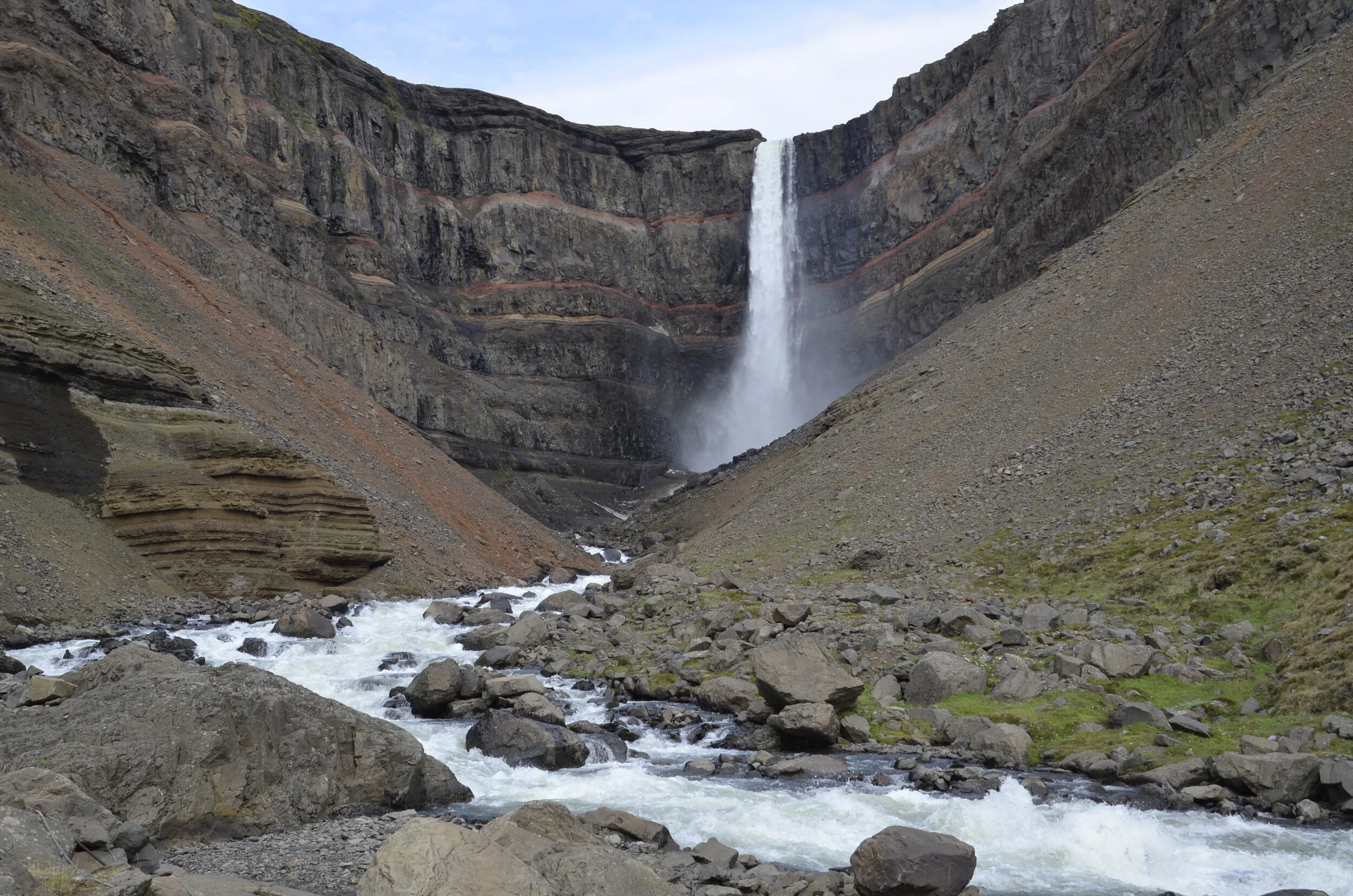
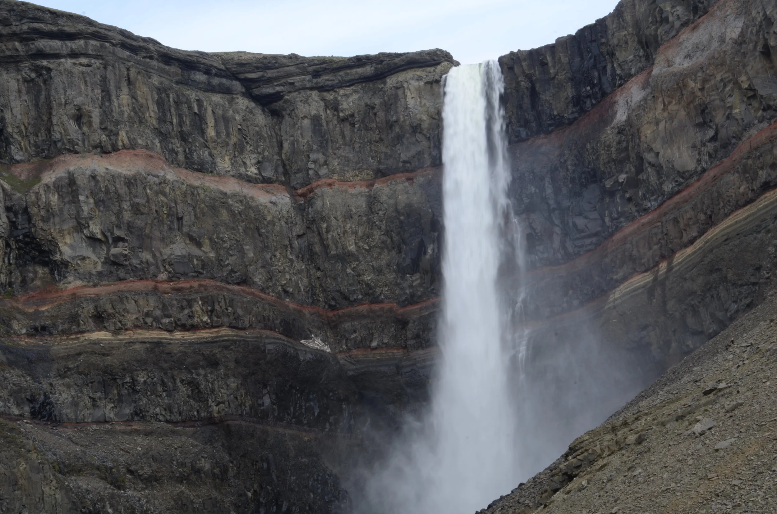
This is the second highest waterfall in Iceland at 650 ft!

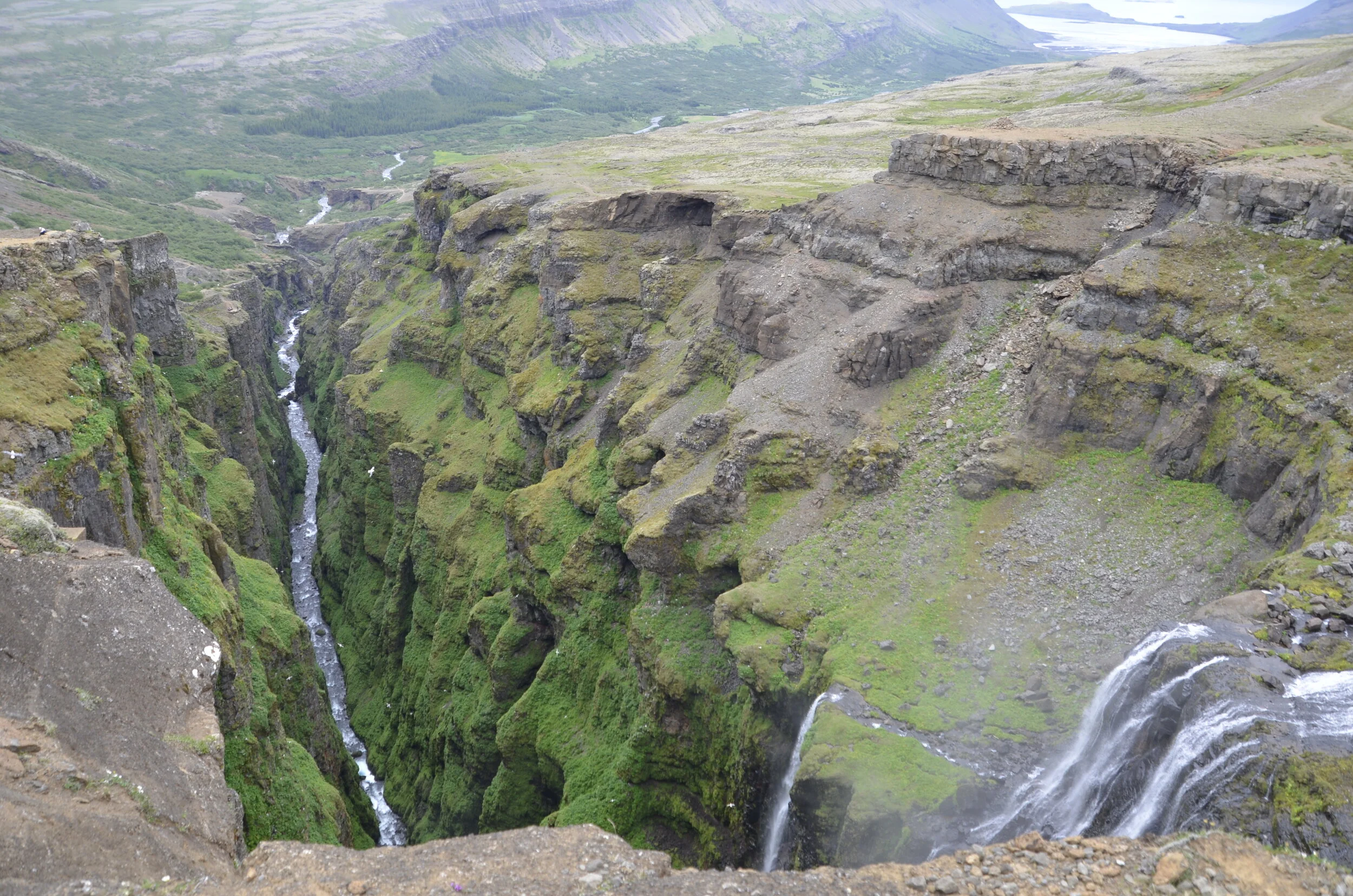
The views back over the valley we climbed out of were pretty expansive:

_DSC1856.JPG

See the tiny people at the top?…

_DSC1858.JPG

You can see people at various points back down the trail we just ascended:

_DSC1864.JPG

Yay - near the top…

_DSC1868.JPG

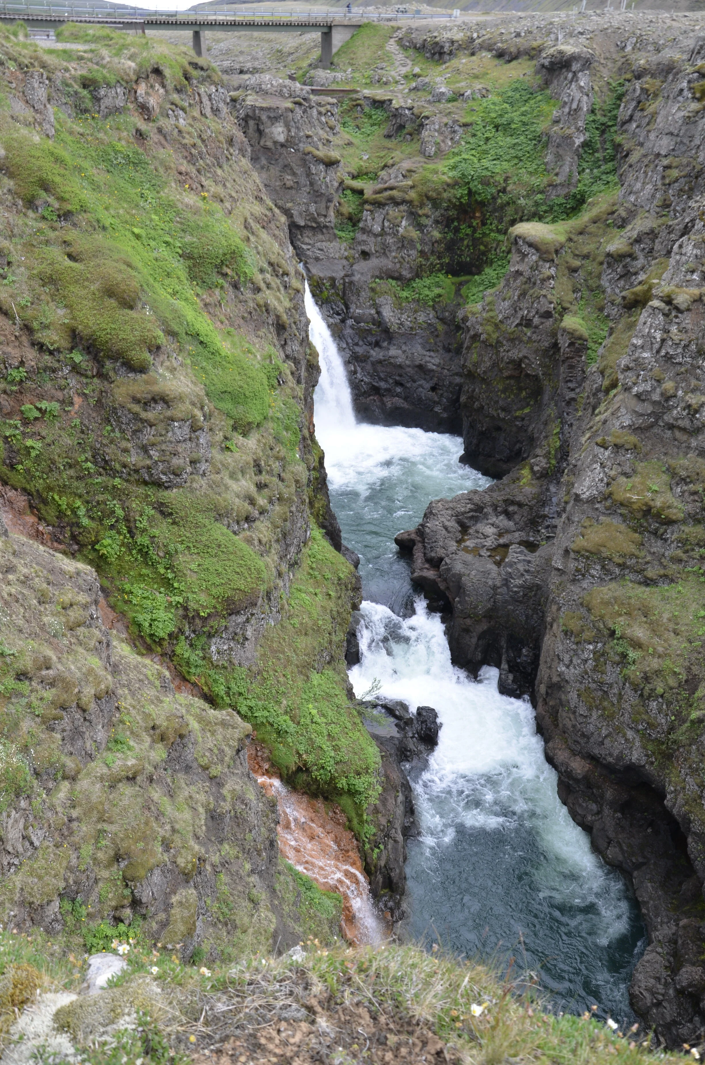
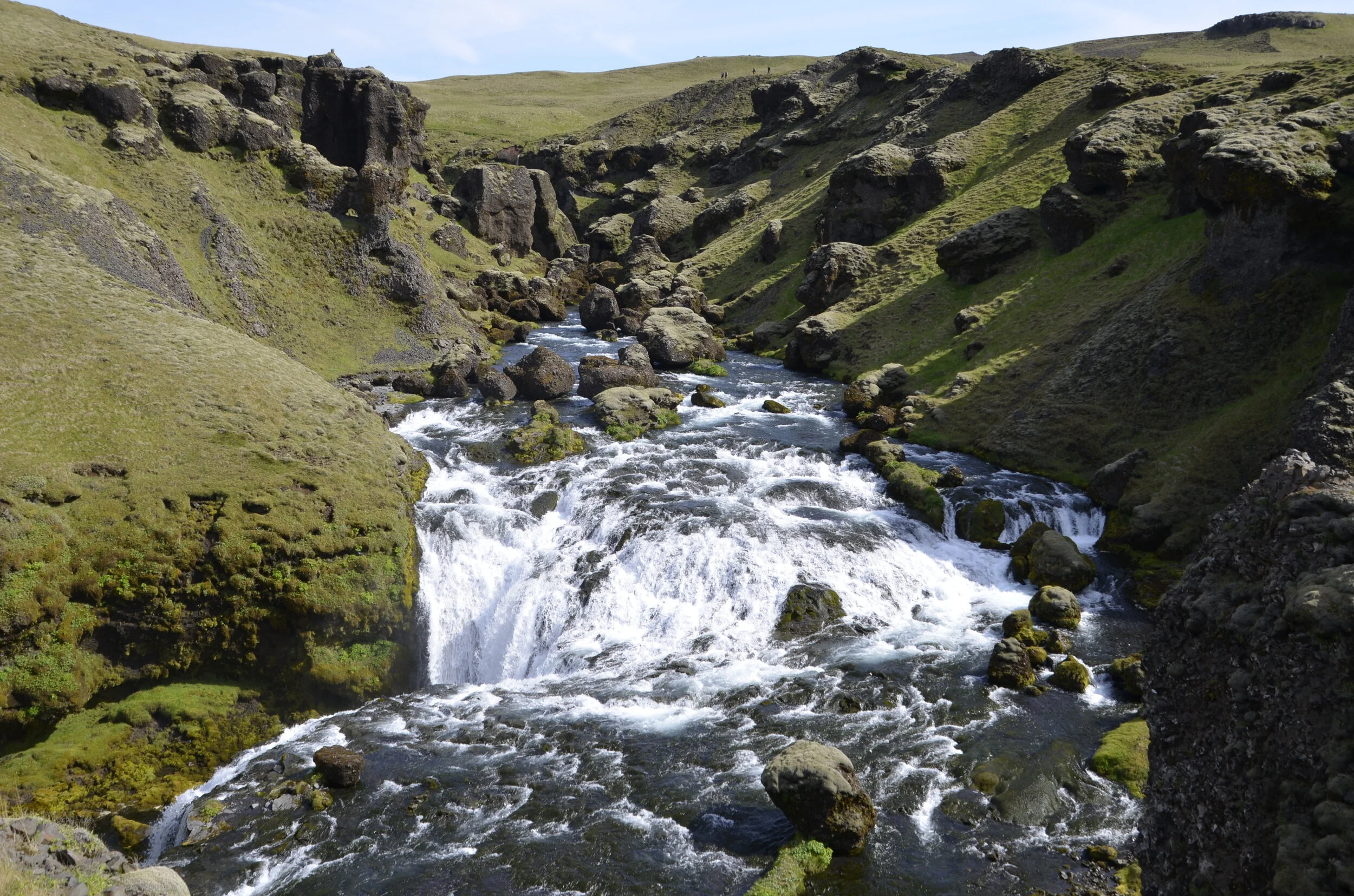
I loved the green filling the canyon walls -

_DSC1870.JPG

After crossing this river barefoot (on very sharp rocks, to me, and mid-calf deep in spots):

PXL_20210711_135708034.jpg

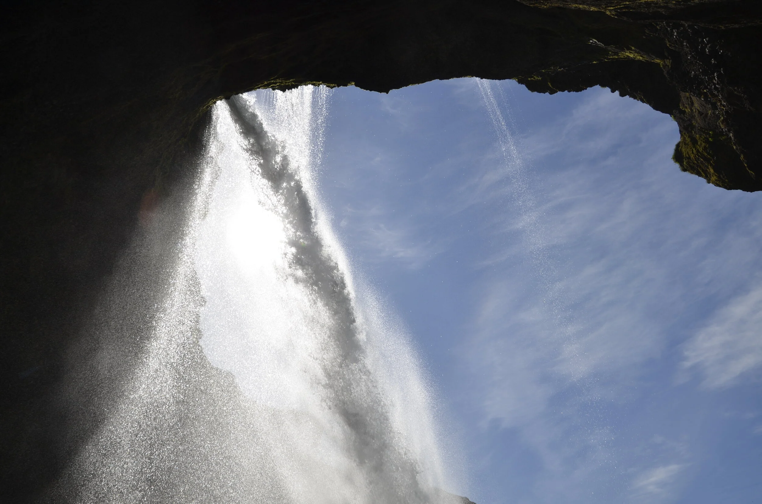
…we got this view at the top of the waterfall -

(talk about dropping over the edge!)

(talk about dropping over the edge!)

The return one hour hike was very boring, but all downhill.

On to Reykjavik… We stayed in the city, near the famous church, Hallgrimskirkja…

_DSC1923.jpg

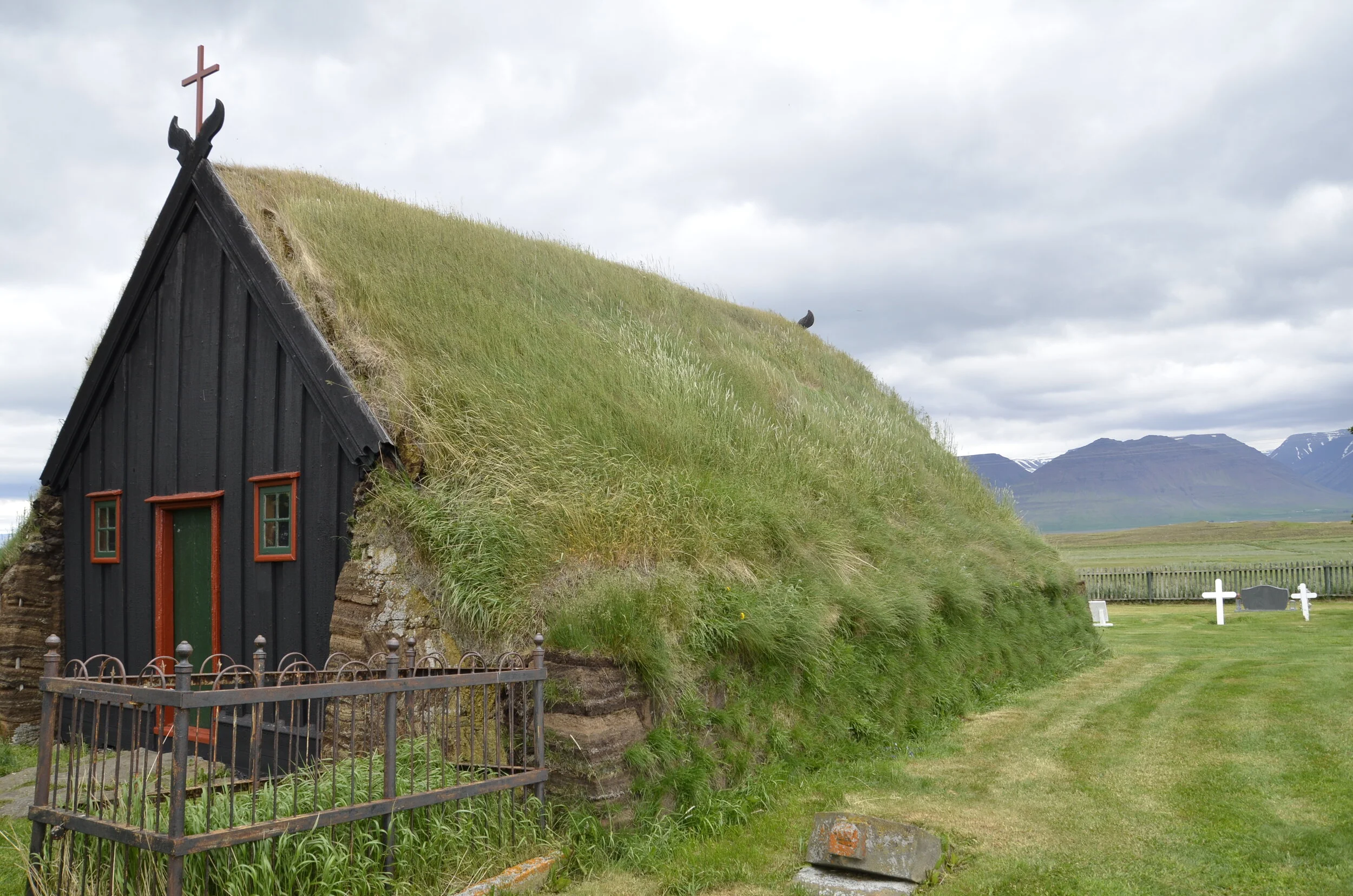
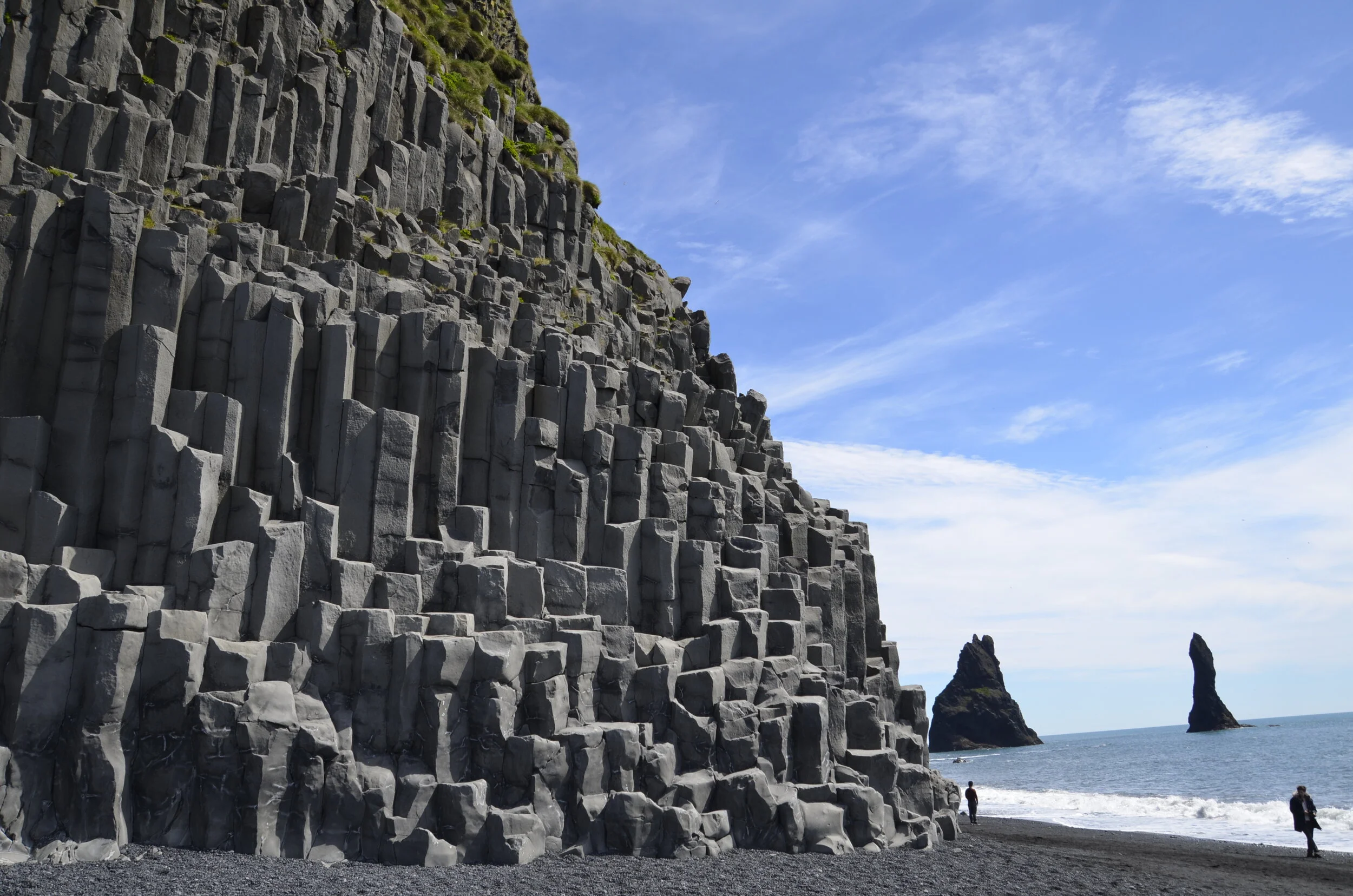
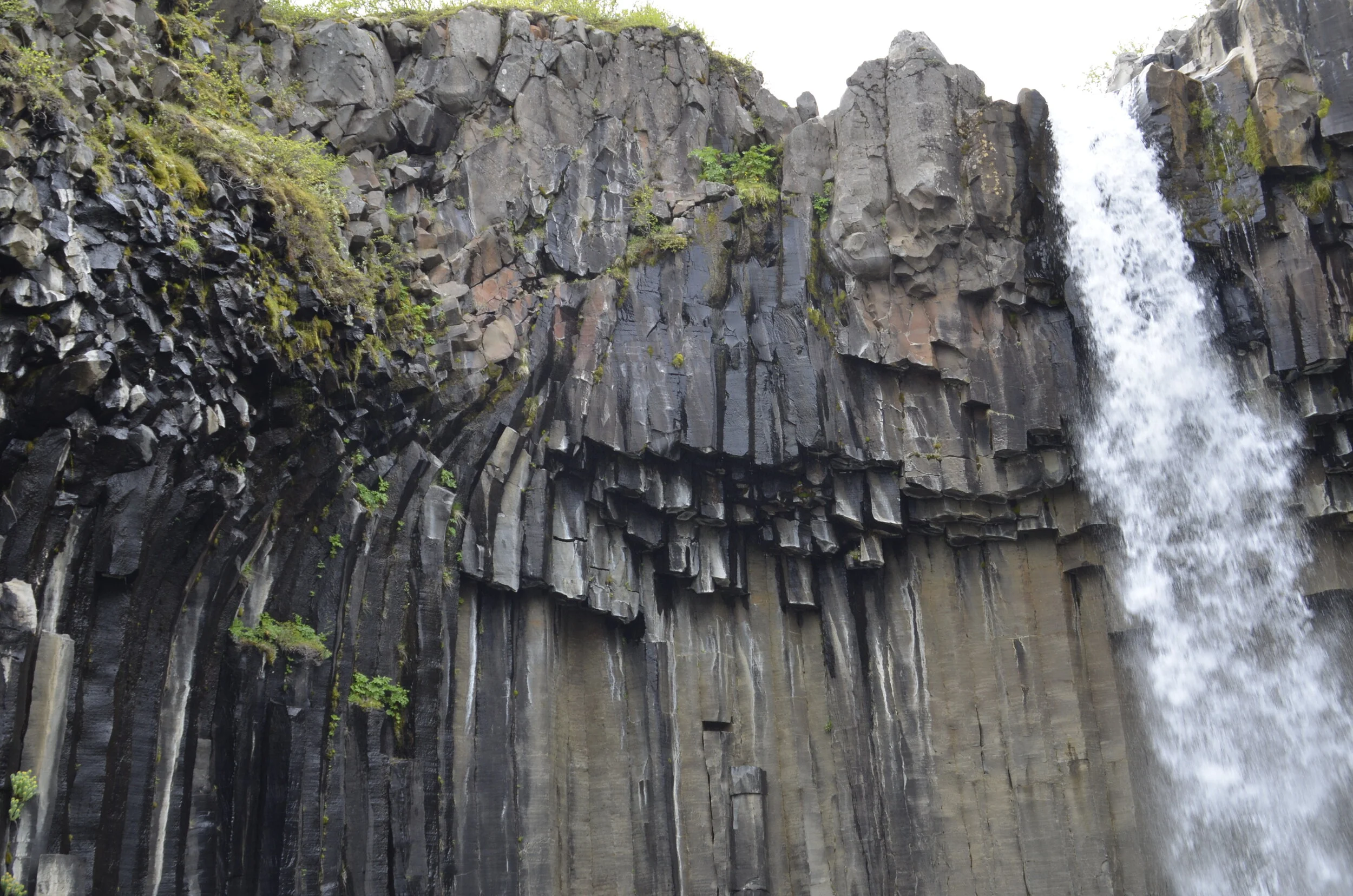
…built to represent the basalt columns that I fell in love with throughout the country. Our Airbnb had some gorgeous poppies in the garden next door -

_DSC1920.JPG

… that was a great color “pop” against the grey skies we had most of the time. The city had some really colorful buildings…

_DSC1931.JPG

… but this was my favorite mural -

_DSC1942.JPG

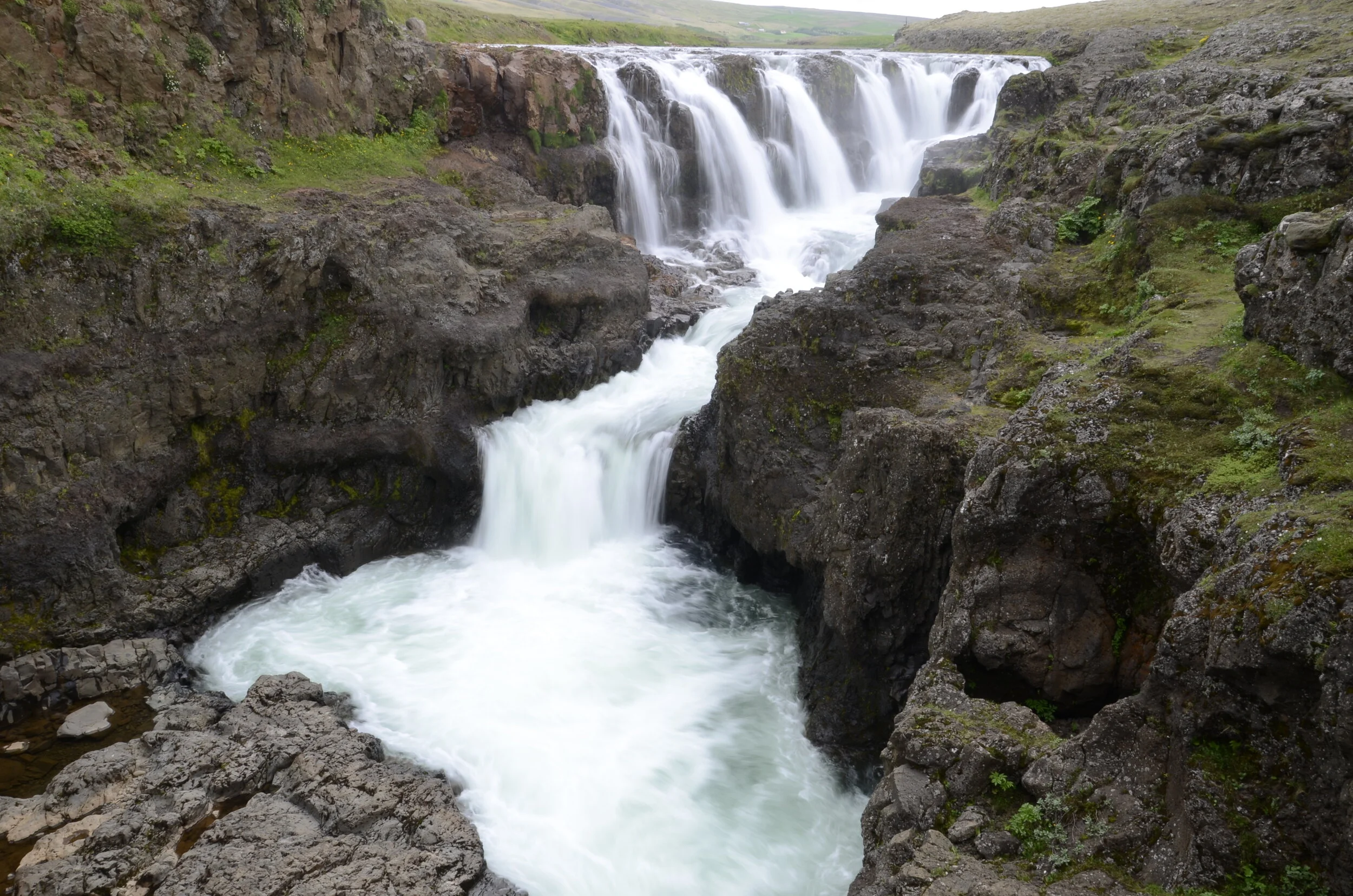
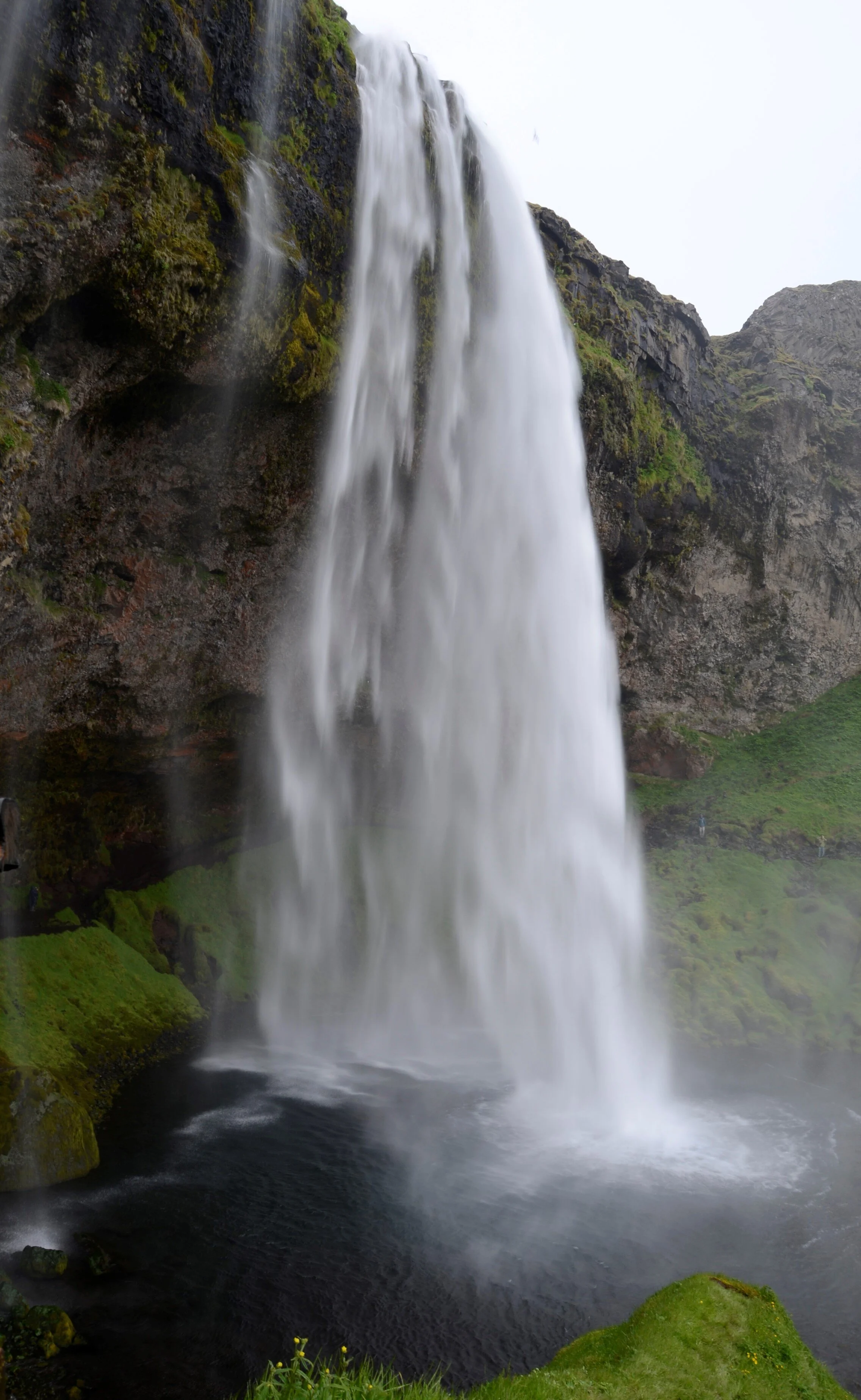
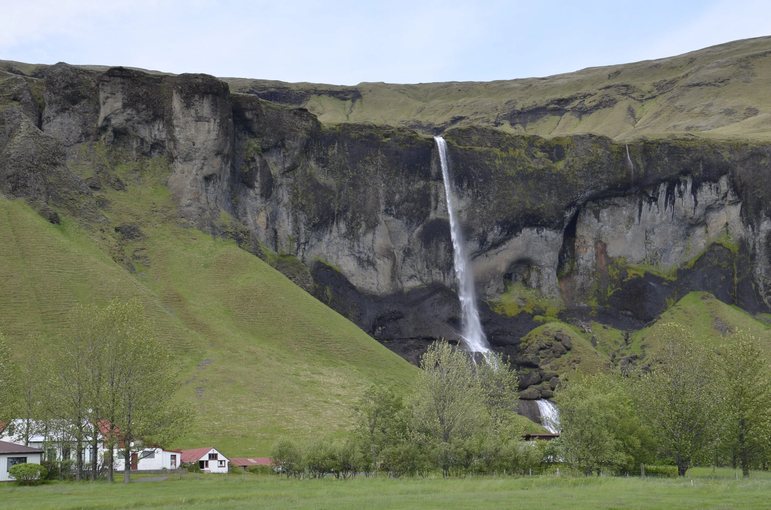
We did visit one more set of waterfalls before we got to Reykjavik, named Hraunfossar (Lava falls) because they flow out of the rocks rather than as a stream or river falling off a cliff.

_DSC1887c.jpg

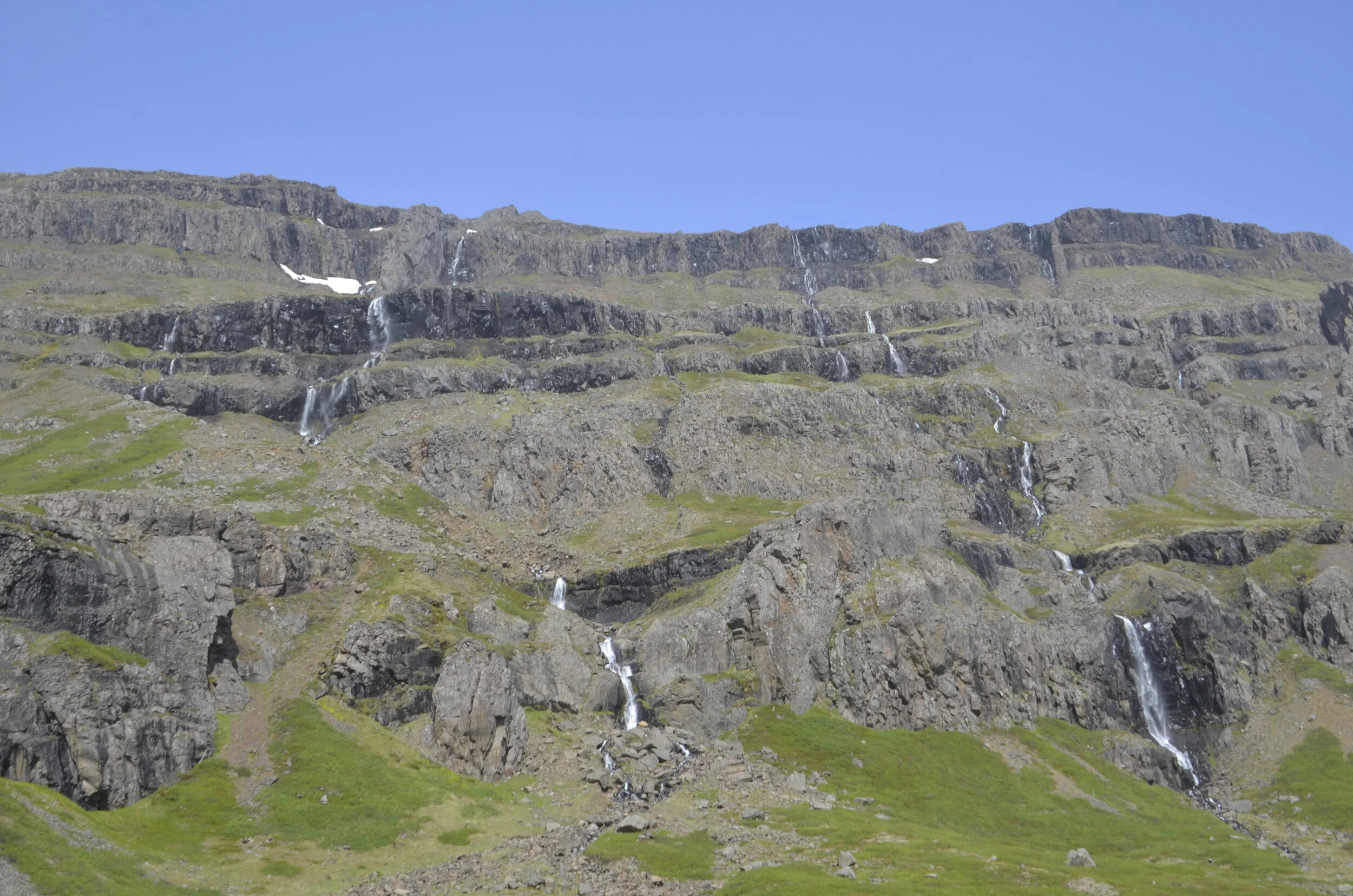
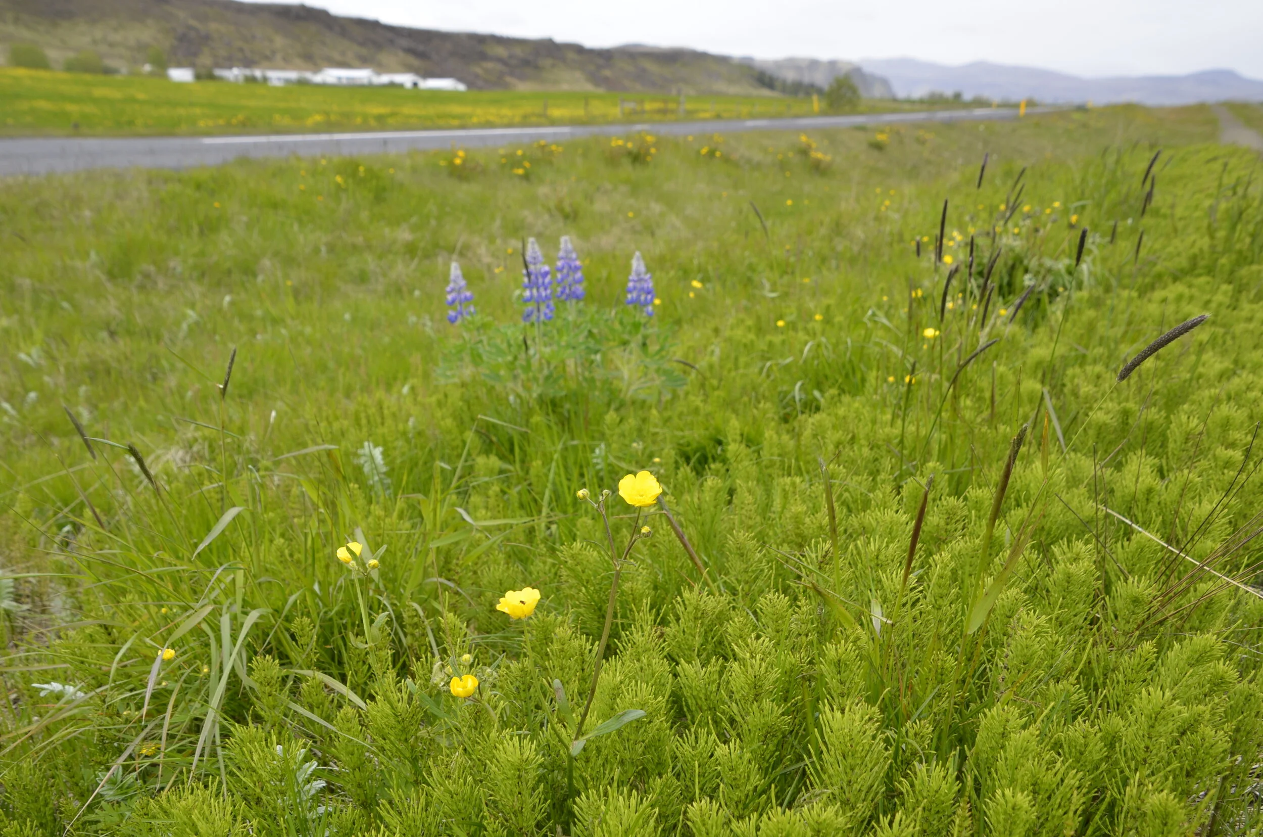
This area is just gorgeous in the fall with the changing colors of the leaves.

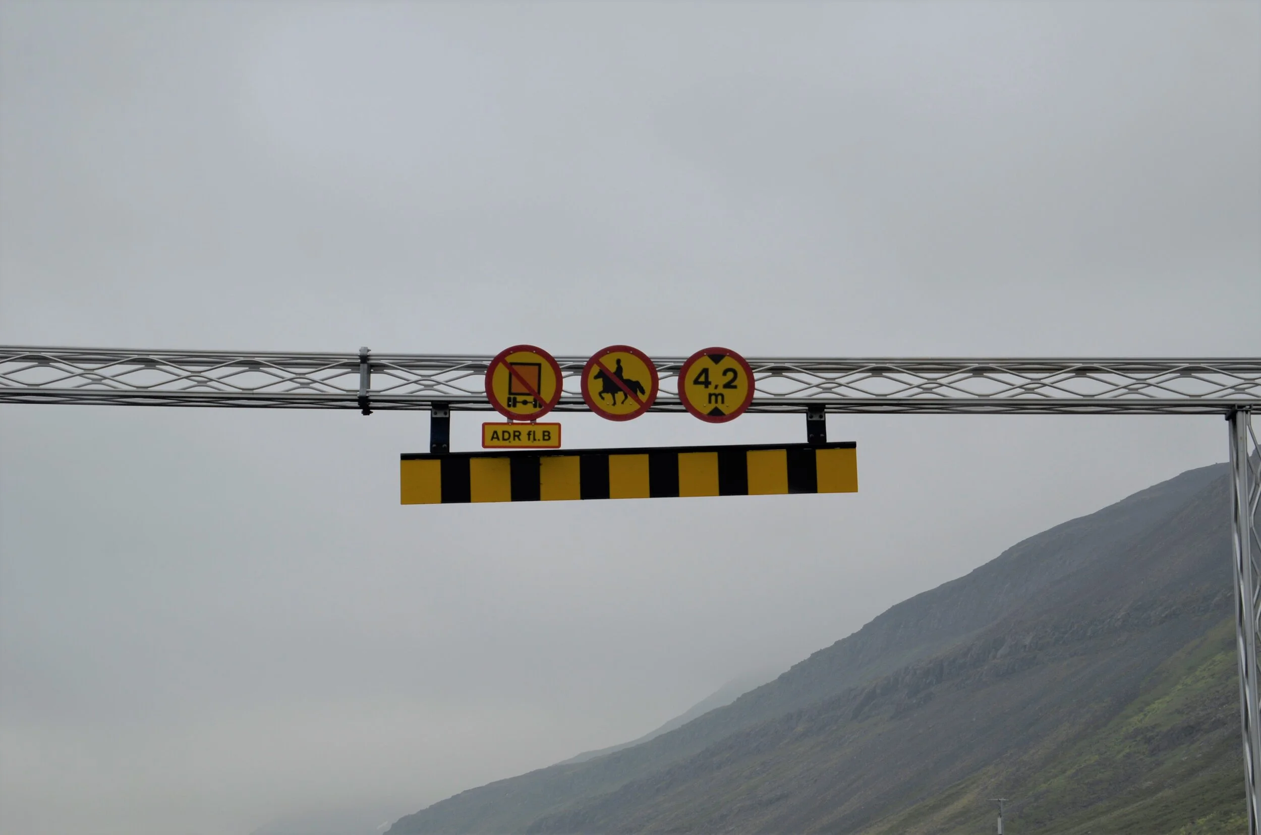
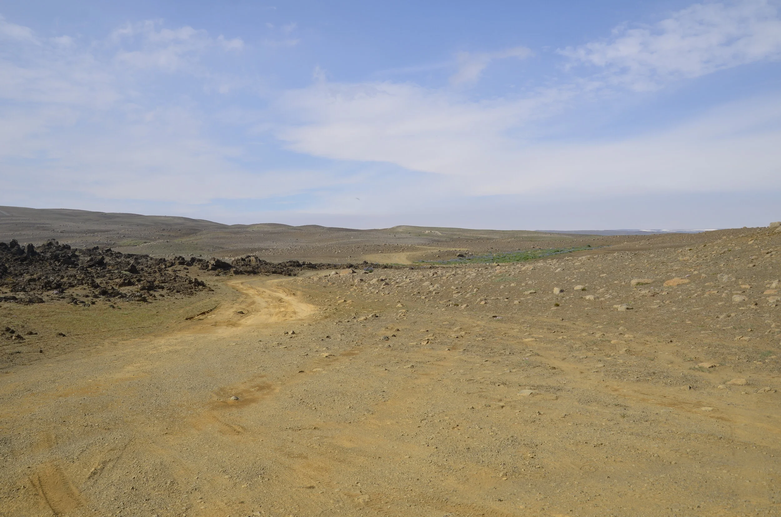
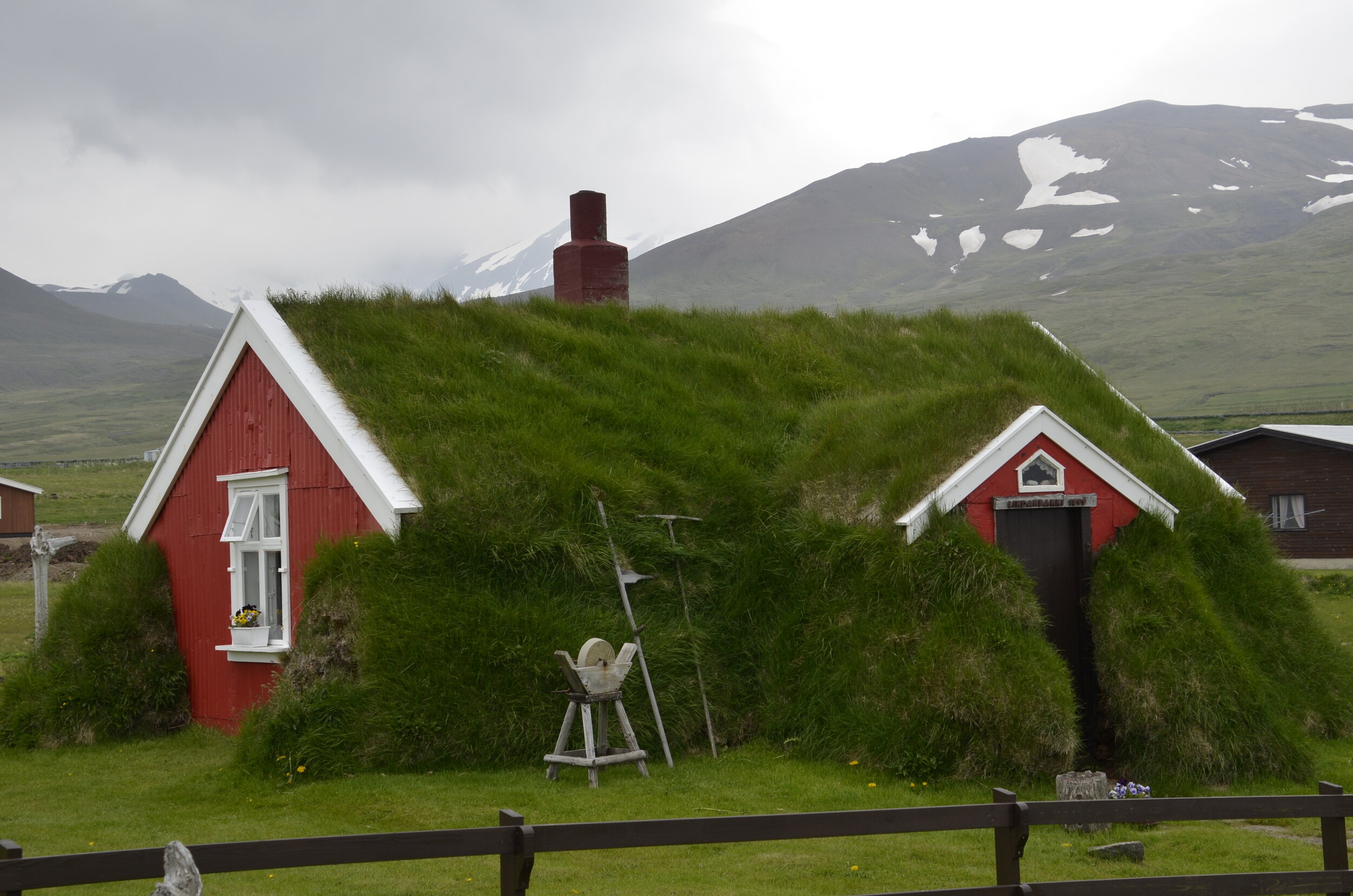
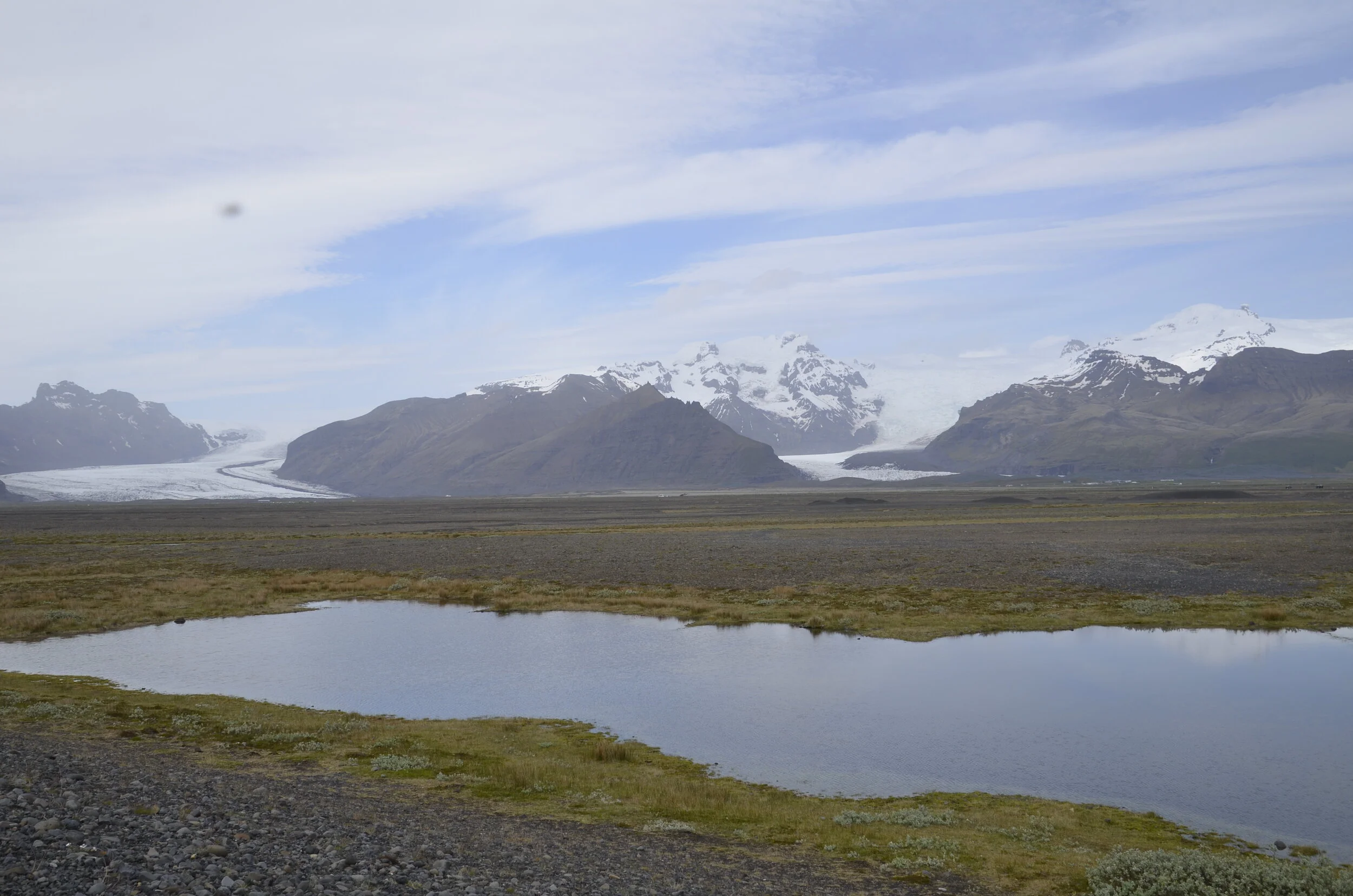
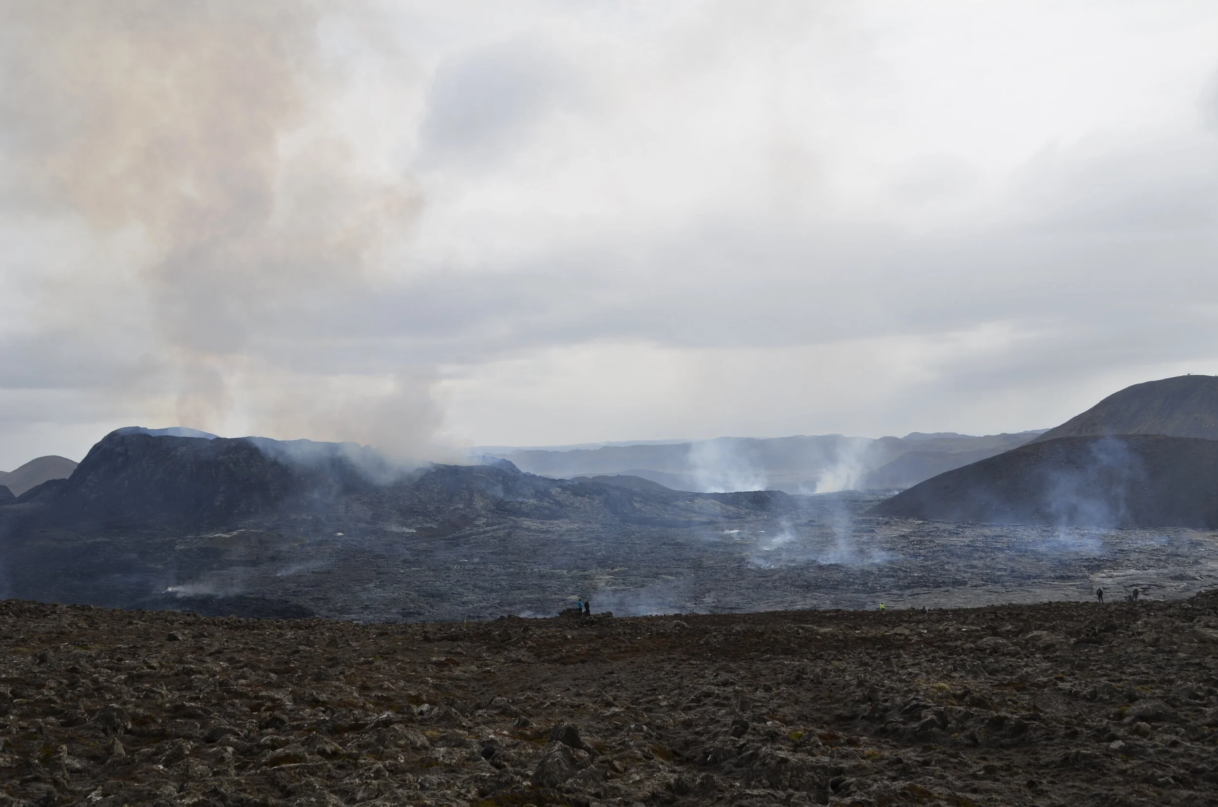
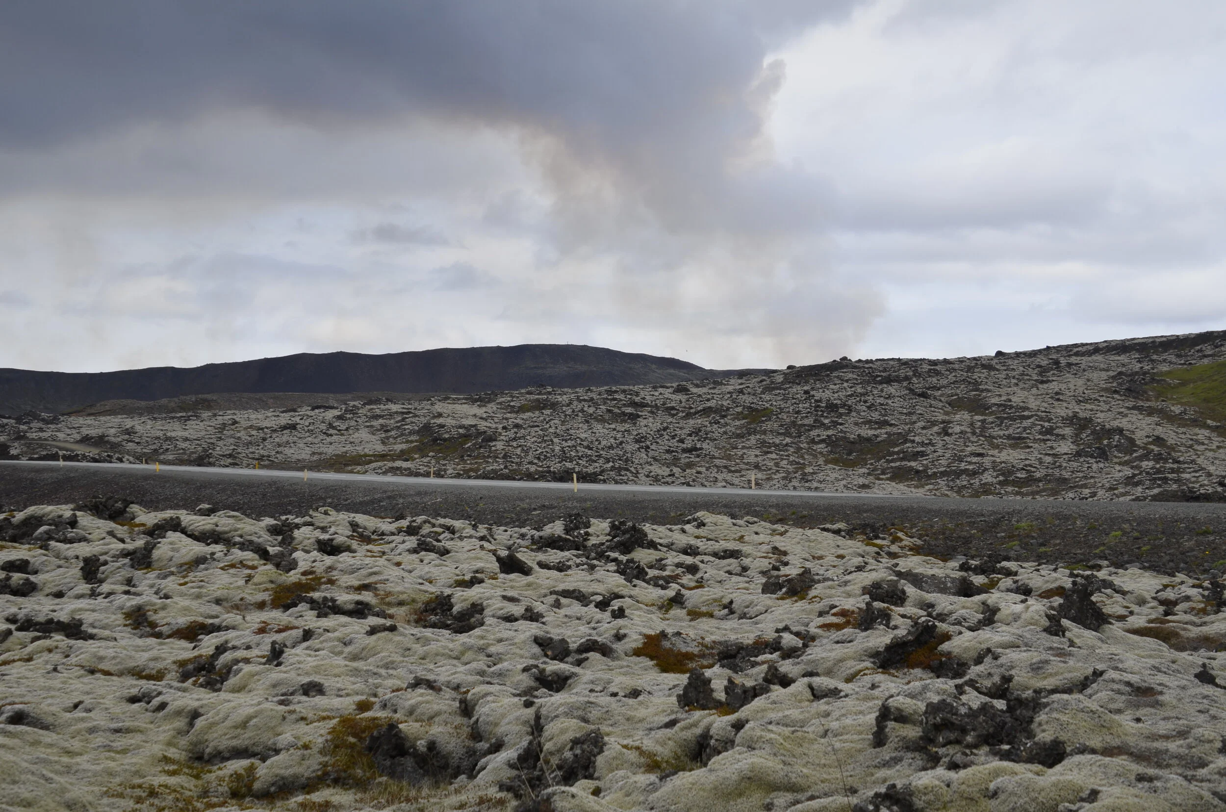
Okay… I’ve been asked, by more than one person, to give an itinerary for those who want to visit Iceland, but don’t have a month to spend, like we did. Rent a car at Keflavik Airport; visit Blue Lagoon for a pricey thermal hot pool experience; hike to Fagradalsfjall volcano (if you can get to it); head to Snæfellsnes peninsula for 3 nights and 2 days of exploring - you really only need one day, but in case the weather is bad, it’s nice to have an extra day built in to get better weather to see everything; then head down to the south coast for all the big tourist stops of waterfalls and glacier lagoons. Our previous posts highlighted where we stopped. The east and north areas of the country are really spread out with regard to interesting sights, and not really worth cramming into a 10 - 14 day visit. You can really see all the beautiful sights of the country by focusing on Snæfellsnes and the south coast.

Steve would feel that I failed, if I didn’t tell you to visit the Iceland Phallological Museum in Reykjavik!

PXL_20210713_112427195.jpg

Driving around Iceland (by Steve)

We landed in Keflavik (the international airport, located 45 minutes from Reykjavik) on June 17, and picked up our four wheel drive Dacia Duster—which is an entry level vehicle with 130,000 kilometers under its belt, but definitely a step up from our cars at home. :-)

PXL_20210704_152606590.jpg

It did not take long to run into a problem. Shortly after starting our trip, we fired the vehicle up one morning only to see the low pressure tire warning on the dash. We filled the tires up, but in less than 4 hours the warning light reappeared. Unfortunately, it was Sunday—and Icelanders take the day of rest seriously; no mechanic was to be found. So for our several hour drive down the coast to our next town, we made sure to pull into every gas station and top the tires off.

The next morning, we came out from our isolated Airbnb and found the tire completely flat. Luckily, we had a full-sized spare, so I loosened the lugs and jacked the car up—only to find that the tire/wheel wouldn’t come off of the hub! I pushed, shoved, and even kicked the tire, but it wouldn’t budge. So, I called the rental company:

Steve: Our tire is flat, and I can’t get the wheel to separate from the hub.

Operator: Ah, it must be a Duster, they have a tendency to do that.

Steve: Yes, it is a Duster.

Operator: Try kicking the tire.

Steve: I did that and it didn’t work.

Operator: Do you have someone with you?

Steve: Yes, my wife.

Operator: You should both kick it at the same time.

Steve: But it is up on the jack.

Operator: Yes, you should both kick it.

Steve: Ummm…. OK? “Lisa, come out here!”

Much to our surprise, our mutual vigorous kicking did the job—and the car didn’t fall off of the jack!

Iceland is basically the size of Kentucky, with a total population of 343,000 (216,000 of whom live in the Reykjavik area). With this population density and distribution, even much of the main highway around the country (Route 1, aka the “Ring Road”) is only lightly traveled for most of the country. So it makes sense that the majority of bridges in the East and North, much less on the rural roadways in the Westfjords and Snæfellsnes Peninsula (which are not served by Route 1), are only one lane:

Only rarely do these signs contain an English caption; but it is not that difficult to figure out !

Only rarely do these signs contain an English caption; but it is not that difficult to figure out !

The Ring Road is a high quality, predominantly two-lane highway that is roughly the same length as the drive from Houston to Nashville (1,328 kilometers / 825 miles) and, much like the American west, lightly serviced in many areas. Moreover, when you happen upon a gas station in the hinterlands, there is a good chance that it will be untended; thus, you need to have a credit card with a PIN to dispense gasoline (although you can pay with your smart phone at some of these stations). And, given the distance between stations, it is a good idea to keep your fuel gauge at 1/2 or above. (note that gas is about $7.20 a gallon here)

We almost made a big mistake on this by relying upon our fuel gauge and “remaining range” indicator. One morning, we drove away from civilization towards the glacier lagoons, with a “half tank.” After we reached our turnaround point and started the 100 kilometer return trip, however, we noticed that the fuel gauge was falling in tandem with the plunge in remaining range from “160 Kilometers” to 100, then 60, then, literally, “- - -”. Time for another call to the car rental place: “approximately how many kilometers are left when the fuel warning light comes on?” Given the answer, we saw that we had 7 kilometers to spare! Luckily, the wind was behind us. The owner’s manual gives the fuel tank capacity as “approximately 50 liters.” In reality, it is at least 50.4.

Once you get off the Ring Road, it isn’t only the bridges that can be narrow. In the Westfjords, there is a 7 kilometer tunnel, which is not only 1 lane for much of its length, but it has an intersection in the middle!

PXL_20210706_110904606.jpg

Luckily, although the occasional sheep is said to wander in, horses are not allowed:

(Sheep, however, have been known to wander in….)

And there are handy pull outs for the lane that does not have the right-of-way:

Lane with Red Arrow must yield for the next 4 kilometers

Lane with Red Arrow must yield for the next 4 kilometers

Pullouts are handy, but some might wish they were bigger!

Pullouts are handy, but some might wish they were bigger!

Outside of the tunnels, narrow roads are a bit less interesting, but still can be a challenge, even though they tend to be well marked:

Fortunately, you often have either warnings or other help when cresting blind hills on these narrow roads,

_DSC1290.JPG
_DSC0763.JPG

and the country is amazingly good at providing directional signage:

(The symbol behind Aldeyjarfoss is the universal “tourist attraction” indicator on signage.)

(The symbol behind Aldeyjarfoss is the universal “tourist attraction” indicator on signage.)

On Day 13, we saw our first traffic light of the trip in Akureyri, the largest city outside of the capital district, which boasts a population of 18,000. Two days later, we discovered that Akureyri actually has at least 12 traffic lights (although we continued looking for our second stop sign until day 17!).

As you might suspect, the empty areas on the map give plenty of space for the country’s 400,000 sheep, which tend to be proudly free range:

PXL_20210625_191525288.jpg

Still, being sheep, they enjoy walking and sunning themselves in the roadway, which serves to keep drivers alert on long rural stretches:

Roadside sheep almost always come in threes: the Ewe and her two lambs.

Roadside sheep almost always come in threes: the Ewe and her two lambs.

Another impact of the sheep is found on some secondary roads (but not on the Ring Road itself):

Old style sheep gate

Old style sheep gate

Steve’s high-priced gate opener

Steve’s high-priced gate opener

If you visit Iceland and choose to drive, you’ll want to determine your itinerary and, if necessary (or if you plan to rely on Google Maps and its “shortcuts”), get a 4WD vehicle, as certain roads (the “F” roads) are off limits to standard vehicles—even those with all wheel drive.

These roads, which are only open in the summer, are basically lightly plowed gravel/rock/dirt,

_DSC0611.JPG

with water crossings of various depths a possibility.

_DSC0613.JPG

Even with four wheel drive and decent ground clearance, you should be careful. Sometimes, the road is no longer there:

Fortunately, our target waterfall was off to the left, before the fence, on a car width path/trail that didn’t rise to F road status.

Fortunately, our target waterfall was off to the left, before the fence, on a car width path/trail that didn’t rise to F road status.

Other times, the road is simply too difficult for mere four wheel drive vehicles:

PXL_20210622_151948125.jpg

Needless to say, you don’t want to be this guy, who was less than 100 meters past the above warning sign:

“So that’s why they put the sticker on the dash about insurance not covering damage from water crossings….”

“So that’s why they put the sticker on the dash about insurance not covering damage from water crossings….”

Fortunately, our rental car didn’t experience that much excitement. After heading out to the westernmost point in the country at the end of our third week, however, it finally looked like it had been put through a wringer:

PXL_20210707_152116754.jpg

The multiple hour gravel road trek was worth it though, not only for the scenery and Lisa’s bird pictures, but also because it contained one of my favorite road signs from Iceland:

No dogs permitted, but falling to your death is O.K.??

No dogs permitted, but falling to your death is O.K.??

These are 2 other favorites, one of which took us a couple moments to figure out the first time we saw it:

Now, this is a proper cliff edge warning!

Now, this is a proper cliff edge warning!

We searched for the landing strip, then realized it was a wind advisory…

We searched for the landing strip, then realized it was a wind advisory…

Finally, on July 12, we drove into Reykjavik, having to pass through only one more tunnel, which ran for 6 kilometers under the fjord, but had at least two lanes all the way through

PXL_20210712_122437297.MP.jpg
PXL_20210712_123014055.jpg

Then, after driving multiple lane highways and experiencing the subjective traffic crush, we were reminded that although Reykjavik is a world class city, it is closely surrounded by agricultural areas:

In the heart of the City, across from the University and National Museum, close by numerous consulates.

In the heart of the City, across from the University and National Museum, close by numerous consulates.

Finally, we reached the rental car office and returned our trusty steed, with an additional 5500 Kilometers (3400 miles) on the odometer. It was a fun month and we’d definitely recommend a driving tour of Iceland if you have the time and inclination. The roads are good (except where you are warned in advance that they are not), navigation is fairly easy, and the drivers are attentive, polite, and compliant with the rules of the road—just keep an eye out for those sheep!

Snæfellsnes Peninsula

This is a gorgeous peninsula that sits south of the Westfjords, that Steve and I commonly referred to as “Snuffleupagus” (the beloved Sesame Street character) before we mastered the pronunciation - sny’ fuls ness.

On the way there, we passed the ubiquitous enormous waterfalls without name -

_DSC1431.JPG

… until we came to the numerous islands in the fjords, that are unique here…

_DSC1435.JPG

… and the isolated church (which was not - unique, that is).

_DSC1436.JPG

Our first day started out sunny where our lodging was, allowing us to enjoy this distant waterfall (yay! basalt columns!)

_DSC1440.JPG

… and another church amid lupines -

_DSC1443.JPG

But by the time we reached the west end of the peninsula, where the majority of sights were, the clouds had lowered, and it rained all afternoon. We actually parked at one of the spots, hoping the weather would clear, but bagged it after an hour.

(that’s me, fighting gale force winds and carrying my camera in a plastic bag, in case I could get a shot)

(that’s me, fighting gale force winds and carrying my camera in a plastic bag, in case I could get a shot)

So, we headed out early the next day, to cover the entire peninsula in one day. We started with broken lava fields covered in moss and lichen -

_DSC1537.JPG

… stopped at the oft photographed Kirkjufell and its attendant waterfalls (which were quite puny in our estimation, after our many weeks of waterfalls throughout our wanderings)…

_DSC1548.JPG

We headed on to this little heralded canyon (Raudfeldsgja), that was so cool!

_DSC1576 Raudfeldsgja Canyon.JPG

Inside, it narrowed quite quickly, and had you feel like you found a secret place

PXL_20210710_105831238.jpg

Looking back out gave you a glimpse of the beauty of this peninsula -

_DSC1588.JPG

We then hiked along the coast, on a 2 km trail between two small towns…

_DSC1601.JPG

… that had some fabulous basalt formations…

_DSC1635.JPG

… arches…

_DSC1607.JPG

… and cliffs.

_DSC1636.JPG

This was my favorite of the entire hike:

_DSC1640.JPG

Some scenes looked almost made up or staged -

_DSC1669.JPG

Moving on, we visited Londrangar cliffs…

_DSC1688.JPG

… before we reached the west end of the peninsula at Djupalonssandur (Black Lava Pearl Beach).

_DSC1700.JPG

It was huge…

(the people near the water and the cars in the parking lot give scale)

(the people near the water and the cars in the parking lot give scale)

… and gorgeous (with the namesake lava pearls) -

_DSC1718.JPG

The color variety in the surrounding rocks was eye-catching:

_DSC1733.JPG

Again, it looks like a painting…

_DSC1746.JPG

We were thrilled that the sun came out for our last hike of the day at Bjarnafoss -

_DSC1755.JPG

The “official” trail ended at the bridge across the stream (where you could get really nice pictures)…

_DSC1757.JPG

… but once we saw people hiking up nearer the falls, we knew we had to try!

_DSC1773.JPG

You can see the people in the picture above, but it doesn’t begin to show the pitch.

Where we came from:

_DSC1775.JPG

Our goal -

_DSC1777.JPG

On our way back to our lodging, we passed a small lake and finally saw what we had been wondering about all month. All the swan pairs everywhere, but no cygnets. At last!

_DSC1808.JPG

Finally, tucking in at 2330…

PXL_20210710_233735844 time 2330.jpg

Wildlife and waterfalls

I wanted to visit the Hornstrandir Nature Preserve in extreme NW Iceland because Arctic foxes thrive there. It’s quite a challenge to get there, as there are only 2 ferries a day from Isafjordur - one in the morning to drop off hikers and campers, and one in the late afternoon to pick you up, if you’re only there for the day.

_DSC1068.JPG

The ferry is the white boat, while the red Zodiac is what brought all 8 of us on the day hike to the beach. We had a pretty nice welcome -

_DSC1075.JPG

…and I was thrilled to see a fox so quickly, until our guide said this fella patrols the beach and greets most groups.

_DSC1091.JPG

As you can see, he isn’t too afraid…

_DSC1086.JPG

We set off hiking through fields of wildflowers…

_DSC1097.JPG

… and said goodbye to our buddy.

_DSC1096.JPG

We basically just walked on up the hill, with no set path to walk on.

_DSC1111.JPG

It felt kinda wrong to just walk over the moss, lichen, and plants that we’ve been conditioned to not tread on when hiking on set paths, so as not to destroy decades or even centuries of growth. The “cushiness” of the moss was awesome -

_DSC1110.JPG

Even though there was a fair amount of snow still on the ground…

_DSC1112.JPG

… the ambient temp wasn’t that uncomfortable for us. The walk was occasionally challenging, to navigate over or around streams that would just pop up across our general direction of travel -

_DSC1118.JPG

We didn’t have a set point to reach, so once we got to this little lake with its resident swan pair (you’ll definitely need to enlarge the picture to see them)…

_DSC1144.JPG

… we turned back around (as the lowering clouds weren’t very welcoming) to end up near the beach, and Steve and I spent some of our waiting time “flower bathing” (i.e. napping) in this field -

_DSC1153.JPG

The next day, moving on down the Westfjords, we passed mountainsides of lupine…

_DSC1156.JPG

… and rare beaches of golden sand…

_DSC1282.JPG

… until we reached Dynjandi.

_DSC1196.JPG

This is actually a collection of seven named waterfalls…

_DSC1197.JPG

… that were each…

_DSC1200.JPG

… quite beautiful in their own way (don’t worry, I won’t belabor the point with pictures of all 7).

_DSC1205.JPG

The largest, at the top, was quite impressive:

see the woman at the bottom right corner for scale

see the woman at the bottom right corner for scale

Steve wanted me to include this clip of Arctic Terns dive-bombing me as I returned from some bird watching, which you’ll need to watch from your browser. (Yes, I’m wearing a “midge net” over my hat to keep the buggers out of my nose and ears.)

On the south side of the Westfjords are some interesting sights - Raudasandur (Red sand beach) -

_DSC1288.JPG

… which looked more red with cloud cover, than when they were breaking up:

_DSC1349.JPG

There was a picturesque church…

_DSC1291.JPG

… on the way to the Latrabjarg cliffs (the westernmost point in Iceland)…

_DSC1376.JPG

… and their (literal) millions of residents. 40% of the world’s population of Razorbills -

_DSC1385 Razorbills.JPG

… comes here to breed and raise their chicks, along with everyone’s favorite -

_DSC1368.JPG
_DSC1370.JPG

It was amazingly windy and gloomy when we were there…

_DSC1406.JPG

… so rather than walking more kilometers, we opted to enjoy the antics of the gulls trying to land -

_DSC1410 Glaucous gull.JPG

Steve caught some of it on video:

See you later!

_DSC1363.JPG

The Westfjords

We left North Iceland and drove west into the Westfjords. This is the NW corner of the country and lies outside the Ring Road. It’s still pretty isolated to this day, and not visited near as often as the rest of the country.

_DSC0771.JPG

We would drive up a fjord, only to reach the end, and then drive up the other side, to get to the next one. Sometimes there were churches standing on the coast all by themselves, or with just one or two houses nearby -

_DSC0757.JPG

Large sections of the main roads were gravel -

_DSC0787.JPG

At one point we drove up and over a peninsula, and found this sod-roofed structure in the middle of nowhere:

_DSC0807.JPG

Down the other side of the pass, the blues of the ocean were almost other-worldly…

_DSC0824.JPG

…and there’s another glacier “up here” -

_DSC0844.JPG

As we rounded the corner to enter the fjord where we’d be staying for the next few days, there was an awesome cloud layer filling it and lying right on the ocean:

_DSC0849.JPG

Another church…

_DSC0902.JPG

I just loved the look -

_DSC0919.JPG

The town we stayed in, Isafjordur, was quite picturesque -

_DSC0928 Isafjordur.JPG

A very interesting thing in many small towns was the rainbow striped object pictured above on the right.

PXL_20210703_133408634 (1).jpg

This was very tough canvas that had air blown under it from 1000 - 2200 every day, for the kids to bounce on like a trampoline. I thought it was interesting that they let it deflate at night…ostensibly telling the kids it’s time to go home. :)

We found an isolated waterfall, tucked into the ravine below:

_DSC0937.JPG

… that took a little hike to get to. We enjoyed spending a lazy afternoon, taking our time…

_DSC0940.JPG

… and a number of pictures (of course!).

_DSC0955.JPG

The next day, I had booked a solo horseback riding tour (Steve is not the horsey type), as my way to celebrate the Fourth of July.

2.jpg

I had a blast! The galloping had me feel like a 12 year old again, when I would ride bareback with my cousin on her horse. The Icelandic horse has a special gait called the “tolt”, that feels like you’re in a rocking chair - it’s that smooth. (again, reminder to open this post in your browser to see the video)

The next video captured our water crossing and breaking into the tolt again -

In case you were wondering, the guide had a GoPro mounted on the back of her helmet.

I’ll close with a hint about the next post -

PXL_20210702_165718882.MP.jpg

Waterfalls and other interesting things across North Iceland

We set out north from where we were staying, to visit Vatnajokull National Park.

_DSC0448.JPG

Along the way, the roadsides were gorgeous…

_DSC0450.JPG

… as well as the views -

_DSC0452.JPG

We were intending to visit an area in the park called Echo Cliffs, but the roads were being constructed (re-constructed?) with huge machinery. We did manage to maneuver around them without having any boulders dropped on us, and found a very out-of-the-way trail in Holmmatungur, that led to Katlar. (again, I’m only including the names in case someone uses this blog to find some of the sites we visited)

This is from the top of the trail - we’re heading to the brown area in the middle:

_DSC0467.JPG

Once there, we found a racing torrent of glacier melt and numerous waterfalls -

_DSC0483.JPG
_DSC0491.JPG

I just can’t get enough of basalt columns -

_DSC0494.JPG

The darker water on the left, in the picture below, is actually “fresh” water (from snowmelt or springs?) that is joining the silty glacier melt on the right -

_DSC0502.JPG

Next up were the two jewels of the park, Selfoss…

_DSC0513.JPG

… which paled in comparison to Dettifoss -

_DSC0521.JPG

This is Europe’s most powerful waterfall - (make sure to open this blog in your browser to see the video)

The rainbows were mesmerizing -

_DSC0544.JPG

… and led to way too many pictures. :)

_DSC0551.JPG

OK… so… this is going to be a really long post, as I’m going to combine two days of visiting “all” the sights (and then some) along the Ring Road in the North. Godafoss was our first stop the next morning -

_DSC0579.JPG

We then ventured 40 km down a dirt road (that’s a looong way on dirt) and through two gates…

PXL_20210701_100135061.jpg

… to reach Aldeyjarfoss, and were amazed to find that someone else had beat us to it!

_DSC0581 Aldeyjarfoss.JPG

Ahhhh… my favorite -

_DSC0585.JPG

Aldeyjarfoss -

_DSC0588.JPG

Heading west across North Iceland, we passed through Oxnadalur Valley…

_DSC0617.JPG

… on our quest to find - sod stables:

_DSC0644 Lytingsstadir.JPG

… and a sod church (built in 1834 from turf and driftwood) -

note how thick the turf is to the right of the door

note how thick the turf is to the right of the door

Another (relatively) short detour led us to this unique basalt and limestone church constructed in 1877 -

_DSC0673.JPG

My favorite side trip of the day led us to Kolugljufur canyon…

_DSC0684.JPG

… and waterfall.

_DSC0706.JPG

Another stop, at this natural basalt “fortress”, Borgarvirki -

_DSC0723.JPG

… gave us quite the expansive view over the surrounding lakes and valley -

_DSC0719.JPG

Well, the day wasn’t quite done with us yet…

We were just driving on to our night’s lodging, and these beauties were running along the fence for the joy of it! Note the unusual gait of the black horse closest to the front. This is the “tolt,” which is unique to the Icelandic horse.

Our ending view of the day, from the hot tubs on the edge of the fjord, at 11 pm.

_DSC0749.JPG

Puffins and North Iceland

We next headed for a small town in the NE corner of Iceland, specifically to see puffins up close. The weather was somewhat foreboding as we made our way up and over a pass -

_DSC0072.JPG

The valley and town on the other side were nice and peaceful.

_DSC0084.JPG

There are several areas around Iceland where the Atlantic puffins are known to nest in the summer, but at Borgarfjordur Eystri, you can get up close and personal.

_DSC0099.JPG
_DSC0109.JPG

In one of their burrows, I witnessed “billing” which apparently strengthens the bond between a pair -

_DSC0113.JPG

The markings on these birds are so colorful:

_DSC0130.JPG

It was amazing how close we were. This little one wasn’t upset; he was just stretching his wings as I was snapping away -

_DSC0136.JPG

As we left town, we saw a bright example of a sod house -

_DSC0147.JPG

The gloomy day persisted as we continued passing by amazing walls of waterfalls -

_DSC0161.JPG

A quick stop at another named waterfall, Rjukandafoss, along the way…

_DSC0193.JPG

… before crossing into the more barren and dry North…

_DSC0199.JPG

… with miles of stone cairns stretching into the distance -

_DSC0209.JPG

There is a huge lake in the middle of this area, Myvatn, which translates as “midge lake” Midges are non-biting flies like gnats that can easily swarm you, so Steve and I had come prepared with nets that fit over our hats and down over our shoulders. (alas, no picture for you) These worked very well to keep them out of our eyes, nose and ears. This lake is rich in bird life due to the bounty of the midges as food.

At the south end of the lake are “pseudocraters” that were formed by steam explosions when hot lava flowed into a body of water -

_DSC0216.JPG

Further up the lake is an area called “Dark Castles” (Dimmuborgir) -

_DSC0251.JPG

I’ll just share the sign, which explained the formation very well:

_DSC0260.JPG

You Game of Thrones fans might recognize this cave (Grjotagja) -

_DSC0266 copy.jpg

Next up was the area known as Hverir, a geothermal area with steaming vents…

_DSC0303.JPG

… and bubbling mud pots.

_DSC0271.JPG
_DSC0321.JPG

Up a long winding road, past the geothermal plant…

_DSC0342.JPG

… was a gorgeous crater lake, Viti.

_DSC0351.JPG

Before we left the area, we treated ourselves to some time in the Jardbodin Nature Baths.

PXL_20210629_153057833.jpg

Ta-ta for now…

PXL_20210629_153002341.MP.jpg

East coast

So we left the “busy” south coast and headed up the east coast…

_DSC9822.JPG

…which is much less populated and more rugged.

_DSC9823.JPG

We then climbed up and over a very long valley and pass, with innumerable waterfalls…

_DSC9843.JPG

… to reach a beautiful fjord.

_DSC9869.JPG

Can you see the blue-purple covering on the hillsides above the town below? That’s all lupine!

_DSC9885.JPG

Near the town we stayed in, there was a gorgeous valley filled with a milky, silty lake…

_DSC9906.JPG

… that had a pretty neat set of waterfalls.

_DSC9938 Litlanesfoss.JPG

The color variation in the basalt columns was interesting -

_DSC9944.JPG

That waterfall was Litlanesfoss, while a continued climb upward led us to Hengifoss -

_DSC9953 Hengifoss.JPG

This is one of the highest waterfalls in Iceland, at 387 ft…

_DSC9957.JPG

… and the sandwiching of the red clay layers in between the basalt is unique.

_DSC9967.JPG

It was quite the experience to get up to the waterfall,

PXL_20210627_104218331.jpg

… as the signs attested.

PXL_20210627_105352366.MP.jpg

We decided to try the trail, because we had seen some others coming away from the waterfall, as we approached the warning sign. We were easily able to get around those boulders, which were right at the end of the trail, near the waterfall. (And no more fell while we were walking….)

One more set of waterfalls, Fardagafoss was back near our lodging,

_DSC10026.JPG

… and was made even prettier by the sun coming out a little.

_DSC10056.JPG

Very common sights as we drove around this beautiful country were expansive grazing fields filled with sheep.

_DSC9992.JPG

We had a quest to document…

_DSC0157.JPG

… the different variations…

_DSC0676.JPG

… in momma and lamb colors.

_DSC0767.JPG

Have you any wool?

_DSC10007.JPG

A day of ice

We saw the fire at the beginning of the trip, so now we get to see the counterpart. When we got up, there was a cool cloud formation over the two glaciers in the guesthouse’s backyard -

_DSC9663.JPG

We took our time before heading out to the glacier lagoons, giving the sky (hopefully) time to clear. We hit the jackpot!

_DSC9680.JPG

There are two glacier lagoons, with Jokulsarlon being the larger of the two. Along the shore, my attention was caught by a beautiful bird -

_DSC9681 Eider duck.JPG

This is a male Eider duck. For those of you who might have heard about eiderdown, this is a very long but fascinating article about the harvest of said down: https://www.theguardian.com/world/2019/jul/19/eiderdown-harvesting-iceland-eider-duck (I guess I found it so interesting because we’ve visited the places mentioned.)

It’s the females that provide the down -

_DSC9710.JPG

But I digress…

_DSC9703.JPG

The variety of icebergs, in both color and shape, was fascinating.

_DSC9695.JPG

We learned that the bright blue color is indicative of an iceberg that has recently flipped, and the part that had been under the water had not yet been melted by the sun, which reduces the “blueness”.

_DSC9699.JPG

I was so fascinated by the various shapes and colors…

_DSC9702.JPG

… that I found it very hard to stop taking pictures (I know… shocker!).

Steve actually took this picture, as the sun suddenly hit this berg, while I was on a bathroom break.

Steve actually took this picture, as the sun suddenly hit this berg, while I was on a bathroom break.

It was also very neat to see the submerged parts of the icebergs, in the crystal clear water -

_DSC9690.JPG

We then moved down to Diamond Beach. This is where icebergs end up after having been tossed around in the ocean for a bit, before being stranded back on the beach.

_DSC9725.JPG

There was again the variety of sizes and shapes…

_DSC9727.JPG

… that we found quite interesting.

_DSC9734.JPG

We then drove just 10 km away to Fjallsarlon, to experience a very different glacier lagoon -

_DSC9755.JPG

The edge of the glacier was much closer, and the water was exceptionally still…

_DSC9777.JPG

… giving us lots of time to just “Zen out” on the reflections.

_DSC9795.JPG

I was also quite taken with the jet black icebergs -

_DSC9768.JPG

Back at our lodgings for the night, this pair of Whooper Swans greeted us, and I’ll let them bid you adieu -

_DSC9816 Whooper swan.JPG

A VERY full day

We are now setting off down along the south coast of Iceland, which is rich in waterfalls and other sights to see. Being the intrepid explorer, I had a “modest” list to check off. ;)

_DSC9356.JPG

That was a common sight - white washed buildings with red roofs tucked back up against tall cliffs (as protection against the storms that blow in from the sea on the south), as well as “seasonal” waterfalls -

_DSC9350.JPG

Many of these “ho-hum” waterfalls are taller than named ones that Americans get excited about in our country.

And then you get the glacier, on top of what you thought were tall cliffs -

_DSC9363.JPG

A quick backpedal here… for those of you who might follow in our footsteps in the future… I almost left out a waterfall we visited on the evening after we came back from our Super Jeep tour. Seljalandsfoss is unique in that you can walk behind it, and I’ve seen some gorgeous photos of setting suns and twilight clouds seen through the falling water. Not quite like that when we were there on a cloudy, drizzly evening. The wind was blowing really hard, and the people venturing behind the fall were coming out drenched.

people definitely help for scale

people definitely help for scale

At least the low light helped me practice “softening” the water technique.

_DSC9103.JPG

Now, back to our journey along the South Coast. The first named waterfall we came to was Skogafoss:

_DSC9369 Skogafoss.JPG

Since there were steps to the top (500+), we of course had to take them!

_DSC9393.JPG

… plus there was a trail to still more waterfalls…

_DSC9405.JPG

… and canyons…

_DSC9421.JPG

…and sheep.

_DSC9430.JPG

Moving right along…

_DSC9435.JPG

… we got to climb our first stile, to visit an off-the-beaten-path waterfall, Kvernufoss.

_DSC9440.JPG

It was really special for me, because you could get behind it…

_DSC9461.JPG

… and not get wet!

_DSC9467.JPG

Remember the gloomy Black Sand beach that we saw on the rainy day? This is the arch that we saw from a distance -

_DSC9479 Dyrholaey Arch.JPG

The basalt columns at the Black Sand Beach were awesome -

_DSC9495 Reynisfjara.JPG

I liked this day much better -

_DSC9516.JPG

… compare and contrast -

_DSC8971.JPG

Ok, next on the agenda was a hike…

_DSC9538.JPG

… to Feather River Canyon…

_DSC9542.JPG

… with… you guessed it… a waterfall!

_DSC9563.JPG

There are so many cliffs and waterfalls here, that some are even private -

_DSC9583.JPG

Our final stop for the day (“you mean she’s gonna quit with all the waterfalls??”) was Skaftafell National Park, with not just one…

_DSC9595.JPG

… but two glaciers…

_DSC9597.JPG

… and a waterfall - Svartifoss (you didn’t really think I was done with the waterfalls, yet, did you?).

_DSC9619.JPG

Basalt columns are formed when a smooth mixture of lava cools fairly quickly, and the “centers” cooling the fastest pull in the material into even shapes, usually hexagonal.

_DSC9636.JPG

I was looking for a good closing picture, and happened upon this kinda wistful one:

PXL_20210624_132251540.jpg

Landmannalaugar

As I was starting to write this post, Steve and I were discussing the hike, and decided that this was probably our favorite hike that we have done on our own since retirement. Yes, Salkantay in the Andes was great (but we had a guide) and Mist Trail in Yosemite is beautiful but crowded, but this was just a whole ‘nother level of fantastic!

_DSC9111.JPG

First you drive 2 1/2 hours into the southern Highlands, including a good distance on rough gravel roads (this is exactly why we rented a 4x4 for our trip), passing glaciers and irregular lava fields…

_DSC9115.JPG

… that get more desolate…

_DSC9124.JPG

… until you pass a beautiful lake…

_DSC9129.JPG

… and finally get close to the hills…

_DSC9158.JPG

… that you know you’ve arrived.

_DSC9167.JPG

First, you have to cross the river to get to basecamp, and sometimes it’s low enough to drive across, but not when we were there!

_DSC9166.JPG

For those who might want to use this blog as a guide for a future Iceland trip, the trail we hiked was the Blahnukur - Brennisteinsalda loop. We first climbed Mt. Blahnukur…

_DSC9170.JPG

… which is the taller of those two dark peaks in the picture above. (if you enlarge that picture, you can see the people on the trail, and at the top of the first “hill”)

copper in the rocks gives the green cast, sulfur gives yellow and iron gives red

copper in the rocks gives the green cast, sulfur gives yellow and iron gives red

Pausing for a breather, we started seeing some awesome views -

_DSC9183.JPG

This was our second peak, Mt. Brennisteinsalda:

_DSC9188.JPG

Getting higher…

_DSC9189.JPG

… and looking back on what we had accomplished so far -

(the little red dot is a building in basecamp)

(the little red dot is a building in basecamp)

Still going up…

_DSC9195.JPG

… and getting new views -

_DSC9196.JPG

On reaching the summit (3100 ft), we had climbed 2,000 ft in under 2 miles!

(yes, the trail continues along that grey spine in the foreground!)

(yes, the trail continues along that grey spine in the foreground!)

There was a horizontal spine at the summit, that I asked Steve to go out on for a picture, but he said the wind was too strong to safely stand upright:

_DSC9201.JPG

The hills and lakes in the distance almost look like a painting -

(note the edge of the rough lava field just above basecamp)

(note the edge of the rough lava field just above basecamp)

So, moving on…

_DSC9209.JPG

… we had to cross some snow fields…

_DSC9212.JPG

… which proved a little challenging for Steve when his right leg postholed -

_DSC9215.JPG

Still beautiful views…

_DSC9213.JPG

… but then we reached the stream…

_DSC9218.JPG

… where we had watched the group in front of us walk up and down, looking for a dry place to cross, without luck. Soooo…

PXL_20210623_133813820.MP.jpg

I had to dry off my bright red feet (after wading across the quite frigid river) and put my socks and shoes back on to continue our hike. We were now much closer to our second peak -

_DSC9223.JPG

The colors were just spectacular…

_DSC9231.JPG

… when the blue sky cooperated.

_DSC9228.JPG

Even though this second peak was lower (at about 2600 ft)…

_DSC9241.JPG

… there were still some magnificent views and colors.

_DSC9242.JPG

It was hard to stop taking pictures.

_DSC9250.JPG
_DSC9255.JPG

As we neared the end, we crossed this lava field, and the valley opened up before us -

_DSC9261.JPG

As we walked back to the car, we took one last look -

_DSC9269.JPG

Now, this being Iceland, of course there were waterfalls along our driving route “home”…

_DSC9150.JPG

… a whole valley of them!

_DSC9293.JPG

This little guy shows how we felt at the end of the day. :)

_DSC9347.JPG

Thorsmork

Before I get into our trek into Thorsmork, I wanted to share what our day was like after that last glorious sunny day I posted about. We woke up to dark cloudy skies and a flat tire (Steve is going to fill you in on all the interesting details later). We did get it fixed that morning, but our planned long hiking excursion was put off for another day. Since it was raining, we tried heading down the south coast, hoping the weather might improve, and allow us to see some of the sights on my long list. No such luck.

We drove about an hour, and sat reading in the car for 2 hours, hoping to see the Black Sand Beach (Reynisfjara). Instead of the “usual” 100 - 250 pictures I can take in a day, I took 15!

_DSC8968.JPG

That picture summed up our mood that day.

So, anyway… the next day we had a “Super Jeep” tour of Thorsmork booked, and luckily, the weather was pretty decent. This is a wilderness area tucked between two glaciers and a mountain range, that has rather challenging “roads” within it. Everything I read said you should not drive in there, even with a 4 x 4, but rather take a tour in a special vehicle adapted for river crossings. This was our trusty steed -

PXL_20210622_161441571.MP.jpg

Our first stop was a beautiful canyon with a waterfall, that we had to cross a river (without getting our feet wet, while our guide stood in the water and gave us a hand across) and climb up to find -

_DSC8983.JPG

It was quite beautiful close up…

_DSC8990.JPG

… and Steve got this picture from behind it -

ThorsMark still from behind water fall.jpg

Waaayyyy down into the valley -

_DSC8995.JPG

Next stop was near a glacier edge, and the sun peeked out!

_DSC9011.JPG

After a quick lunch at the end of the valley, we turned back to explore a huge canyon…

_DSC9030.JPG

… that was beautifully lush and green (remember, this is Iceland!).

_DSC9043.JPG

This is why we booked a tour -

(reminder…there is a video here, so you need to open this post in your browser)

Several of us were standing on this bridge to document the crossing (note the wheels, when not flat, could be used to move it where it was needed to cross rivers) -

_DSC9054.JPG

An “elf” church (where couples have actually come to get married):

PXL_20210622_122406830.jpg

Our final treat was this magical lush valley that I couldn’t capture in just one picture -

_DSC9064.JPG

That one had Steve for scale, while the one below has another tour member -

_DSC9077.JPG

Peek-a-boo!

PXL_20210622_155415756.jpg

It was great to see the sun!

We finally saw the sun on our fourth day in the country, and we woke up to gorgeously clear, blue skies. This was nice, as we had planned to hike up “Steam Valley” (Reykjadalur) that’s just outside the town we’d been staying in - Hveragerdi. During these posts, I will try to share the Icelandic names of places with you, but most of them are quite long and are definitely tongue twisters. I’m not going to try and find an Icelandic keyboard, but rather just type the close approximation in English.

_DSC8914 Reykjadalur in Hveragerdi.JPG

At this point, we hadn’t seen a lot of sheep yet, so I found it charming that they were grazing right beside the path.

_DSC8918.JPG

We hiked steadily uphill…

_DSC8920.JPG

… and were rewarded by a waterfall about halfway along.

_DSC8922.JPG

Hiking deeper into the valley, we started seeing more signs of geothermal activity -

_DSC8928.JPG

Finally, after battling fierce headwinds the whole 2.5 mile way in (and climbing nearly 1000 ft), we made it to the “hot river”.

_DSC8929.JPG

We had actually taken our suits and towels with us, intending to soak after the hike. However, the VERY brisk cold wind, crowded conditions and shallow water of the river talked us out of it. We turned around and enjoyed the much faster hike back down, with the wind at our backs. We also enjoyed a chance encounter with a ewe and her two pretty big lambs -

_DSC8933.JPG

Especially on the lambs, the curly coat looked so soft.

The better lupine picture I promised earlier:

_DSC8941.JPG

They are everywhere, and line the roads quite deeply. One of the guides we had for a trek said it was imported from Alaska to plant in sandy soil to help prevent erosion, but then it has taken over and become quite invasive. I don’t know about you, but this is much prettier than kudzu!

_DSC8942.JPG

So we’re now heading east, and being treated with glorious landscapes - Mt. Hekla above - and an unnamed glacier below:

_DSC8953.JPG

I’m leaving the glacier unnamed, as you’ll be seeing many more of them on our travels along the south coast, and the names have at least 10 -15 letters in each one. Mt. Hekla is an extinct volcano, and is said to have been J.R.R. Tolkien’s inspiration for Mt. Doom.

I’ll close this short post with the reason I’m having trouble falling asleep. This was taken at 11 pm!

PXL_20210623_230539071.jpg

The Golden Circle

On our second day of touring, we first stopped at Kerid crater, which is an extinct volcano that has filled with water. The level of water in it rises and falls with the water table.

_DSC8690.JPG

The usually gorgeous turquoise blue water was muted due to the overcast skies all day. We’re coming to learn that overcast (read dreary grey) or rain is very common here.

_DSC8697.JPG

The “Golden Circle” is composed of three major natural attractions, all within about an hour’s drive of Reykjavik. The waterfall above, Gulfoss, is quite large, and reminded us of the Great Falls of the Potomac, because of the layered cascades. We are definitely liking travel right now, because we literally had the falls to ourselves at one point. [Because this is so close to Reykjavik, probably most of the 2 million tourists who came to Iceland in 2019 visited here.]

The lower set of cascades pour down into the valley:

_DSC8723.JPG

This was just a random river we crossed over, but the blue of the water and the banks lined with lupines definitely caught my eye -

_DSC8725.JPG

The second natural area that we visited in the Golden Circle was the Geysir Geothermal area. This is the original Geysir, after which all others in the world are named.

(again, people for scale, behind the greenery at the bottom right of the steam)

(again, people for scale, behind the greenery at the bottom right of the steam)

This was not the actual “Geysir”, but another that spouts about every 5-15 minutes. This is the original one…

_DSC8734.JPG

…that only rarely erupts now. If you’ve been to Yellowstone and wandered around the enormous geothermal field there, this stop on the tour would be a bit underwhelming.

_DSC8733.JPG

Moving on… as the skies lowered and it started to rain, we headed out to hike to Bruarfoss (Blue Waterfall). It was a very easy hike along a river for a magnificent yield -

_DSC8740.JPG

The power of the water rushing through the narrow rock cut, and being right next to it was fantastic.

_DSC8747.JPG

The third sight in the Golden Circle is Thingvellir National Park. This area was chosen as the site for the world’s first parliament in 930 AD, and Icelanders met here yearly in the summer to pass laws and render judgments. Steve knew of “Law Rock”, where one third of the country’s laws were recited each year, owing to oral tradition. The flagpole is planted at the site:

_DSC8849.JPG

You might notice there are blue skies in that picture. We are now into our 3rd day of touring. The main reason we went to Thingvellir was to snorkel between the continents. In this park, the Eurasian and North American tectonic plates are continuing to separate about 2 cm per year.

_DSC8797.JPG

There are multiple fissures or rifts throughout the area, but the one we were interested in is filled with glacial melt water.

_DSC8867.JPG

Hopefully, you can appreciate the clarity of that water from the picture above.

So anyway, we got all dressed up in dry suits - meaning, we had long underwear on under a thermal jumpsuit, topped by the neoprene dry suit that was quite restrictive at the neck and sleeves. This is to prevent the 34 degree water from getting in!

(again, make sure you are looking at this post in your browser, rather than your email, so you can see these next videos)

This was unbelievably restrictive, but kept all but our cheeks and lips away from the water. Did you notice the lobster claw gloves? Unfortunately, they were of wetsuit material, allowing water in. I’ll come back to this point later.

Both the water clarity and frigidity were shocking.

The only life to see was vibrant green strings of algae -

And yes, the water was really that blue, and clear. At the deepest point, our guide said the rift was 75 ft deep, but the clarity made that hard to believe.

Now back to the point about the gloves… my hands were so cold after our 30 - 40 minutes in the water, that I couldn’t button my shirt as we were getting dressed afterwards! I could bring my right thumb and forefinger together, but they couldn’t grip the button or shirt material. it was still so worth it, though! What a unique experience.

_DSC8841.JPG

There was a relatively small waterfall in the park, Oxararfoss, that allowed me to practice some new photography techniques -

_DSC8837.JPG

I used to be partial to the first shot, where the water is “frozen”, but I’m coming around to the “softer” waterfall. How ‘bout you? We’ll talk more in the next post…

Land of Fire and Ice

Since we’re here in the summer, Iceland so far has just shown us fire -

_DSC8632.JPG

The volcano, Fagradalsfjall, that started erupting in March (after an 800 year sleep) was our first stop after landing at 0630. All arriving tourists, even though vaccinated, had to be tested for COVID, and are supposed to quarantine until results are back in 4-5 hours. So, being the intrepid travelers we are, we got our rental car, headed to the volcano, and proceeded to hike all morning (well away from others) until our negative results came in - as we were hiking back to our car, after a tough 7 mile hike. My eldest son requested oozing lava video:

We were able to walk right up to the edge of the new lava, and feel the heat coming off of it. This was the newest land on earth! (at that moment)

(if you don’t see the videos above, you need to open this post in your browser)

The extent of the new flow is amazing -

(see the “tiny” people near the left edge of the smoke?)

(see the “tiny” people near the left edge of the smoke?)

After hiking up and over a steep ridge to get to the actual volcano, we were disappointed in what we could see -

_DSC8636.JPG

The darker smoke near the left side of the picture is the actual volcano, but while we were there, it didn’t bless us with any spewing lava, so we just had to trudge back to the car.

As we drove on to our lodging for the next few nights, we passed an area with interesting moss (?) growing over volcanic rocks (from an eruption 5,000 yrs ago). This picture is looking back at the smoke from the volcano -

_DSC8659.JPG

The lupines and buttercups lining the road at times threw some bright color our way -

_DSC8666.JPG

I hope to have much better lupine pictures, as our trip goes on.

The house we’re staying at is near a horse farm, and the Icelandic horses are beautiful, shaggy, and look quite rugged -

_DSC8676.JPG

The buildings here are heated with geothermal energy, and you can understand why, when you notice the ground around here just smokes, randomly:

_DSC8683.JPG

So I can get this post out before we head off to our next adventure, I’ll let this guy say goodbye for us…

_DSC8679.JPG

Last Egypt post

We spent 2 days in Cairo after leaving the boat on the Nile. I had been really looking forward to seeing the pyramids and Sphinx, as well as touring the 2 big museums in the city. It was interesting to me to see how close Cairo is to these “Wonders of the Ancient World”.

_DSC8492.JPG

The largest pyramid, the Great Pyramid of Khufu, is the left most one in the picture above and dates to 2700 - 2500 BC (4600 years old!). The center one still has the limestone casing at the top, which all three originally had covering all four sides, to make them shine immensely brightly in the sun.

_DSC8475.JPG

I don’t know why, but I was just kinda disappointed in how rough the pyramids looked.

_DSC8474.JPG

We got to go into the middle pyramid, but again, I was unimpressed (I guess since we had seen Luxor and Valley of the Kings). It was a somewhat claustrophobic passageway…

PXL_20210521_074828823.jpg

… and the only thing to see was a stone sarcophagus:

PXL_20210521_074534539.jpg

The Sphinx was something I have always wanted to see -

_DSC8506.JPG

… but the reality disappointed, due to all the “stuff” around -

_DSC8511.JPG

I just wanted the Sphinx and the pyramids with empty desert surrounding them…

_DSC8514.JPG

We then headed to the Step Pyramid at Saqqara that is the oldest monumental structure ever built -

_DSC8532.JPG

I’m sorry that I don’t have any people in that enormous courtyard, or against the pyramid for scale.

We then headed to the site of Memphis, which was the ancient capital of Lower Egypt, and were impressed with the colossal granite statue of Ramesses II -

_DSC8548.JPG

It was originally 30 ft tall, and the anatomic detail was amazing -

_DSC8553.JPG

Now here was a sphinx I could really appreciate. It is one of the largest monuments made from alabaster.

_DSC8558.JPG

Before I relate our last day in Cairo, I don’t want to forget to mention our first day in Cairo, before we even went to Jordan. We took a tour of “Coptic Cairo”, checking out the Old City and a number of the churches in the area.

The “Hanging Church” is called that because it was built over a Roman fortress and is one of the oldest churches in Egypt. It was built about 690 AD and has some gorgeous mosaics on the walls of the courtyard leading to it -

_DSC7024 Hanging Church.JPG

It happened to be Good Friday in the Greek Orthodox liturgical calendar, so we couldn’t go in most of the churches due to services being held. However, The Church of St George…

_DSC7055 Church of St. George.JPG

… was open…

_DSC7058.JPG

… so we could peek in and marvel at the beauty -

_DSC7061.JPG

Now, for some pictures of daily life in Cairo.

_DSC7068.JPG

I couldn’t get all those stalls, as well as the tuk-tuks, donkey drawn carts, and tons of cars and pedestrians, into one picture.

_DSC7070.JPG

The Old City Bazaar was filled with people in all manner of dress, and shops with an amazing variety of “stuff”.

_DSC7074.JPG

So, I’ll finally end with our last day in Cairo, that we spent at The Egyptian Museum, and the National Museum of Egyptian Civilization. The former felt like a garage sale or attic of a hoarding grandparent. The building was simply enormous and stuffed, almost haphazardly, with innumerable objects that were centuries and millennia-old.

_DSC8580.JPG

These were delicately carved canopic jars of alabaster, for the bodily organs of King Tut.

And these are more examples of amazing alabaster carvings -

_DSC8582.JPG

The lapis lazuli on this golden mask really caught my eye:

_DSC8593.JPG

There was a room of “King Tut’s Treasures” that were beautiful in both their handiwork and the materials used, but alas, no pictures were allowed.

This was a granite capstone from one of the pyramids:

_DSC8606.JPG

The National Museum of Egyptian Civilization was where the recent “Parade of Mummies” ended, to exhibit them in a better home than the older Egyptian Museum. In early April this year, 22 mummies were paraded through the streets of Cairo, with a lot of pomp and circumstance. The exhibit hall was very nice and it was interesting to see the actual mummies, and read their history. Again, unfortunately, pictures were not allowed.

I kept being drawn to alabaster statuary -

_DSC8615.JPG

This is a hint of what had been in Tut’s tomb -

_DSC8617.JPG

Ok. Enough museum stuff.

At times, I was pinching myself, saying, “yeah, we’re really here!”

PXL_20210521_085549850.jpg

More days on the Nile

I knew that our 6 day river cruise on the Nile went from Luxor to Aswan. Silly me to not look up a map before we left. We traveled south on the river, but in the topsy turvy world of the Nile, this is traveling UP river. We were on the Nile Queen, a sailboat that had no motor power. The few hours during our entire time on the river that there was enough wind to put up the sails, the boat looked pretty neat.

_DSC8317.JPG

However, the reality was that for the large majority of our trip, we were TOWED upriver by a tugboat…

_DSC8178 Aggressor Nile Queen.JPG

… not nearly so glamorous.

The lushness along the river at times was gorgeous -

_DSC8298.JPG

One day’s excursions had us using a variety of transportation methods. First up was by tuk-tuk…

_DSC8309 Elkab (7000 yo city within walls).JPG

… and later by carriage -

_DSC8336.JPG

The sites we were visiting paled in comparison to Luxor and the Valley of the Kings, but they were still interesting, and beautiful in their own way. The Temple of Horus:

_DSC8347.JPG

… was completed in 57 BC. Horus is the falcon headed god -

_DSC8362.JPG

The carvings on the huge pylons were amazingly deep and almost three dimensional -

_DSC8352.JPG

The next day, we went to a quarry…

_DSC8380.JPG

… where we could still see evidence of how they moved the huge blocks of stone (ropes through the holes to allow the blocks to slowly slide down to the river?)

_DSC8376.JPG

The marks on the rock wall on the right in the picture above were made by those sharpening their knives and other cutting implements.

The next temple we saw at Kom Ombo was dedicated to both Horus (the falcon headed god) and Sobek (the crocodile god) -

_DSC8384.JPG

… and with color still present (see the picture above) after 3,000 years of exposure to the sun and wind!

_DSC8385.JPG

The museum associated with the temple had crocodile mummies -

PXL_20210519_080726537.jpg

On our last day or touring, we went to the quarry where the obelisks were carved out for Hatshepsut. This was intended to be placed in Karnak Temple, but it cracked.

_DSC8413.JPG

We also drove over the dam at Aswan. I had heard of the “High Dam” at Aswan, but had no idea what it meant. Basically, the Nile was first dammed at Aswan in 1902 by the British, but the Nile continued to flood around it, soon after it was built. The newer “High” dam was started in 1960 with USSR financial support, and completed 10 years later. My picture is not much, but the story was neat.

_DSC8427 Aswan High Dam.JPG

That picture was taken from the “old” dam, looking upriver at the High Dam.

The Temple of Philae was on an island between the two dams. Before it was flooded, it was carefully moved, piece by piece to a new island.

_DSC8432.JPG

In that picture above, you can easily see the two pylons that stood as the entrance to the temple (echoing the idea that was used for millennia).

_DSC8436.JPG

I’ve always liked rows of columns…

_DSC8440.JPG

… and I especially liked how the tops of each column were different -

_DSC8442.JPG

Artsy picture with the sun, and showing the intricacy of the carving -

_DSC8461.JPG

Before we leave the story of the boat, I wanted to show you how secure the handrail was for exiting…

PXL_20210518_080046528.MP.jpg

On our last night, the river was so smooth, it offered some awesome reflections.

_DSC8406.JPG

Next post covers the pyramids.

Valley of the Kings

The second day on the Nile started super early for the rest of our group (0330) so they could do a sunrise balloon flight over the Valley of the Kings. Since we had done a balloon over the Serengeti, we opted to sleep in to 0500. ;) Sunrise on the Nile -

_DSC8176.JPG

The Valley of the Kings is on the west side of the Nile at Luxor (we were on the east side the day before at the temples). This is where the royal tombs were cut deep into the sandstone hills you see in the picture above. From the 16th - 11th centuries BC, over 63 pharaohs and nobles were buried here, in gorgeously decorated tombs. “King Tut” was a very minor (and short lived) pharaoh, and I’m sure you’re aware of the riches found in his tomb. Imagine what must have been buried with Ramses the Great that was looted over the millennia.

We went into 3 different tombs…

PXL_20210516_051540419.jpg

…and were amazed at the vibrant colors still present after 3,500 years.

PXL_20210516_052220709.jpg

This huge stone sarcophagus was lowered into a tomb, but the entryway was too narrow, and so notches had to be cut into “doorframes” to let it pass -

PXL_20210516_053834997.jpg

We heard all sorts of interesting stories. Many carvings and statues were defaced by later pharaohs to try and erase the memory of their predecessors, or by Coptic Christians to defuse the power of the many gods depicted.

PXL_20210516_054403618.MP.jpg

This was a rare (un-defaced) carving with its original coloring:

PXL_20210516_061122534.MP.jpg

This was the tomb of Rameses III, and it was huge -

PXL_20210516_061235630.MP.jpg

There a number of things to note in the picture above — the multitude of carved hieroglyphs; the vivid colors; the niches and side rooms off the main corridor, and its height; the deep blue color on the ceiling, with stars painted on it.

PXL_20210516_062221459.MP.jpg

This tomb also had a rare depiction of musical instruments -

PXL_20210516_062313679.MP.jpg

Current Egyptian excavation methods:

PXL_20210516_063419340.jpg

Near the Valley of Kings was the Mortuary Temple of Hatshepsut (my favorite female pharaoh). It looks like a little model, doesn’t it?

_DSC8193 Temple of Hatshepsut.JPG

From this angle, it looks like the staircase goes straight up to the third level…

_DSC8195.JPG

… when in fact, there is a broad plaza on the second level -

_DSC8203.JPG

Hatshepsut was depicted on statues and columns with the ears of a cow…

_DSC8211.JPG

… as a goddess who nourishes her people -

_DSC8208.JPG

Words fail me at the intricacy of the carving and the colors still present 3,500 years later -

_DSC8223.JPG

These were the only statues that we ever saw that had been painted. Even a female pharaoh had the beard depicted -

_DSC8233.JPG

Even though we were all hot, tired and “tomb-ed” out, we had one more stop before our guide would let us stop for the day. In the Valley of the Nobles, there was some gorgeous carving inside a tomb (I loved the detail on the hair/wigs) -

_DSC8256.JPG

It was also here that there was evidence of how the carvings were laid out…

_DSC8263.JPG

… (“chalk” snap lines??) and rough drawings -

_DSC8262.JPG

We then had a several hour bus ride to meet up with our boat that had headed upstream. In small villages we drove through, I saw metal containers or clay jars with common cups for thirsty passers-by:

_DSC8279.JPG

We also saw different methods of transportation -

_DSC8283.JPG
_DSC8284.JPG

It was so interesting to see the narrow swath of green, irrigated land on either side of the river, and the desert just on the other side -

_DSC8294.JPG

Next post will have more pictures of the Nile. Sorry, I don’t have any neat pictures to end this one with…

Luxor, Egypt

Luxor is a city in southern Egypt on the east bank of the Nile. It sits on the site of the ancient city of Thebes, the capital of Upper Egypt during the New Kingdom (16th - 11th century BC). For those of you not well versed in ancient Egypt (like me), don’t worry…I’m not going to throw a lot of names and dates at you, other than to show how truly ancient the places we saw are.

The first site we visited was Karnak Temple. Most of the complex was built over 3,500 years ago.

_DSC8111.JPG

That one picture has many interesting points in it — enlarge it to see visitors in traditional garb; rows of sphinxes with ram’s heads (we didn’t see this anyplace else); enormous columns, statues and obelisks.

Ramses II (or Ramesses II as he was referred to in Egypt) reigned for 66 years (died 1213 BC at the age of 90!)). Architecture flourished when he was Pharaoh, and he especially liked erecting statues of himself -

_DSC8122.JPG

Some statues we saw had smaller people depicted between the legs of the main statue. These were children or wives of the pharaoh.

This Hypostyle Hall had 134 columns, most of which are 33 ft tall, while some are 69 ft tall! Seeing the carvings still present on them after 3000 years was amazing…

_DSC8125.JPG

…and there are still colors!

_DSC8134.JPG

We heard so many great stories, but I can’t begin to recall or retell them. I was especially drawn to those about Hatsheput, one of the very few female pharaohs. She had temples and statues built that were bigger and better than those of the pharaohs preceding her, to show how smart and great she was. This obelisk…

_DSC8139.JPG

…stands at 29 meters (95 ft) and is the tallest of the 8 (still) standing obelisks in Egypt. A pharaoh after her reign wanted to erase her monuments, but rather than pull it down, it was built around to “hide” it -

_DSC8140.JPG

Recently excavated, the “avenue of the sphinxes” was found to connect the 2 great temples in Luxor, Karnak and Luxor Temple (a mile apart).

_DSC8147.JPG

The scale of Luxor Temple was quite eye opening (note the men in the shade at the base of the center statues) -

_DSC8145.JPG

The inscription at the base of a statue is amazingly preserved, and depicts the uniting of Upper and Lower Egypt -

_DSC8153.JPG

The columns in the central courtyard were made to resemble bundles of closed papyrus. Papyrus was the symbol of Lower Egypt (the Nile delta), while the lotus was the symbol of Upper Egypt.

_DSC8161.JPG

The statues (of Ramses II, again) were carved of granite, while the buildings were made of sandstone -

_DSC8170.JPG

This first day was very long, hot (104 degrees!), and exhausting. We just wanted to walk away…

PXL_20210515_134341400.jpg

… or at least, walk like an Egyptian.

steve walking like egyptian.jpeg

I’ll tell more stories in the next post. ;)

Better Dead than Red?

The Dead Sea was our last stop in Jordan. On the way there, the hills had interesting layers of different minerals -

_DSC8044.JPG

We were surprised at how blue the sea was -

_DSC8048.JPG

The stillness of the water allowed some neat reflections:

_DSC8060.JPG

As we stepped into the water, we saw some neat shimmering (salinity-clines,, like thermoclines?)

PXL_20210507_063547613.MP.jpg

It was so fun to walk deeper into the water and find that when you were submerged to chest level, you suddenly weren’t walking on the bottom anymore, but suspended. Because the salinity is 33% (10x saltier than the ocean), you cannot sink. If you didn’t consciously keep your legs vertically under you, your feet literally popped out of the water.

PXL_20210507_063629875.jpg

Our next stop was to fly back to Egypt, to join the group from our local dive shop in Nashville, for a week of diving in the Red Sea. We stayed in the southern region of the Red Sea off the coast of Egypt.

The Red Sea has higher salinity than other oceans, so I needed to carry more lead weights in order to descend. Also, because the water was relatively cold (for me) at 75-78 degrees, I had a really thick wetsuit (7mm), necessitating yet more lead. Including the weight of the wetsuit and lead I needed to descend, I was carrying an extra 35 pounds over what I’ve needed on other dive trips. it really was exhausting. Steve dove without a wetsuit and carried 13 pounds of lead.

Our boat:

_DSC8080.JPG

That picture was taken from a lighthouse on a reef out in the middle of the Sea, that we climbed to watch the sun set.

_DSC8073.JPG

I know you’re just dying to see fish pictures, so here goes…

Blue spotted stingray

Blue spotted stingray

Arabian boxfish/bluetail trunkfish

Arabian boxfish/bluetail trunkfish

Masked butterflyfish

Masked butterflyfish

Indian Sailfin tang

Indian Sailfin tang

Those are all creatures that we had never seen before, and are only found in the Indian Ocean or Red Sea.

This Napoleon wrasse was huge (as big as me), and quite friendly -

DSCI4567.JPG

We saw tons of giant clams with gorgeous mantles -

DSCI4599.JPG

Now for some videos from our first night dive. I don’t usually dive at night because I get so cold when I get out. However, because of all my neoprene, I was toasty on every dive, and really enjoyed this dive because of all the things we saw. Underwater was all lit up due to everyone’s flashlights, so please forgive all the moving lights…

We thought we had seen some pretty big moray eels in the Caribbean, but the Giant Moray eels in the Red Sea put them to shame. This guy’s body was at least as thick as Steve’s thigh -

Now for some artsy photos…

Plate coral

Plate coral

A huge school of barracuda that met us as we ascended from a dive -

DSCI4660.JPG

We would occasionally see Nemo (anemone fish)…

DSCI4908.JPG

… and really enjoyed the babies -

DSCI4731.JPG

This was the highlight of our diving, as we hadn’t ever had a leisurely swim with them before…

Good night from the Red Sea…

_DSC8099.JPG