New Brunswick and PEI
For the longest time, I would see PEI in front of mussels or oysters on menus and wonder what it meant. For those of you pondering like I did, it stands for Prince Edward Island. This is the smallest in both land and population of the 13 Canadian provinces and territories. I just wanted to give that bit of explanation before I continue the story of our travels.
Driving north from Maine we entered Canada…

… in the province of New Brunswick. Our main destination was the Bay of Fundy. Steve had first read of the enormous tide changes when he was in grade school, so this was definitely on our list to see. This information sign explained the reasons well, so I’ll let you read it from here:

The Hopewell Rocks are sea stacks caused by water erosion, and they provide a natural measuring stick to be able to appreciate the tidal changes. We first saw them at high tide (41 feet that day)…

… and then were planning on going back near low tide to be able to “walk on the seafloor”, but the provincial park running the concession closed before we could get back from our hike (eyeroll). Obviously, we neglected to note this before we took off on our hike. So we made a quick stop the next morning, but the park didn’t open until a couple of hours after low tide (another eyeroll), so this was the best we could see at the time (it was also raining) -

I wasn’t able to get the exact same viewpoints, but this is easier to see the tide difference side-by-side:


Friends of ours who were visiting on the same day actually paid attention to the posted park hours and allowed me to “borrow” this picture, so you can see scale better -

Here’s another interesting manifestation of low tide -

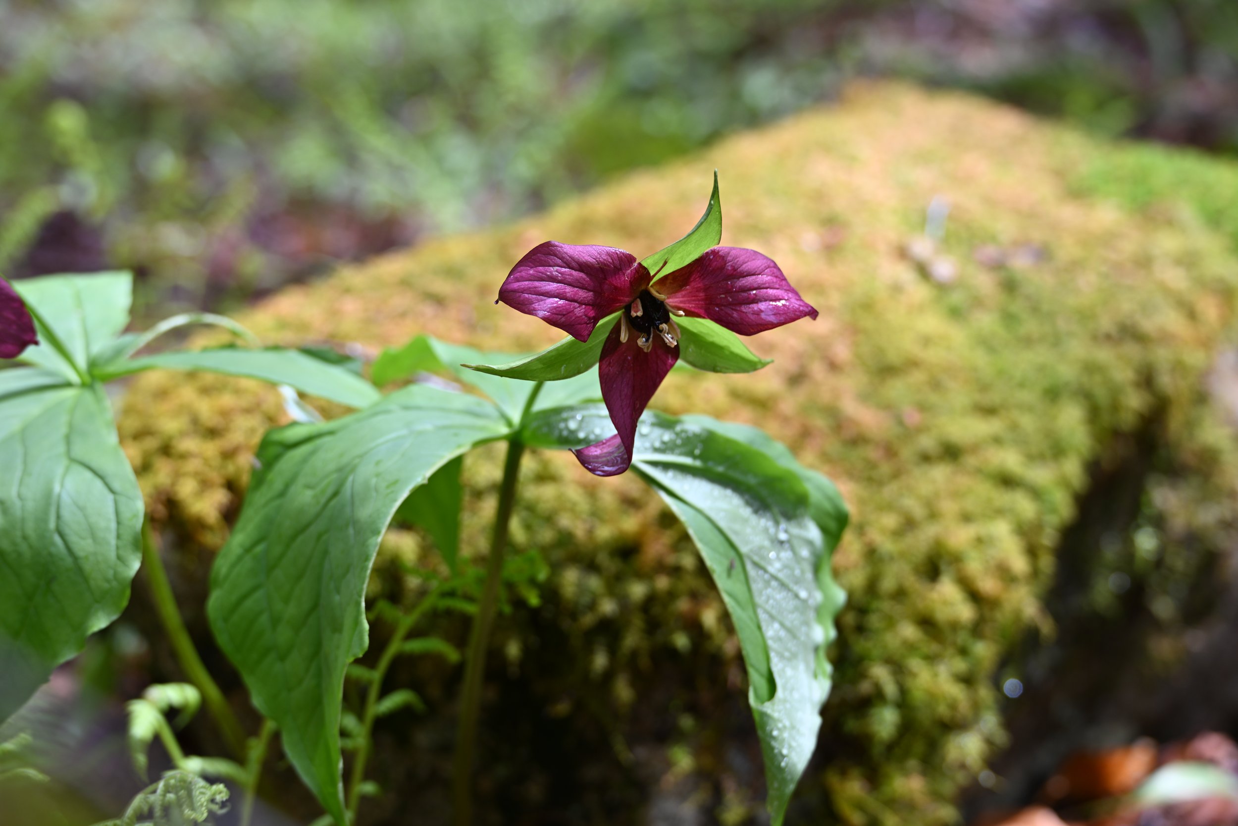
As far as the hike that made us miss low tide at “the Rocks”, it was an easy walk through a lush woods…

… with beautiful early-spring Trilliums…
… and a pretty stream…

… where our hike ended -

After we descended the staircase, this is what we found -

See the little blue sign attached to the tree above? That meant the trail was down that streambed, through the water on slick mossy rocks. No thank you. The waterfall that we were supposed to see at the end of the trail wasn’t worth slipping and falling, ruining ourselves or my camera. I settled for this mini version -

Okay… so now we’ll go on to PEI. It is connected to New Brunswick by a 13 km bridge…

… that is Canada’s longest bridge and the world’s longest bridge over ice-covered water.
As we drove through the center of the island, we were surprised at how much of the acreage was farmland. The dirt is very red…

… due to its high iron-oxide content. It is sandy and well drained, making it very suitable for agriculture—in fact, little PEI is Canada’s largest potato producer! As we drove north across the island, we noticed fog coming in, and the ground began to “smoke” -

We reached the north shore, intending on checking out the red sand beaches and cliffs…

… but it was not your typical late May beach day weather -

Apparently, this is a popular place in warmer weather -

Because the weather was so nasty, we didn’t end up visiting any of the fifty lighthouses that PEI is known for. However, oysters are a big thing here, and we sampled several different kinds -

I read that PEI oysters exported today are all descended from ones originally from Malpeque Bay on the north coast, where the water is clear and cold. We were too early in the tourist season to be able to take a tour of an oyster farm, but we saw a number of bays filled with rafts for “suspended culture” (in contrast to traditional bottom harvesting) -

Oysters take 5-7 years to grow to market-size of 3 inches. There are 6.5 million pounds of oysters harvested annually from PEI.
Our last stop was Charlottetown, the provincial capital, with its quaint historic district…

The tulips were out in full force, letting us believe that spring was really here!
